Name/Title
The WissahickonEntry/Object ID
2013.34.1.26Description
The Edwin C. Jellett Series of Scrapbooks, Volume 1- The Wissahickon
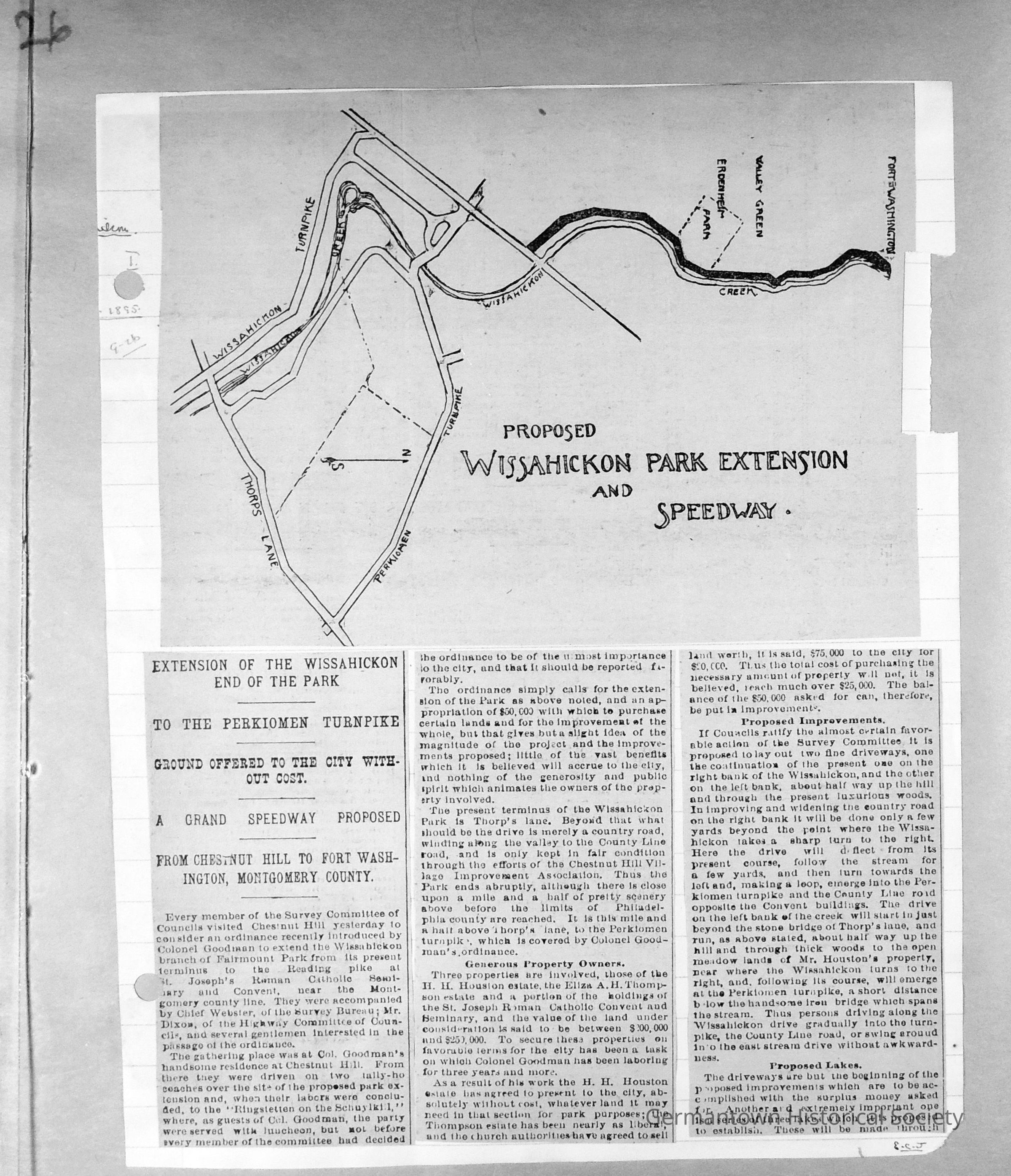
Page 26 contains a portion of an article from the Public Ledger of 09-26-1895 which describes the proposed Wissahickon Park Extension and Speedway. The top portion of the article is a drawing of the current Park limits and the proposed extension from Chestnut Hill to Fort Washington in Montgomery County.
In 1895, the terminus of the Park ended where Thorpe's Lane (in 2013 Thorpe's Lane is now known as Bells Mill Road) and the Wissahickon Creek intersected. The proposal offered in City Council recommended extending the Park boundaries to the Montgomery County line. Beyond Thorpe's Lane is a one and one-half mile stretch of land culminating at the Perkiomen Turnpike which the ordinance considers. Three properties were involved in this one and one-half mile area and two of the three owners agreed to donate their land at no cost, while the third owner agreed to sell at a much reduced cost.Collection
GHS Scrapbook CollectionMade/Created
Date made
1894 - 1925Notes
Creation Date: 1895