Name/Title
The WissahickonEntry/Object ID
2013.34.1.187Description
The Edwin C. Jellett Series of Scrapbooks, Volume 1, Part 2- The Wissahickon
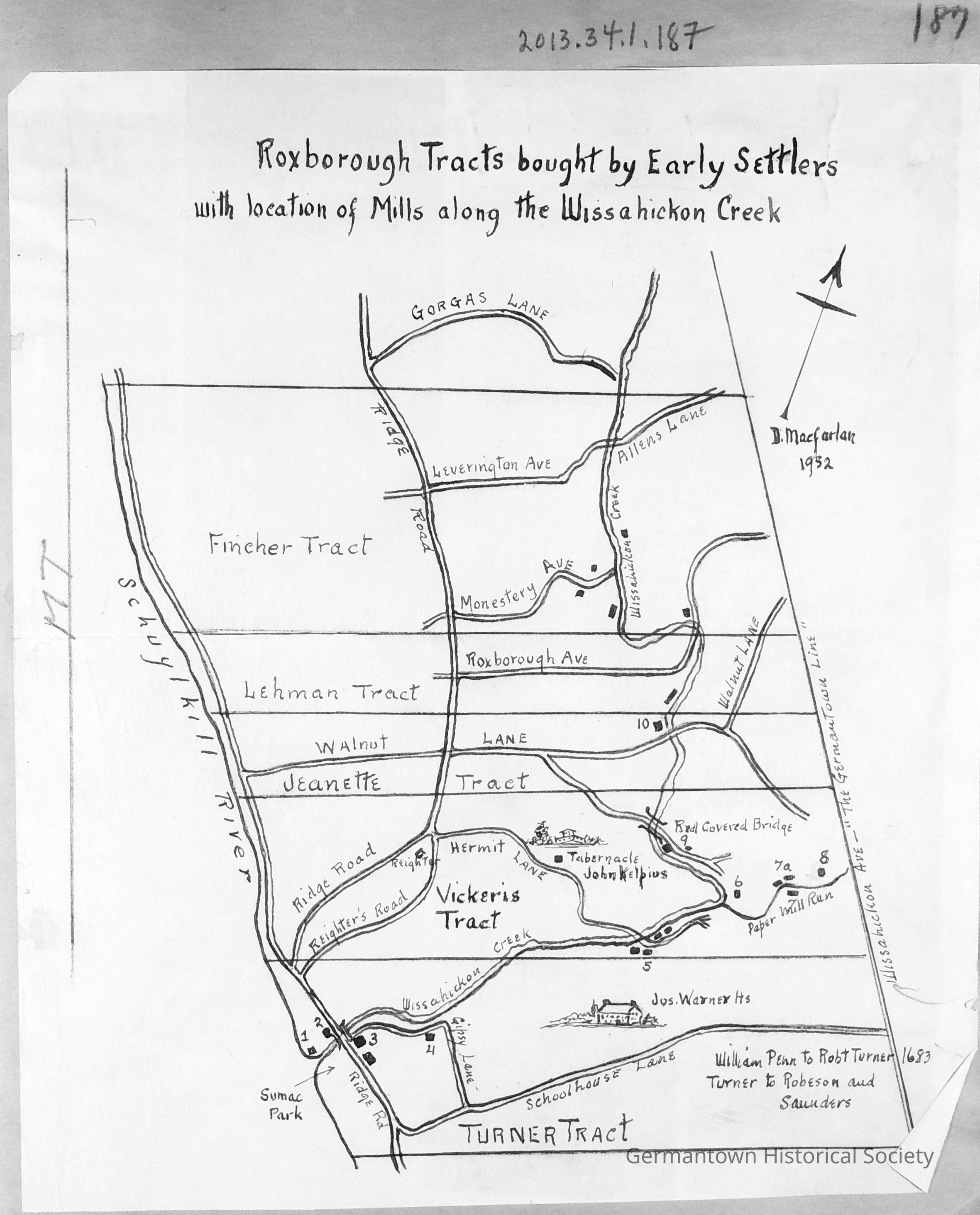
Page 187 contains an illustrated drawing (attributed to D. Macfarlan, 1932[?]) entitled "Roxborough Tracts bought by Early Settlers with location of Mills along the Wissahickon Creek." Starting at the top (North), the boundaries are defined as: Gorgas Lane (extending from Ridge Avenue to the Wissahickon Creek; the Schuylkill River as the western boundary; Wissahickon Avenue (the Germantown Line) as the eastern boundary; and a small area extending south of Schoolhouse Lane (known as the Turner Tract) as the southern boundary. The map focuses exclusively on various tracts of land in Roxborough and lists the names of the settlers who purchased those tracts. Corresponding roads and bodies of water are also named. The mills along the Wissahickon are numbered 1 through 10 but are not further identified by name. It should be noted that the numbered mills on this map are mostly located in the "lower" Wissahickon. There are some additional mills north of Walnut Lane that are unnumbered. Mills are identifed by means of a darkened small square/rectangle.Collection
GHS Scrapbook Collection