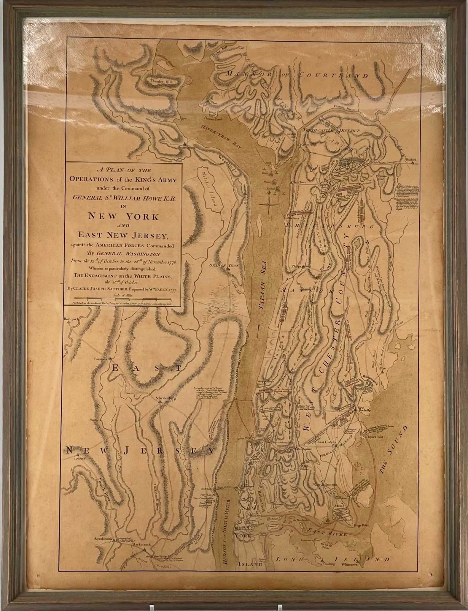
Name/Title
A PLAN OF THE OPERATIONS OF THE KING'S ARMY UNDER THE COMMAND OF GENERAL SR. WILLIAM HOWE, K.B.Entry/Object ID
VC.59.247Description
Map, engraved, and tinted with greenish wash: map of area of Westchester, N.Y.C., and part of New Jersey, entitled "A Plan of the Operations of the King's Army under the Command of General Sr. William Howe, K.B.,/in New York and/East New Jersey,/against the American Forces Commanded/by General Washington/from the 12th of October to the 28th of November, 1776/ Wherein is particularly distinguished/The Engagement on the White Plains,/the 28th. of October." Map, with area extremely attentuated, has, in addition to place names, locations of battle lines, with their dates; a bridge ("Croton Bridge") is shown near Van Cortlandt Manor House (not indicated), as are two mills, one marked "Courtland Mill;" in Manor, "American Winter Quarters." Beneath title, and above scale: "By Claude Joseph Sautier. Engraved by Wm. Fadem, 1777; "beneath scale: "Published...Feb...1777 by W. Fadem...Maiden Lane Charing Cross."Collection
Van Cortlandt Manor Object CollectionMade/Created
Artist Information
Artist
Claude Joseph SauthierAttribution
CartographerDate made
1777Inscription/Signature/Marks
Type
InscriptionTranscription
See descriptionDimensions
Dimension Description
ObjectHeight
29 inWidth
21 inDimension Notes
Display Dimensions: 29 x 21 in. (73.7 x 53.3 cm)Dimension Description
FramedHeight
33-1/2 inWidth
25-1/4 inDepth
1-1/2 inDimension Notes
Display Dimensions: 33 1/2 x 25 1/4 x 1 1/2 in. (85.1 x 64.1 x 3.8 cm)Relationships
Related Entries
Notes
L.2004.97 - Map - RelatedGeneral Notes
Note Type
Curatorial RemarksNote
Mounted on tissue, Newman, N.Y.C., 1959.
Miscellaneous: Almost identical map exists at Hammond Museum, N. Salem, New York, from which reproductions have been made for sale at Sleepy Hollow Restoration gift shops. Hammond map differs from VC.59.247 in that engravers and cartographer's names omitted and it is stated, in region of title, that it was made for "Stedman's History of the American War", and published by the Author April 12th., 1793." In upper right margin, "To front Page 214, Vol.1."
William Faden was also engraver of nautical prints.Note Type
StorageNoteNote
Home Location: Historic Hudson Valley, Union Church, Storage, Unit 4 Slot 07