Transcription
CATALOG NUMBER V 1741 B
OBJECT NAME Letter
DATE May 19, 1884
AUTHOR Ward Carpenter
RECIPIENT C. E. Van Cortandt
MEDIUM Paper, ink
PEOPLE
PLACES “Dur Island”?, Croton Bay, Hudson River, Croton River,
KEYWORDS boundaries of ownership on Croton River, fee simple ownership,
make a caveat,
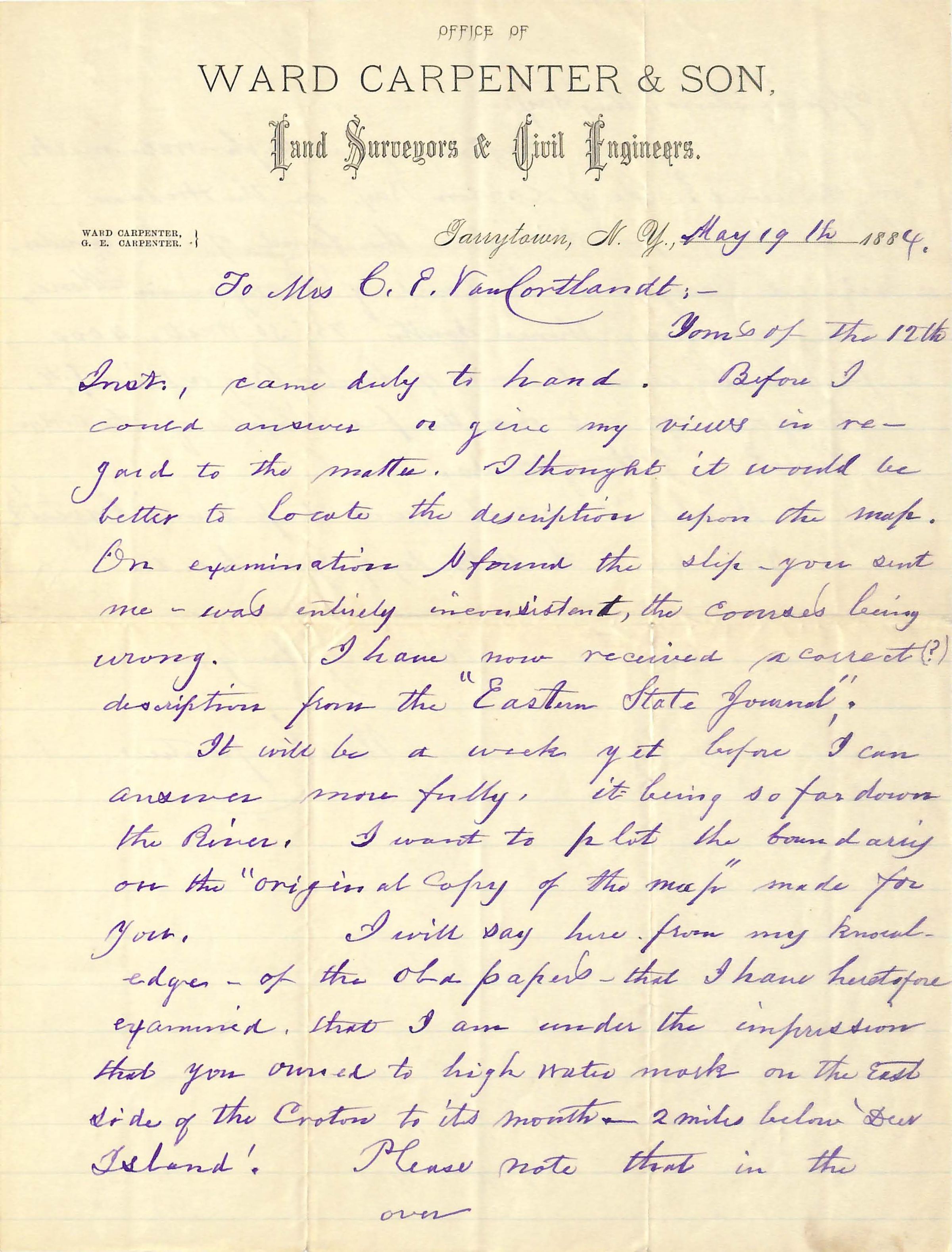
Office of
WARD CARPENTER & SONS
Land Surveyors and Civil Engineers,
Ward Carpenter } Tarrytown, N.Y. Jan. 31, 1871
G. E. Carpenter }
To Mrs. C. E. Van Cortandt: -
Yours of the 12th / Inst., came duly to hand. Before I / could answer or give my views in re- / gard to the matter. I thought it would be / better to locate the description upon the map. / On examination I found the slip - you sent / me - was entirely inconsistent, the [courses?] being / wrong. I have now received a correct (?) / description form the “Eastern State Journal”.
It will be a week yet before I can / answer more fully, it being so far down / the River. I want to plot the boundaries / on the “original copy of the map” made for / You. I will say here from my knowl- / edge - if the old papers - that I have heretofore / examined, that I am under the impression / that you owned to high water mark on the East / side of the Croton to its mouth __ 2 miles below ‘Dur / Island”. Please note that in the
Over
[END OF PAGE 1]
Applications, they say: —
“Beginning at High-water mark, / on the west ? side of Croton Bay, on the Hudson / River, at a point where the land of the under- / signed adjoins the land of Benjamin Moore, / and running thrice South 75° 30’ West, 2000 / feet to the channel bank of the Croton Bay or River !; +c / Do you yo not own the fee simple of the Croton River? I thought so.
Would it not be well to put in a “Caveat’? / You have to the 18th day of June to do so.
Yours very truly,
Ward Carpenter
[LABEL - REVERSE]
W. CarpenterTranscriber
Kathryn AlexanderLanguage
English