HUB
Collections
Classifications
About
App
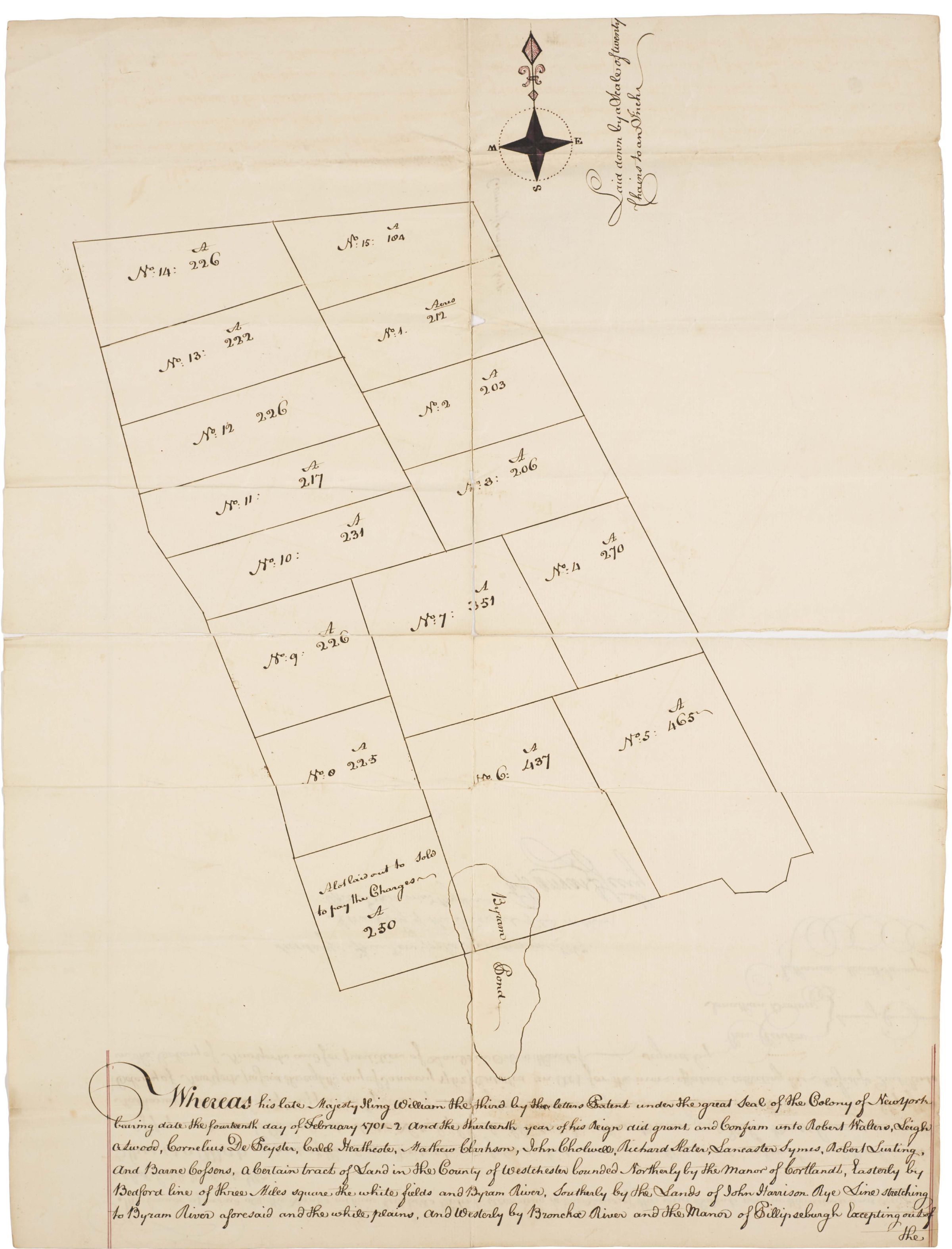
Map of A Portion of Richbell's Patent
Archive
-
Historic Hudson Valley
Oversize Document
Name/Title
Map of A Portion of Richbell's Patent
Entry/Object ID
HHV 001.67
Context
Westchester County history
Collection
Philipse [Philips] Manuscript Collection
Archive Items Details
Title
Map of A Portion of Richbell's Patent
Description
A drawing of a grid of farm or building lots, with numbers
Creator
Nathaniel Merritt
Date(s) of Creation
1767
Subjects
Real estate development
Search Terms
John Richbell (1616-1684), Westchester County
Notes
a copy of the original
Other Names and Numbers
Other Numbers
Number Type
Former Number
Other Number
P 814