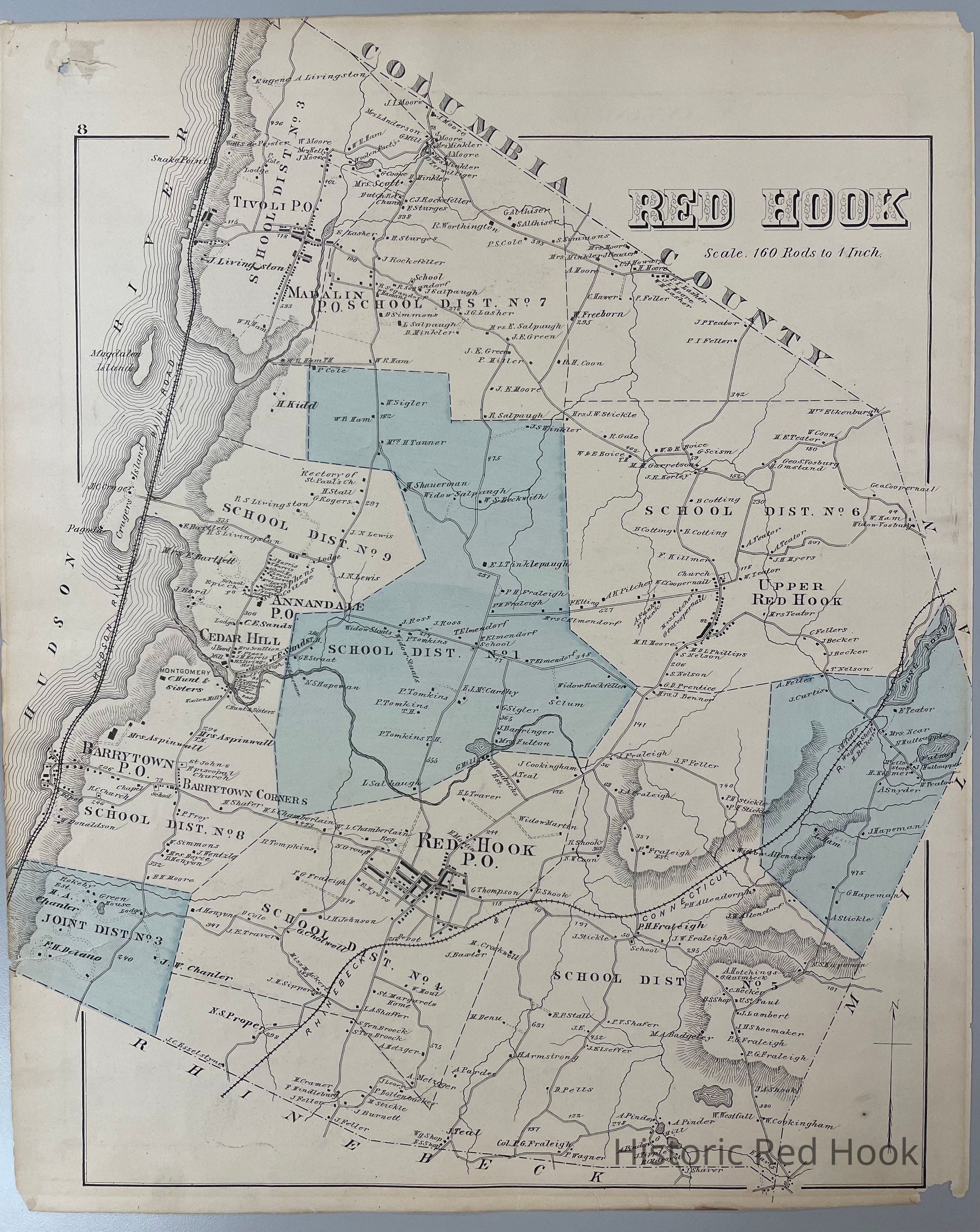
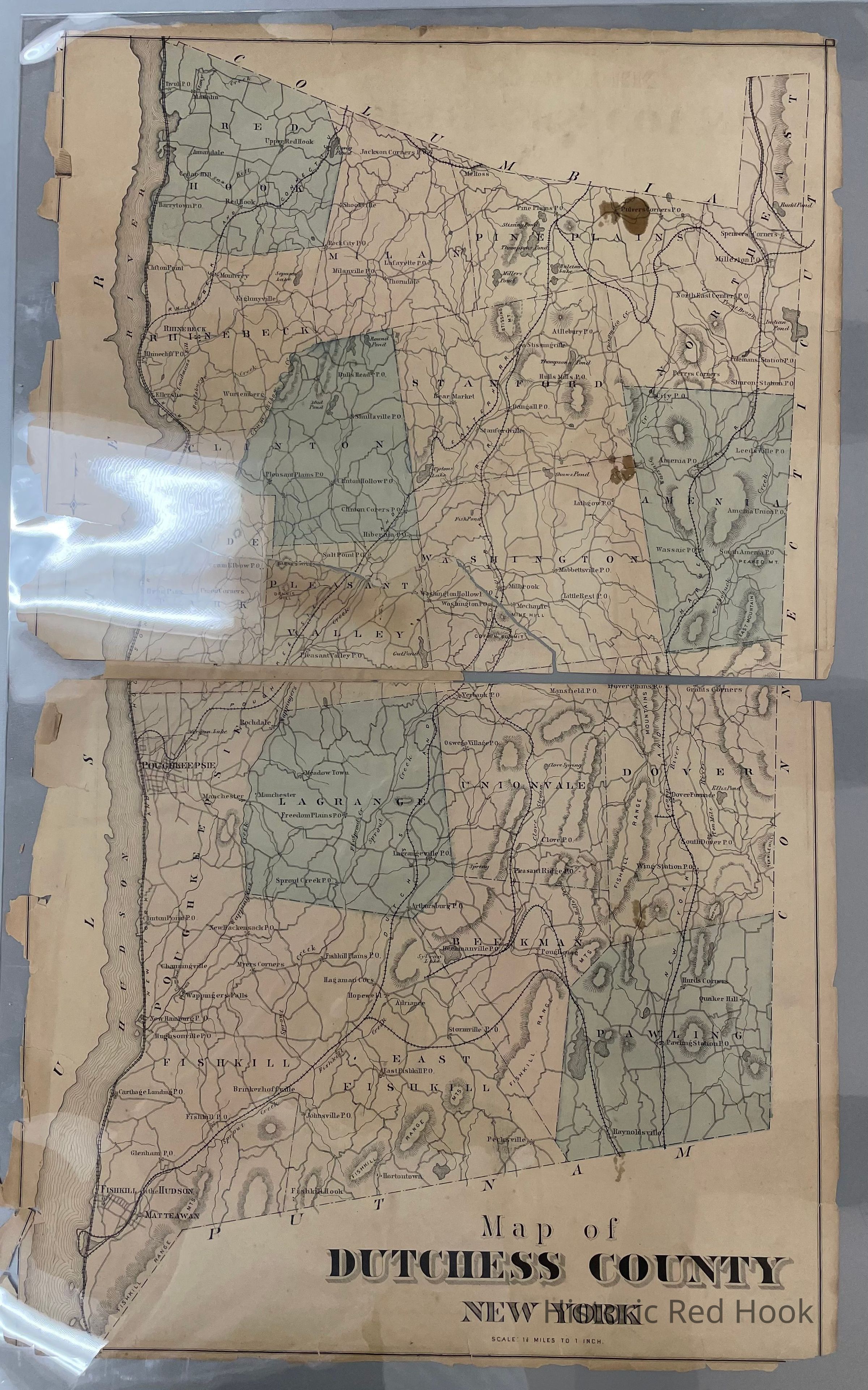
Name/Title
1876 O.W. Gray & Son Map of Dutchess County and Town of Red Hook, Plate #8Entry/Object ID
2014.002.007Description
Plate 8 of the O.W. Gray & Son New Illustrated Atlas of Dutchess County, 1876 - showing map of Town of Red Hook on one side and of Dutchess County on the reverse.Collection
Red Hook MapsMap Details
Maker or Creator
Davis, F. A, W. Gray and SonPublisher
Kochersperger, H. L.