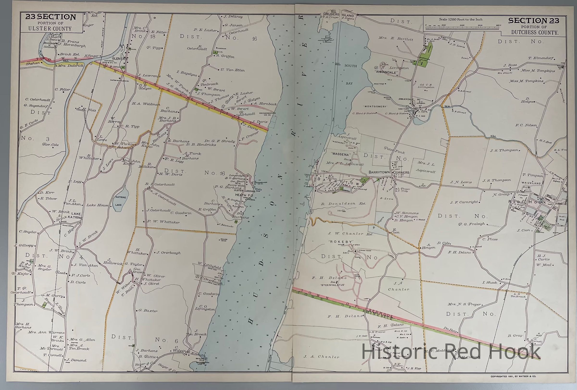
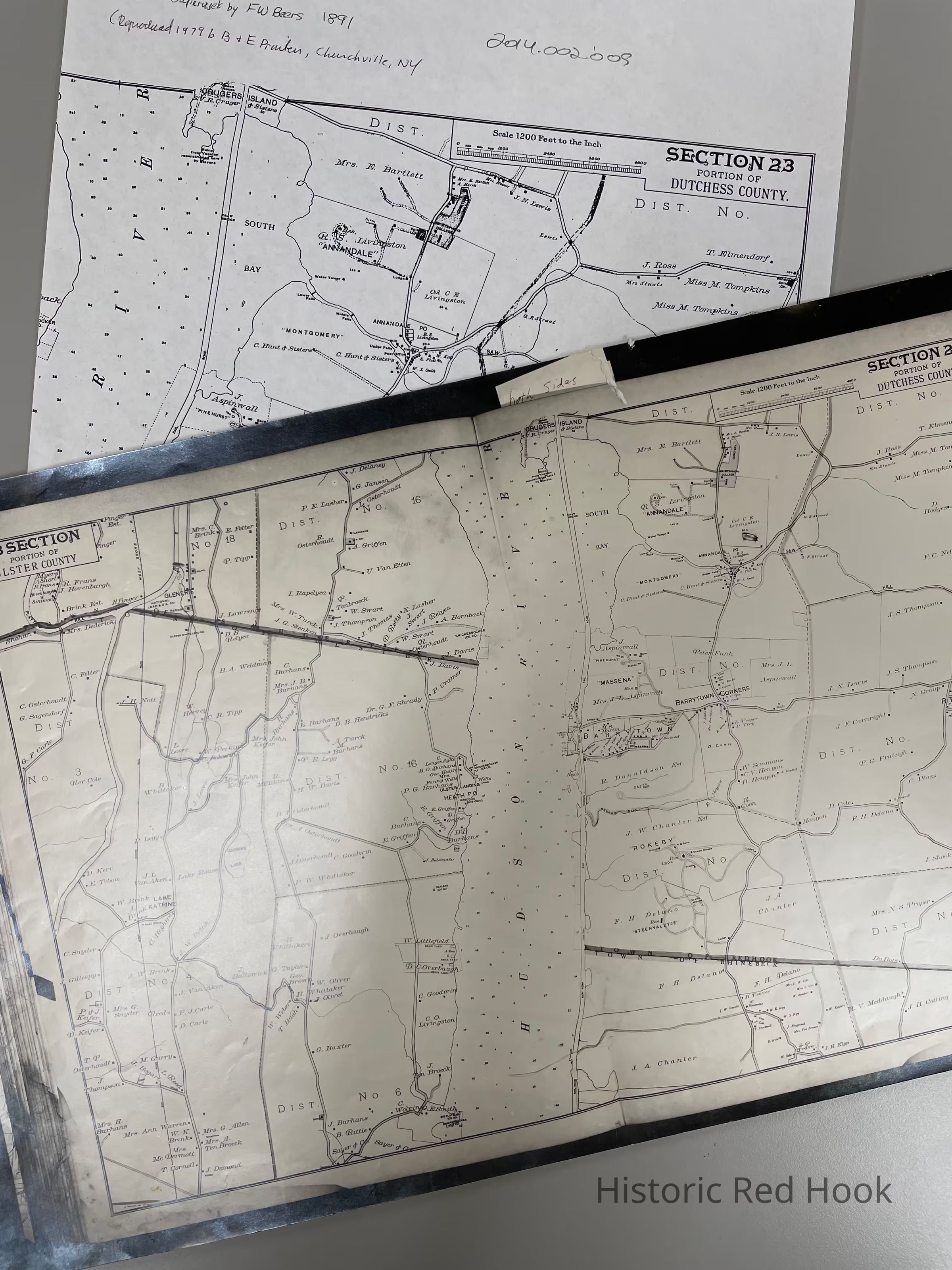
Name/Title
1891 F. W. Beers Map - Section 23 Portion of Dutchess County (southern Red Hook)Entry/Object ID
2014.002.009Description
Original plate from Frederick W. Beers 1891 Atlas of Hudson Valley, Section 23, southern part of Red Hook. Plus photostat and photocopyCollection
Red Hook Maps