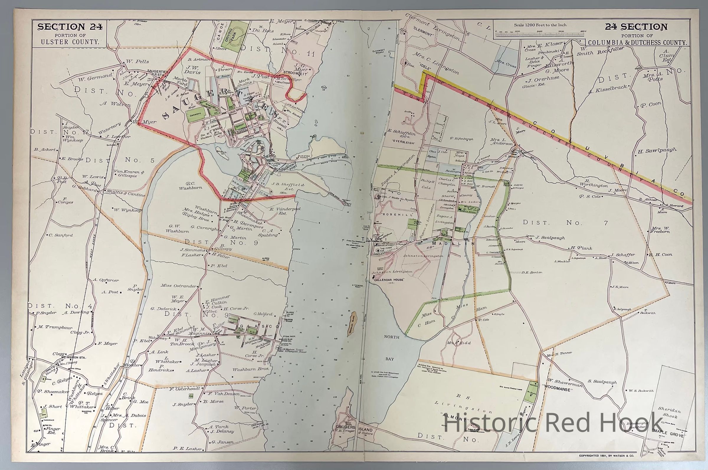
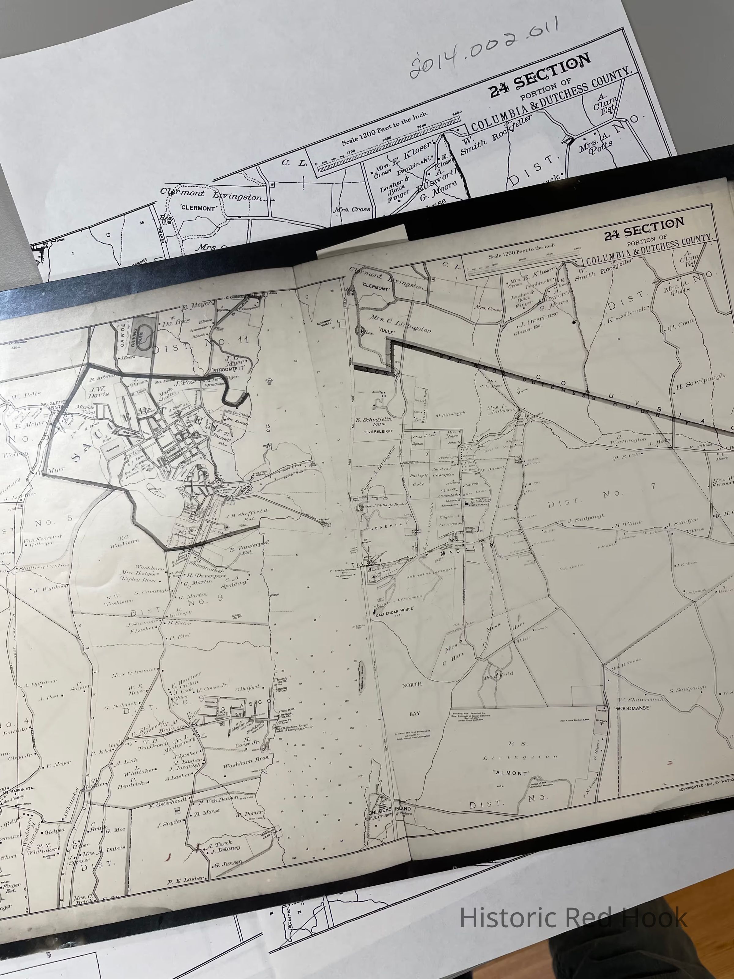
Name/Title
1891 F. W. Beers Map, Section 24 Portion of Columbia and Dutchess County (northern Red Hook)Entry/Object ID
2014.002.011Description
Original plate from 1891 Frederick W. Beers Map, Section 24, Crugers Island to Clermont (northern part of Red Hook).
Plus photostat and photocopiesCollection
Red Hook Maps