Name/Title
1795 Survey of Armstrong land for lots along Cherry Street and East Market Street in Red Hook VillageEntry/Object ID
2014.002.028Description
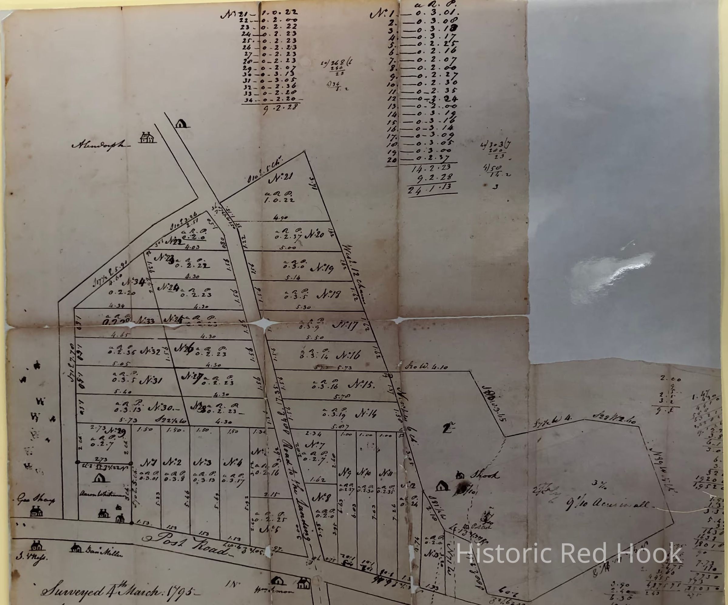
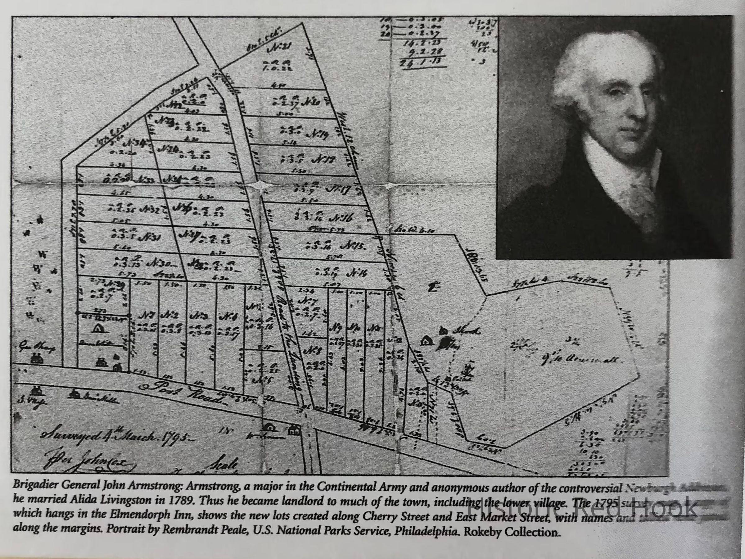
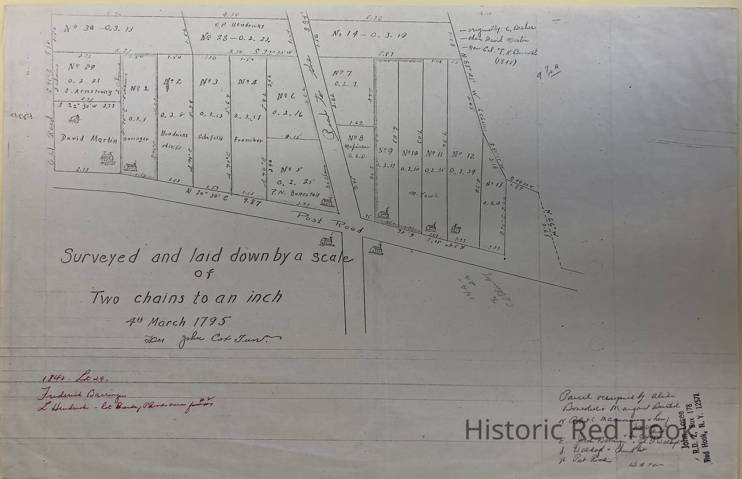
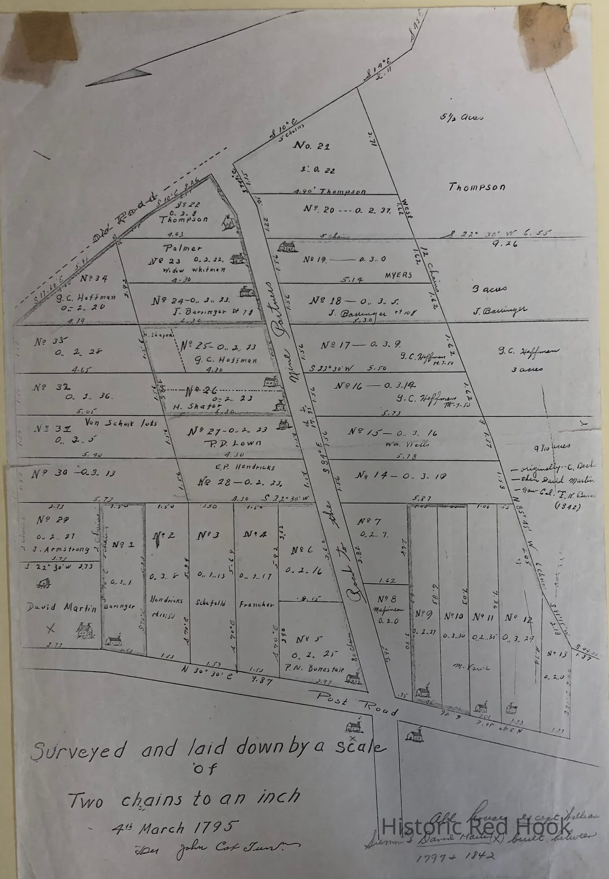
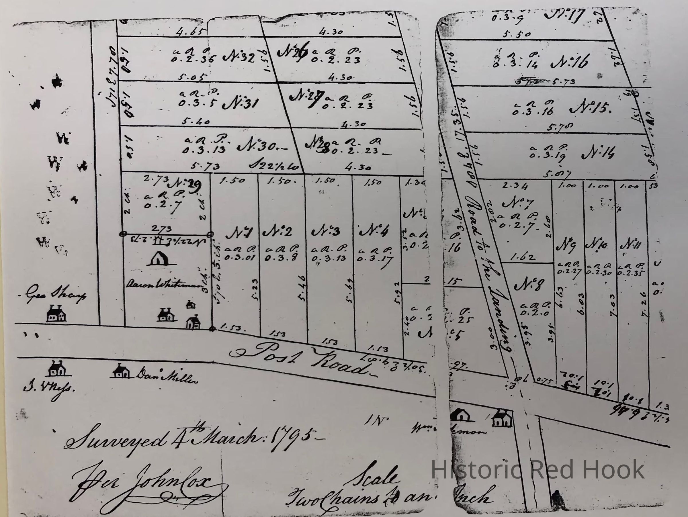
Photographic copies of 1795 survey of land owned by Brigadier General John Armstrong after he married Alida Livingston in 1789 showing subdivided lots with numbers.
Surveyed 4 March, 1795 by John Cox
Scale Two chains to an inch
There are several versions of the survey:
a) The earliest (?) has lot numbers only for the subdivided lots and a few names of owners of houses,
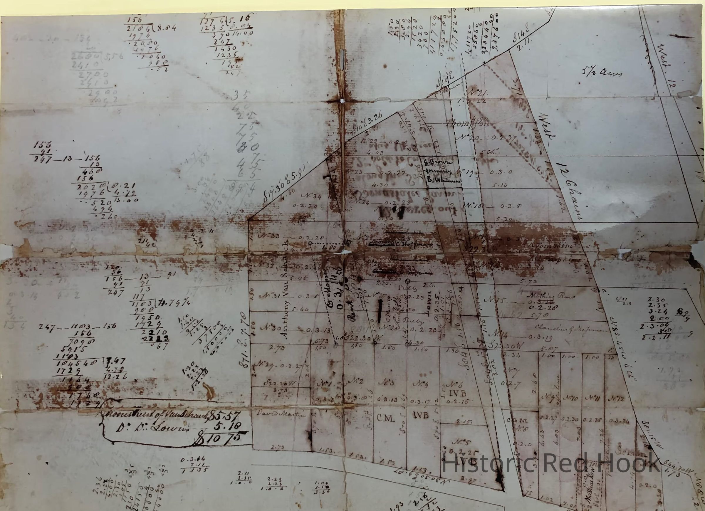
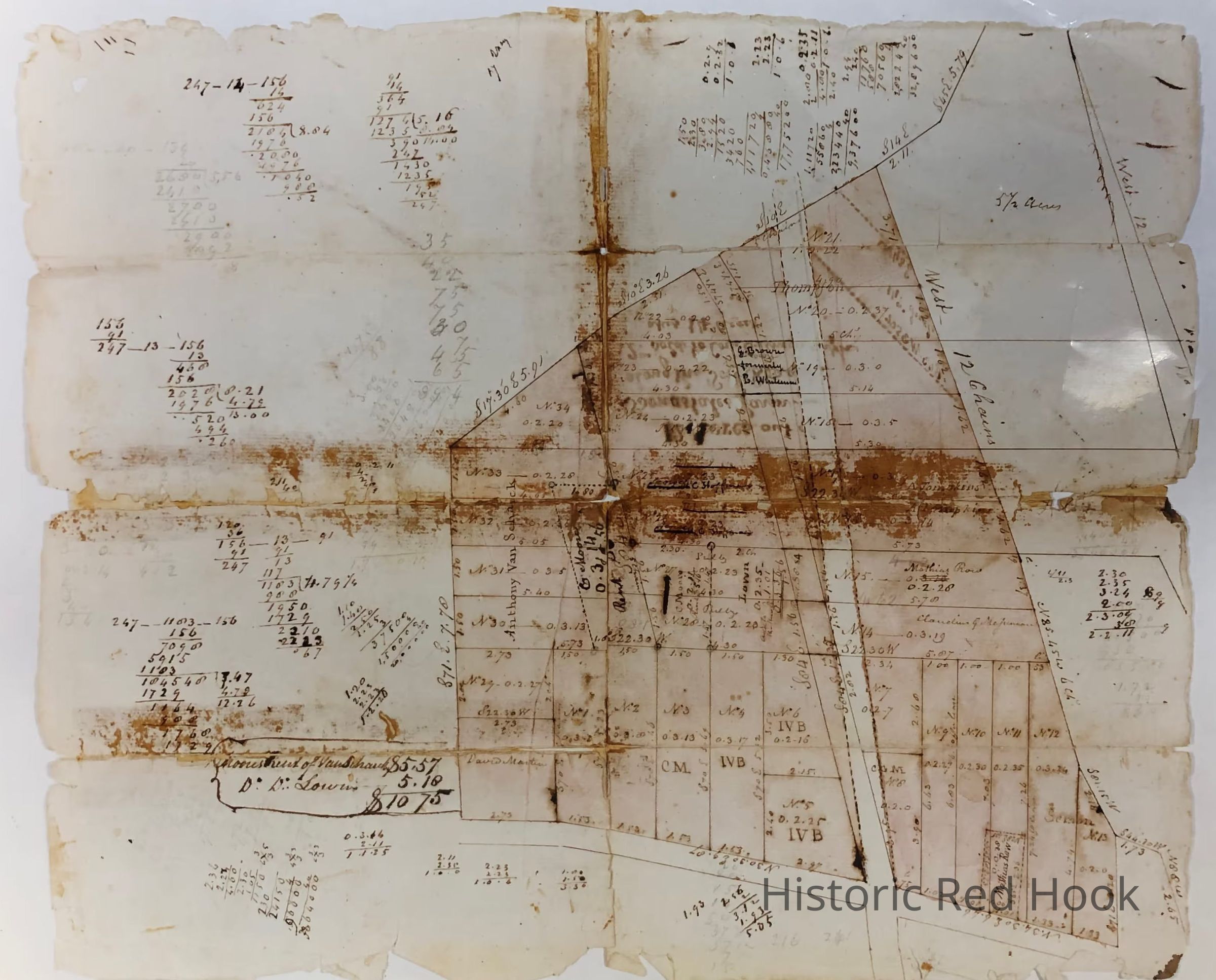
b) Another version appears to be a draft and shows a reorientation of what became East Market Street ("The road to the Landing") and some subsequent subdivided lots.
c) Another version is marked up with owners names for each lot, apparently in 1842.Collection
Red Hook Maps