Name/Title
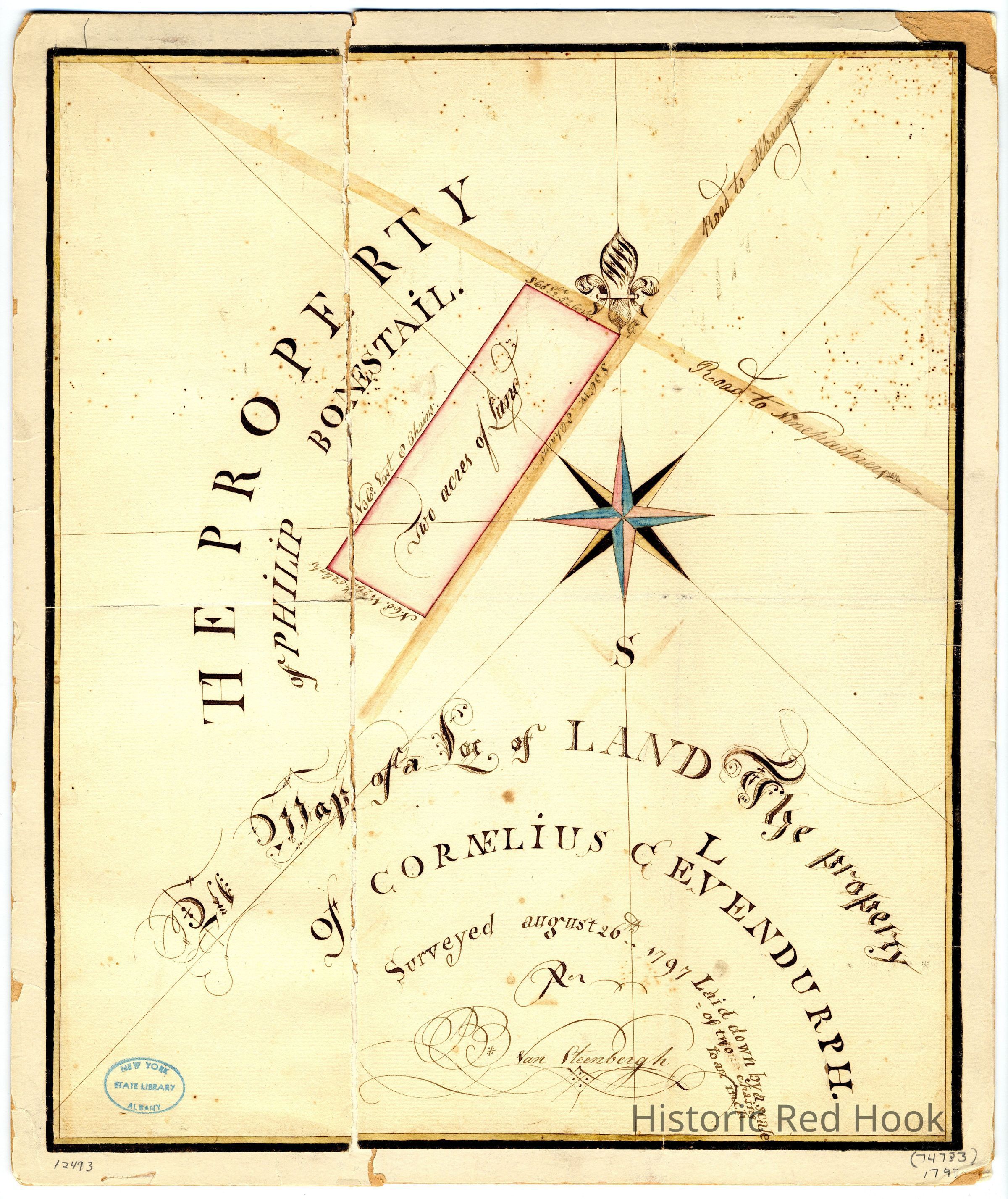
1797 Survey of Land of Philip Bonstail and Cornelius C. Elmendorph at Post Road and Market Street intersection, Red Hook VillageEntry/Object ID
2014.002.029Description
Digital Scan and Photostat (A) of survey by Van Steenbergh (from New York State Library) of two acres of land purchased by Cornelius C. Elmendorph from Philip Bonestail in 1797. Survey map scale was 1" equals two chains (1 ch - 66ft)
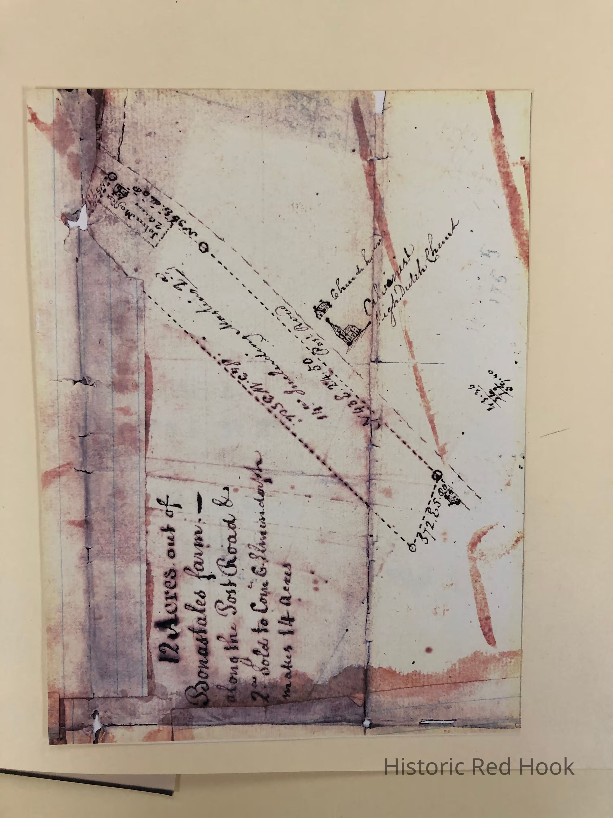
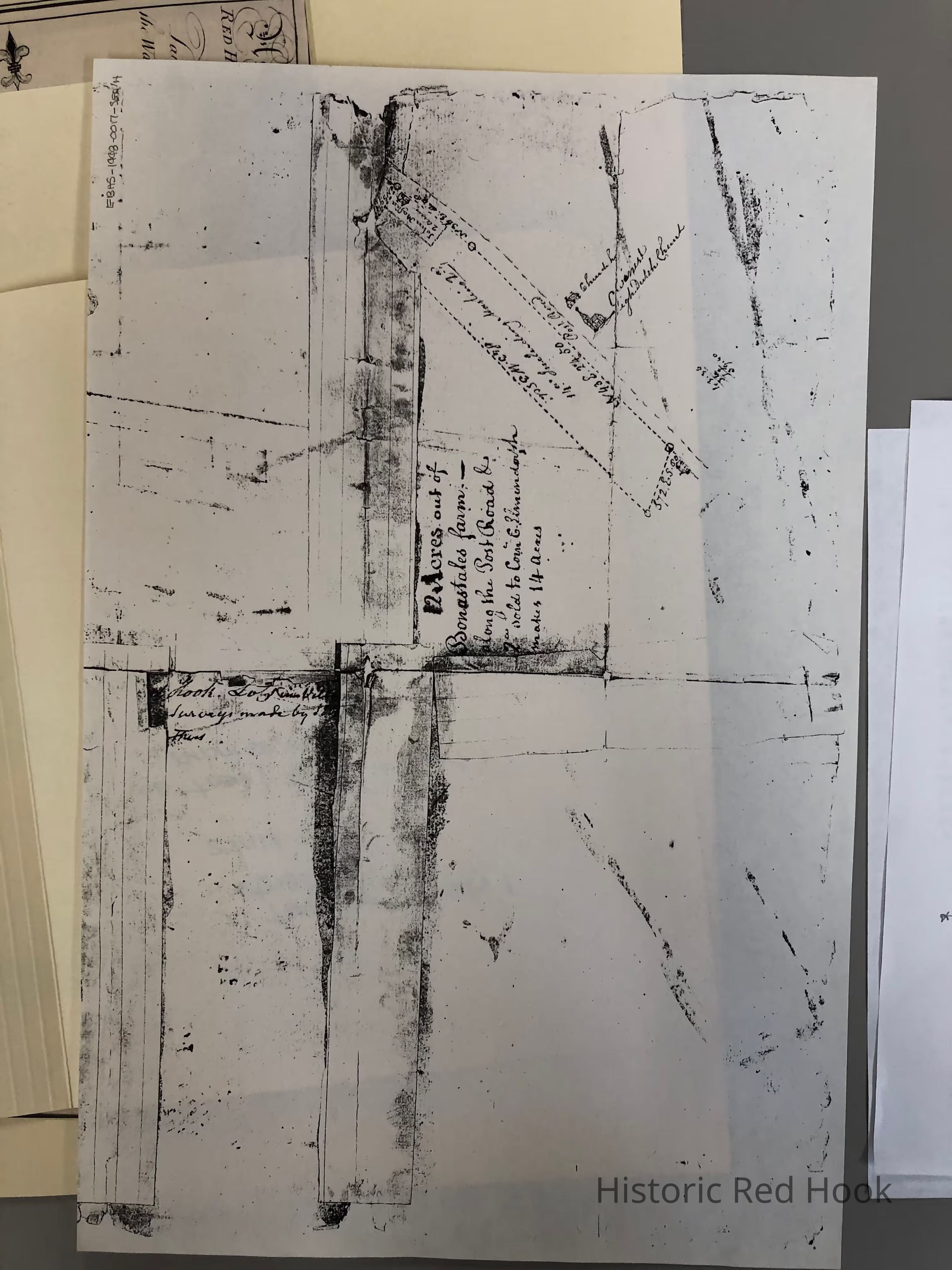
Photocopy (B) of different view of deed survey showing 12 acres out of Bonastail's farm including the two acres sold to Cornelius C. Elmendorph. The two acres represent the site of the future Red Hook Hotel.Collection
Red Hook MapsRelationships
Related Places
Place
Property
2 West Market St.Village
Red Hook Village