Name/Title
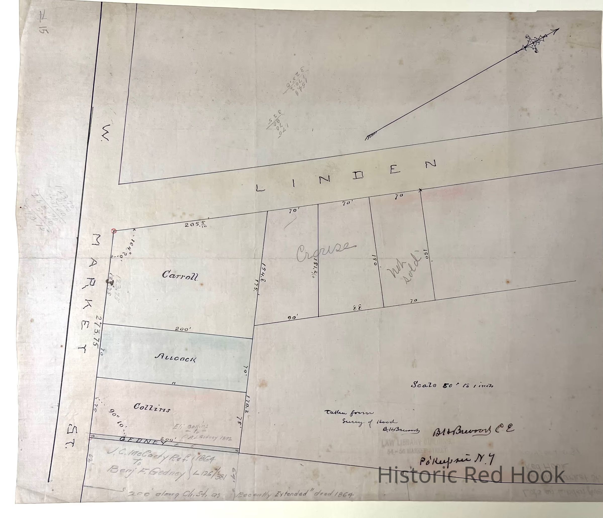
C. 1894 Map of lots in quadrant east of Linden Ave & north of W Market Street, Red Hook VillageEntry/Object ID
2014.002.031Scope and Content
Original Survey map (13 1/2 x 15 3/4) by Bt & Brevoort CE (taken from survey of Hood) with a scale of 50' to an inch, c. 1894, showing lots with names Carroll, Aucock, Collins, GedneyCollection
Red Hook Maps