Name/Title
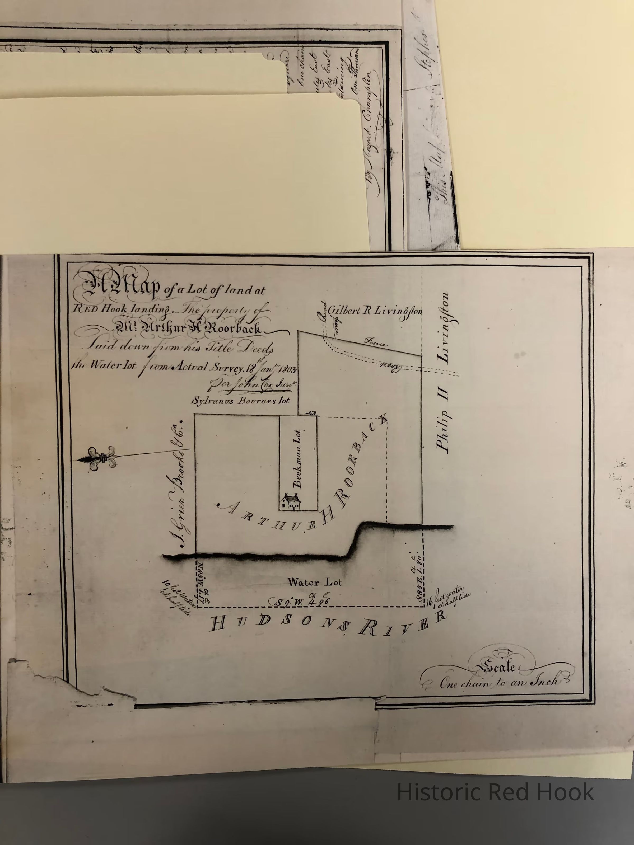
1803 Map of Lot of Land at Red Hook Landing including Water Lot, property of Arthur H. Roorback (later Callendar House)Entry/Object ID
2014.002.033Description
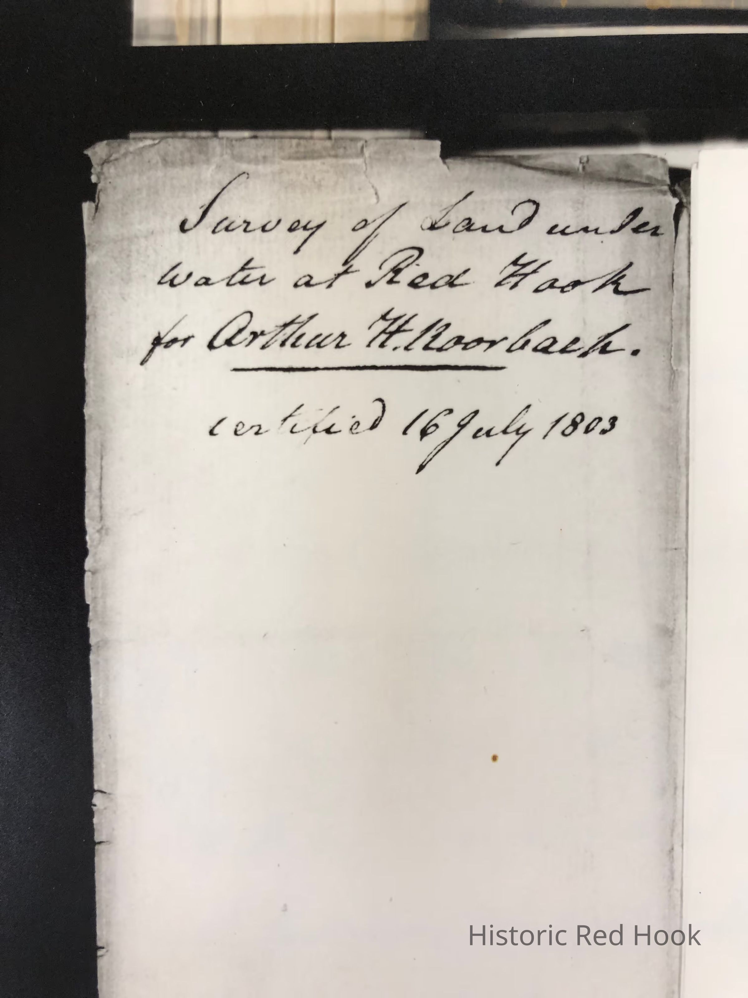
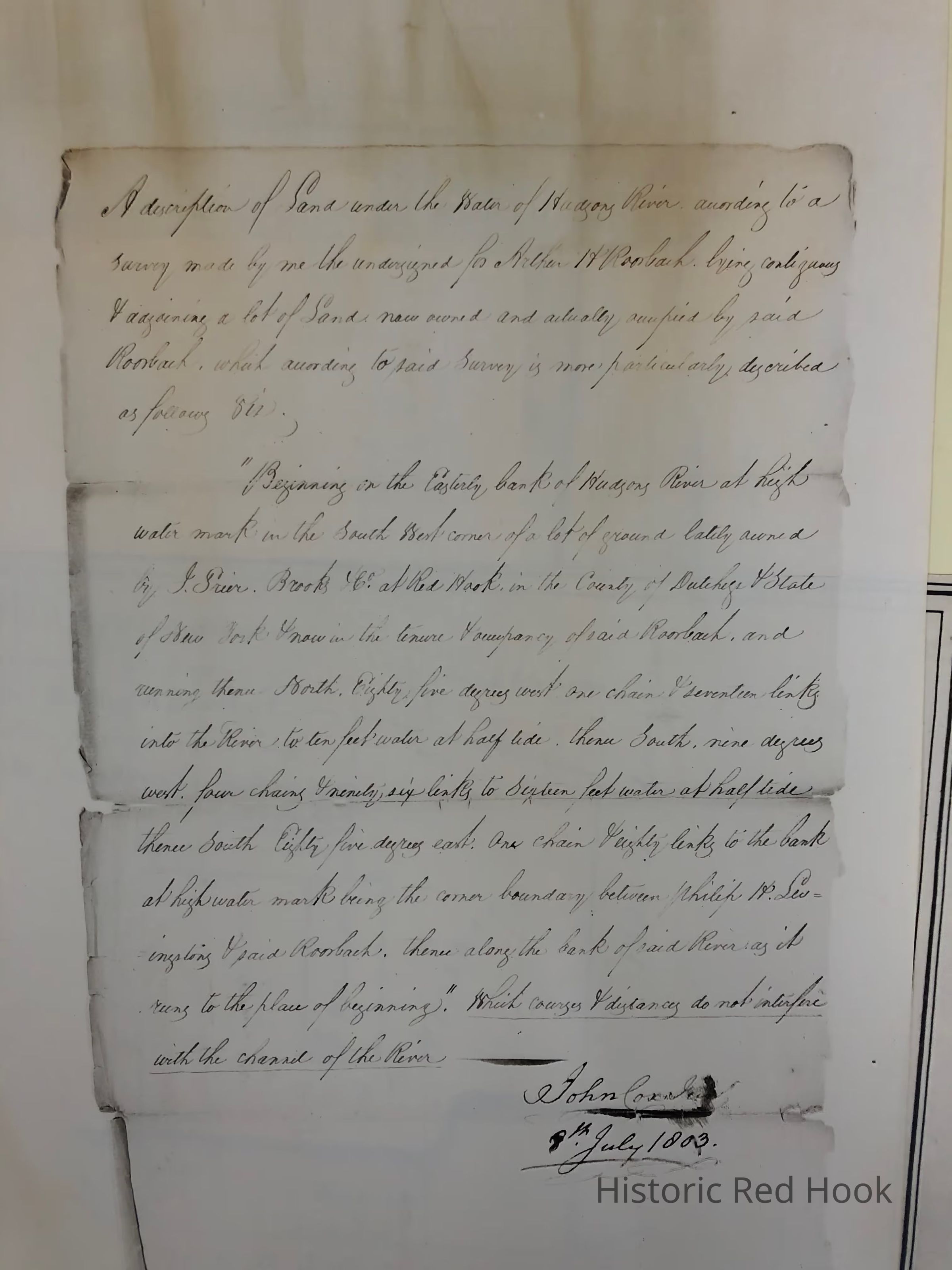
Three page photostat of 1803 Survey of Land and under water lot at Red Hook landing for Arthur H. Roorback by John Cox, scale of one chain to an inch. The third page contains a photostat of a handwritten document describing the land by John Cox dated 1803. Property pictured - site of Callendar House.
Original in NYS Library.Collection
Red Hook MapsRelationships
Related Places
Place
Property
42 Callendar House DriveVillage
Tivoli