Name/Title
1958 Survey map of St. Clare's House in Upper Red HookEntry/Object ID
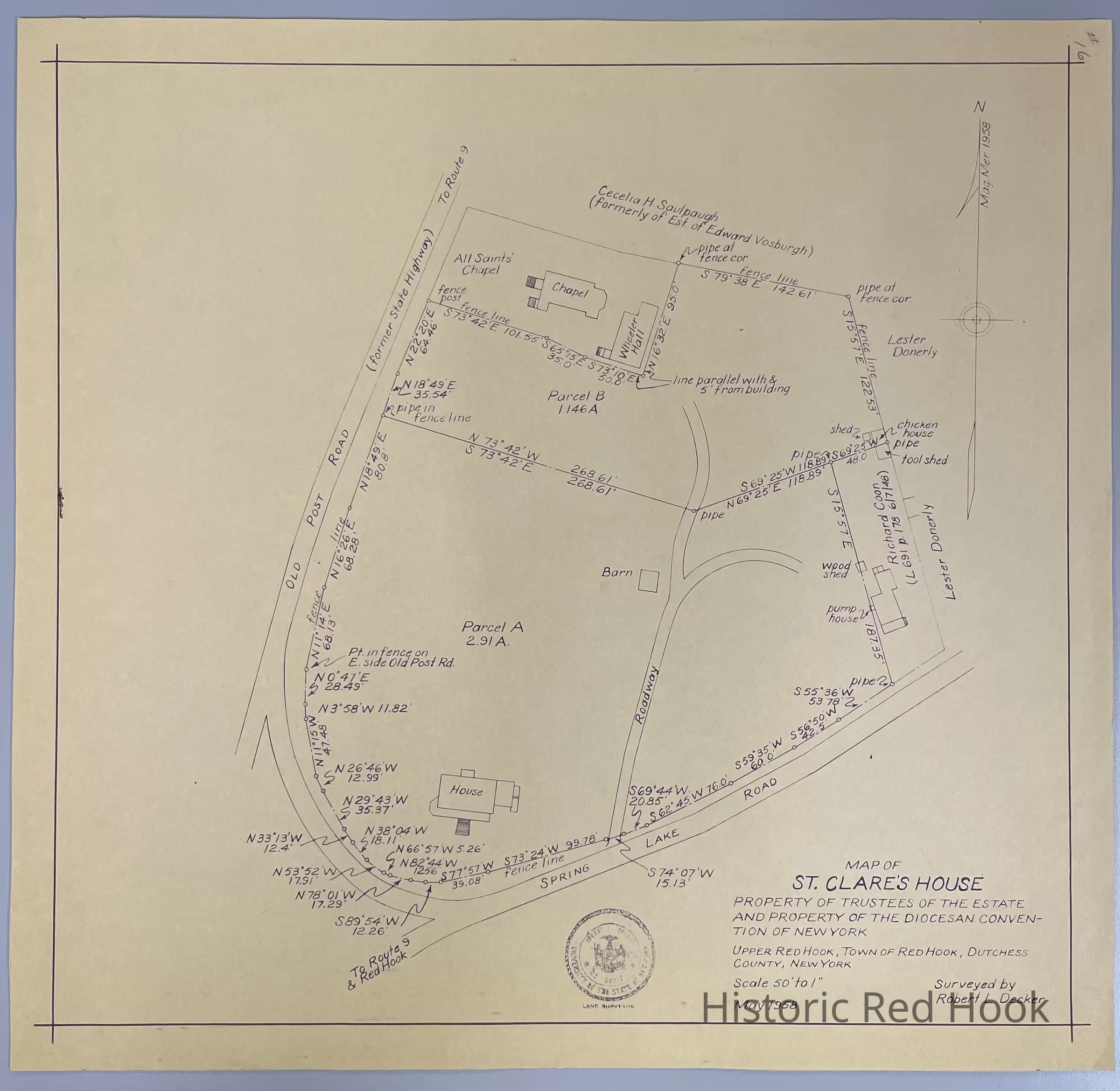
2014.002.038Description
Survey map of St. Clare's House along Spring Lake Road and the Old Post Road by Robert L. Decker with a Scale 50' to 1", May 1958. Additional names on the survey include Donerly and Saulpaugh.Collection
Red Hook Maps