Name/Title
WILKEN BROS. Peter Dodd RED HOOKEntry/Object ID
2016.011.338Scope and Content
Field Notes 14 Aug 1941
Maps: Lots on Depot St.: O. E. Rider, F. W. Coon, Bertha Moore, Bertha Germond, Ellsworth Estate
Field Notes & Survey: For Board of Education 5 Jul 1929 Parcel from southerly portion of land of Peter Dodd 4.94 acres
Survey: For Peter Dodd 26 Sep 1924:From southwesterly portion of land of Peter Dodd on South Broadway 0.57 acres
Survey: For O.E. Rider Aug 1929 West portion of Piester Lot.
128:407 Robert C. Massonneau & wife Elizabeth to Edmond L. Hendricks- Conveys leasehold
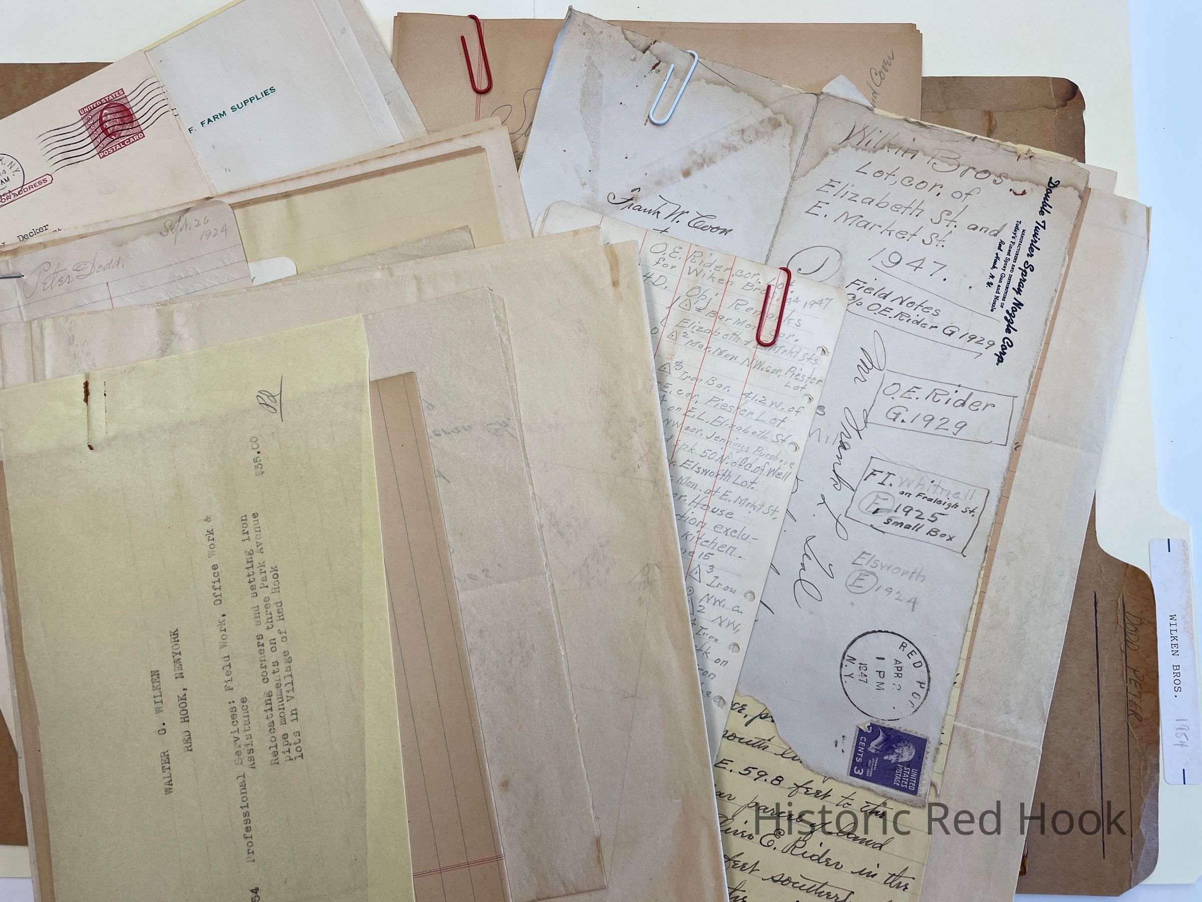
Survey: For Wilken Bros et al Apr 4 1947: Greater portion of lot conveyed by Elizabeth Lloyd to Fred Weaver in 1945 0.176 acre
Deed: 634:322 Elizabeth R. Lloyd to Fred Weaver 7 Jan 1946 Being part of
564:489 Oliver E. Rider & Bertha to Frank I. Whitnall 15 Oct 1937
Map: Showing property of Wilken Bros on East Market Street
Deed: 505:208 Frank W. Coons & wife Edna L. To Oliver E. Rider 21 Apr 1930. Being part of 499:433 land from Elizabeth Mattice to Frank W. Coons13 Sep 1929
Survey: For Oliver E. Rider 7 Aug 1929 Parcel from westerly portion of lot formerly owned by Albert Piester
Map: Showing High School Lot
Survey: For St. Paul’s Lutheran Church 1 Aug 1939 ; Parcel of land now property of Peter Dodd 5.45 acres
Letter: 28 Jul 1939 From Benson Frost to Frank Teal
Letter: 9 Oct 1953 From Walter Wilken to Robert Decker
Letter: 18 Jan 1954 From Wilken Bros. To Robert Decker
Letter: 12 Mar 1954 From Wilken Bros. To Robert Decker
Letter: 28 July 1954 From Wilken Bros. To Robert Decker
Map: Peter Dodd to St. Pauls Church
Survey: For Walter Wilken 27 Oct 1954 Being property of Walter & Thelma Wilken 0.577 acre.
Being 3rd parcel as in a deed from Arthur G. Somers to Walter Wilken 838:122.
Survey: For Walter & Thelma Wilken Oct 1954 0.678
Survey: For Walter & Thelma Wilken 27 Oct 1954 0.574 Acre
Postcards: 14 Sep 1954,18 Oct 1954, Nov 19 1954, Nov 30 1954 From Wilken Bros. To Robert Decker
Survey: For Wilken Bros. Aug 1941: Being a portion of the abandoned ROW and station grounds for NYNHNHRR in a deed from RR to Wilken Bros. 2.65 acres
Survey: For Wilken Bros. Dec 1954 Parcel from former Railroad property 2.539 acres The Martin Parcel
Survey: For Wilken Bros. Dec 1954- The Red Hook Farmers Cooperative Parcel 0.111 of an acreCollection
Teal-Decker CollectionRelationships
Related Person or Organization
Person or Organization
Teal, Frank L.Related Places
Place
Property
65-67 East Market StreetVillage
Red Hook Village