HUB
Collections
Classifications
About
App
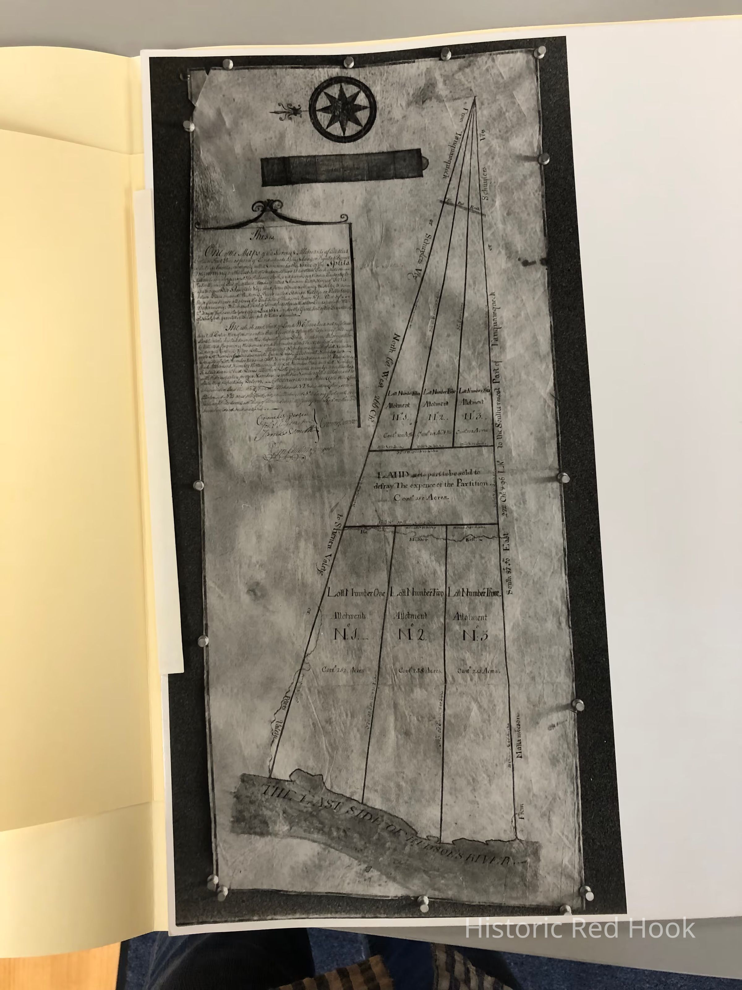
1766, Map of The Splits
Map
-
Historic Red Hook
Name/Title
1766, Map of The Splits
Entry/Object ID
2014.002.046
Description
Photostat of Survey map of The Splits between Rhinebeck and Red Hook with accompanying description of the survey. Survey by George Clinton
Collection
Red Hook Maps