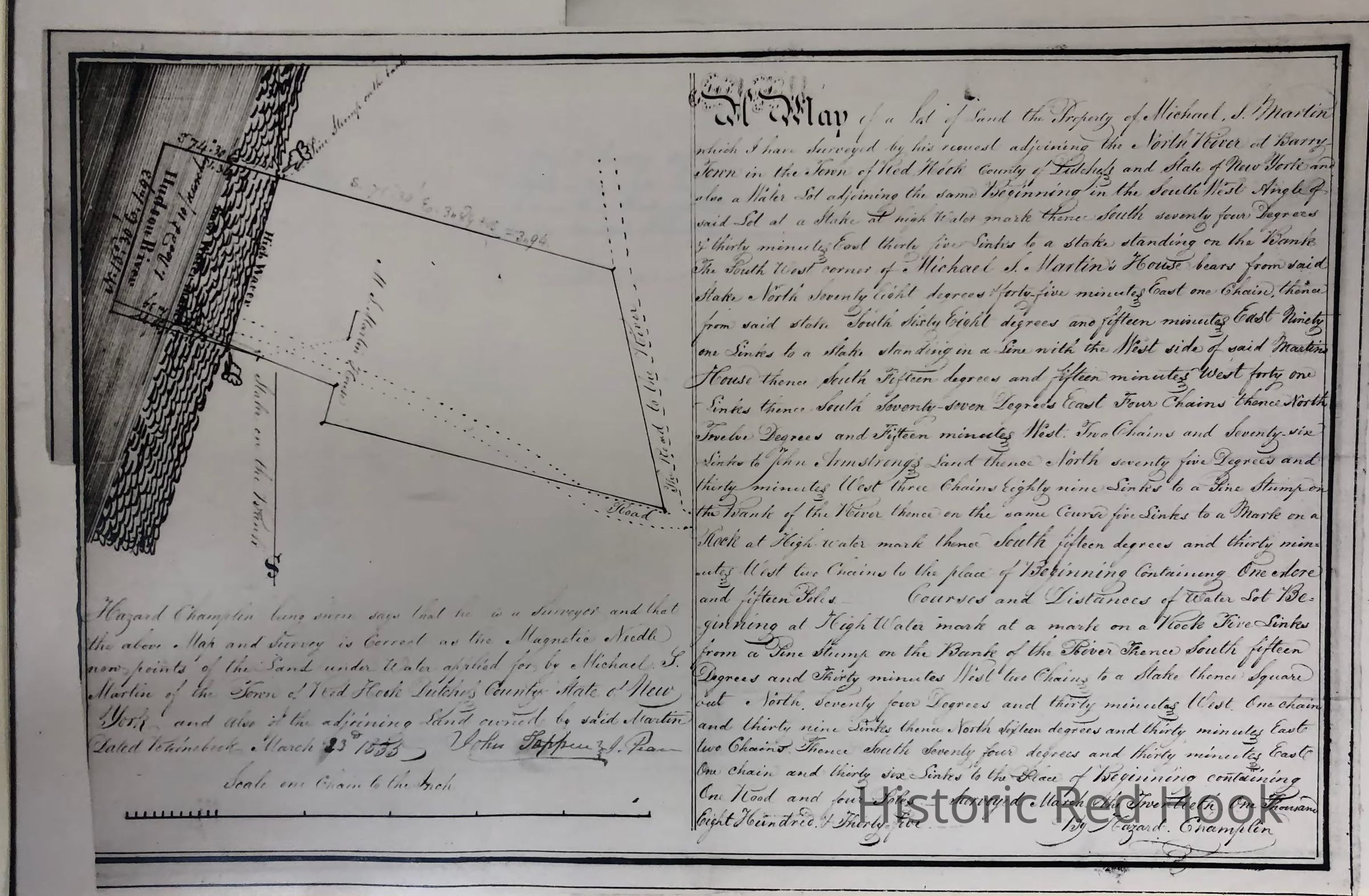
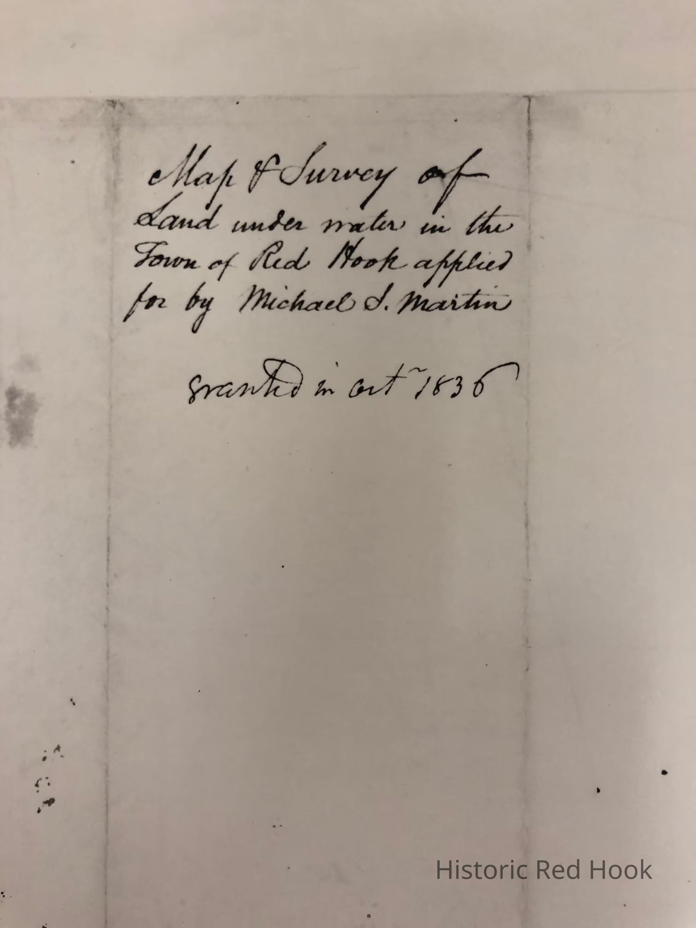
Name/Title
1835 Map and Survey of land under water in the Hudson River in the Town of Red HookEntry/Object ID
2014.002.051Scope and Content
Photostats of Map and Survey of land under water in the Hudson River in the Town of Red Hook applied for by Michael S. Martin, 1835, Map by Hazard Champlin.
Original in NYS LIbraryCollection
Red Hook Maps