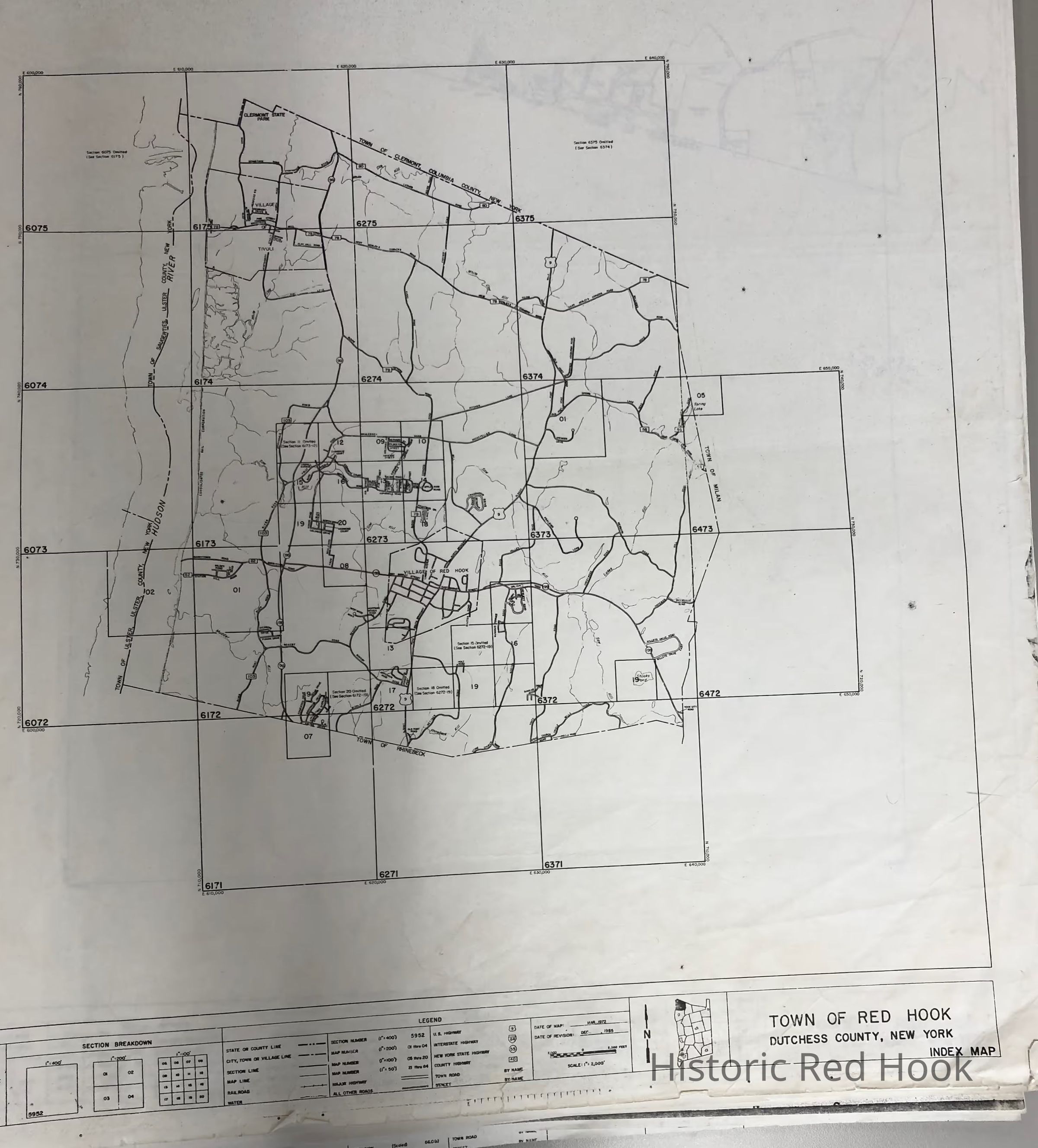
Name/Title
1970s Real Property Maps, Town of Red Hook, "Con Ed Lands"Entry/Object ID
2014.002.056Description
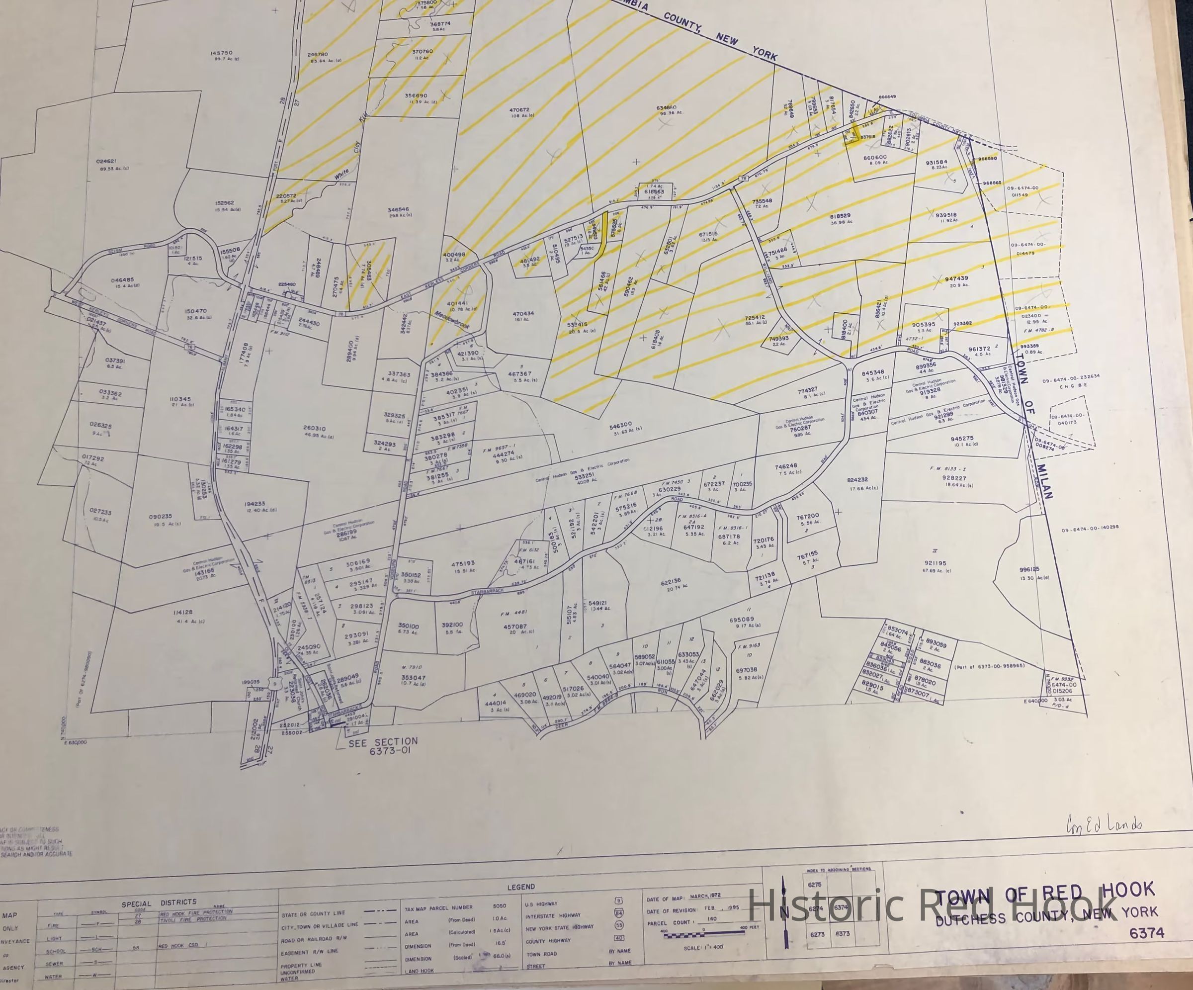
Real Property Maps, Town of Red Hook, "Con Ed Lands"
Map # 6374 - March 1972, revised 1995
Map #'s 6172,6173-15, 6174 and 6175 - March 1972, revised 1979
Plus envelope with tax assessment sheets for individual properties, updated 1978 and 1979Collection
Red Hook Maps