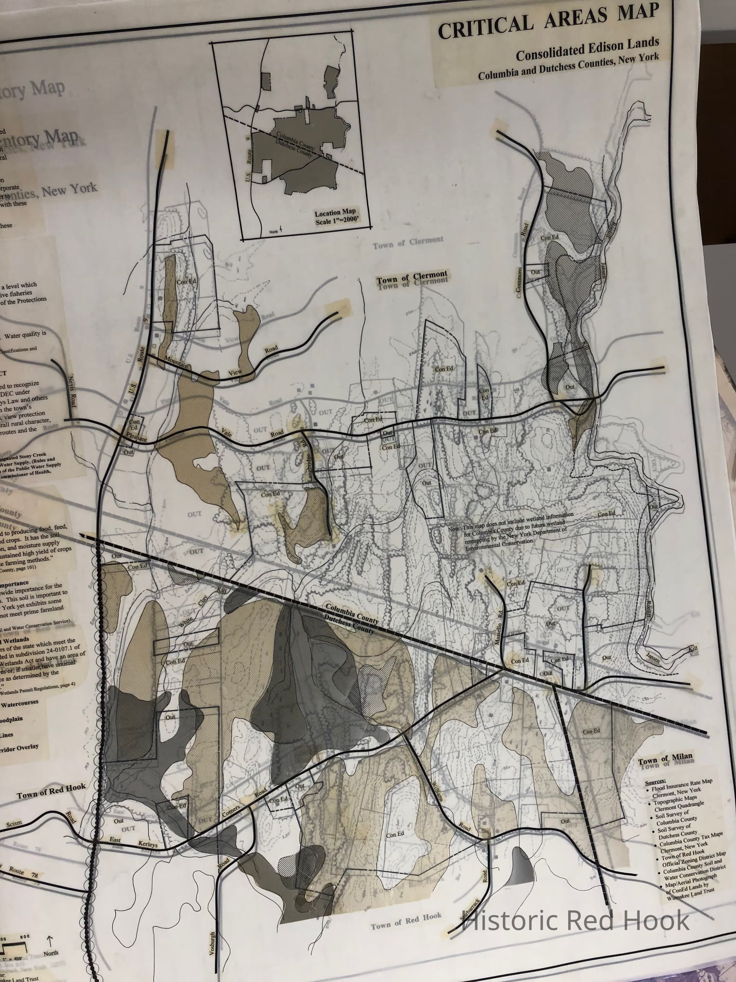
Name/Title
Critical Areas Map and Natural Resource Inventory, Columbia and Dutchess County, "Con Ed Lands"Entry/Object ID
2014.002.057Description
Critical Areas Map and Natural Resource Inventory, Columbia and Dutchess County, prepared for Winnake Land Trust, Jan 1996.
Two original maps and photocopies
One original pieced together map "Aerial Map of Con Ed Lands prepared by Winnake.
Transferred from Rhinebeck Historical SocietyCollection
Red Hook MapsMap Details
Publisher
Columbia Land Conservancy