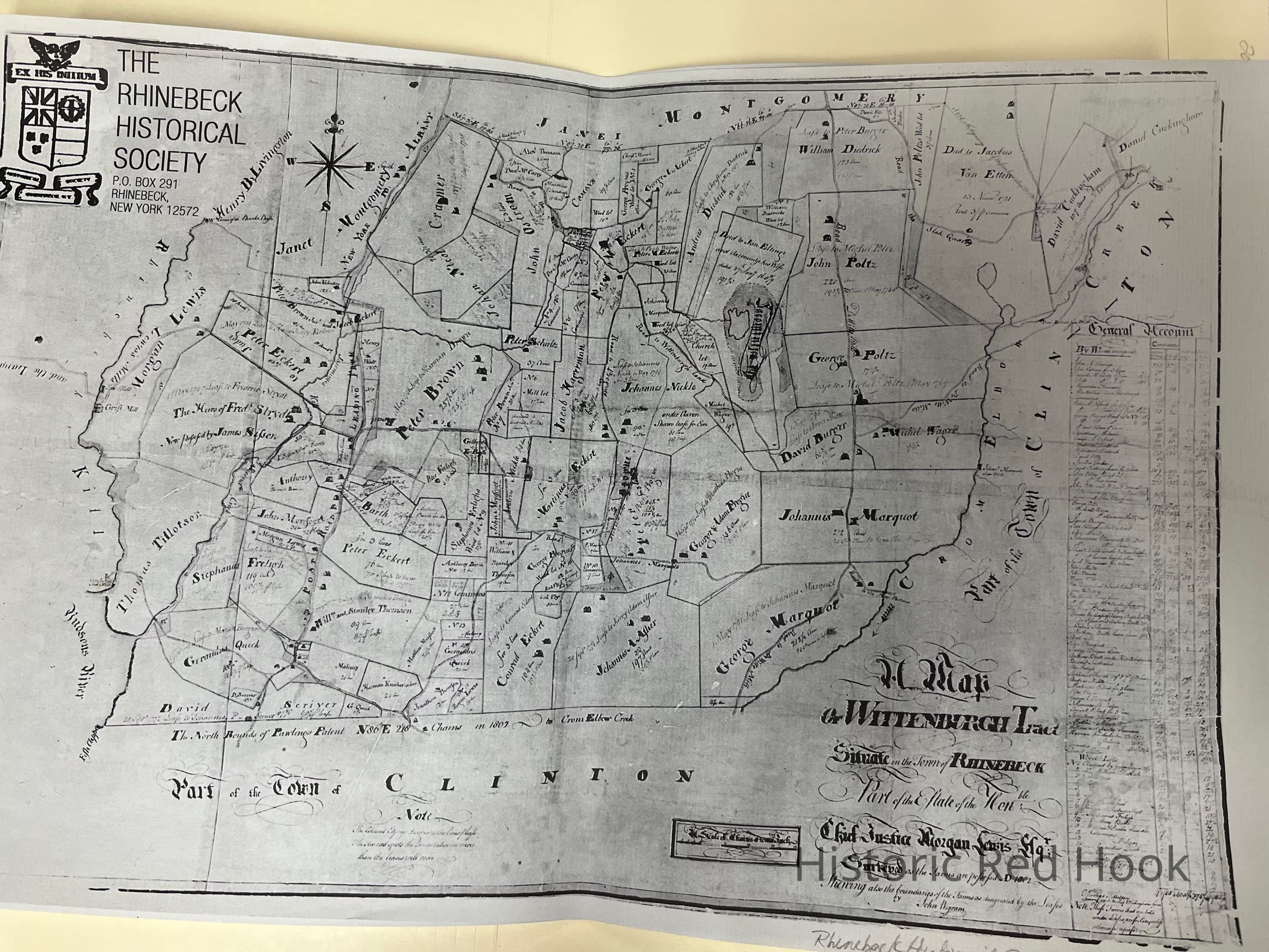
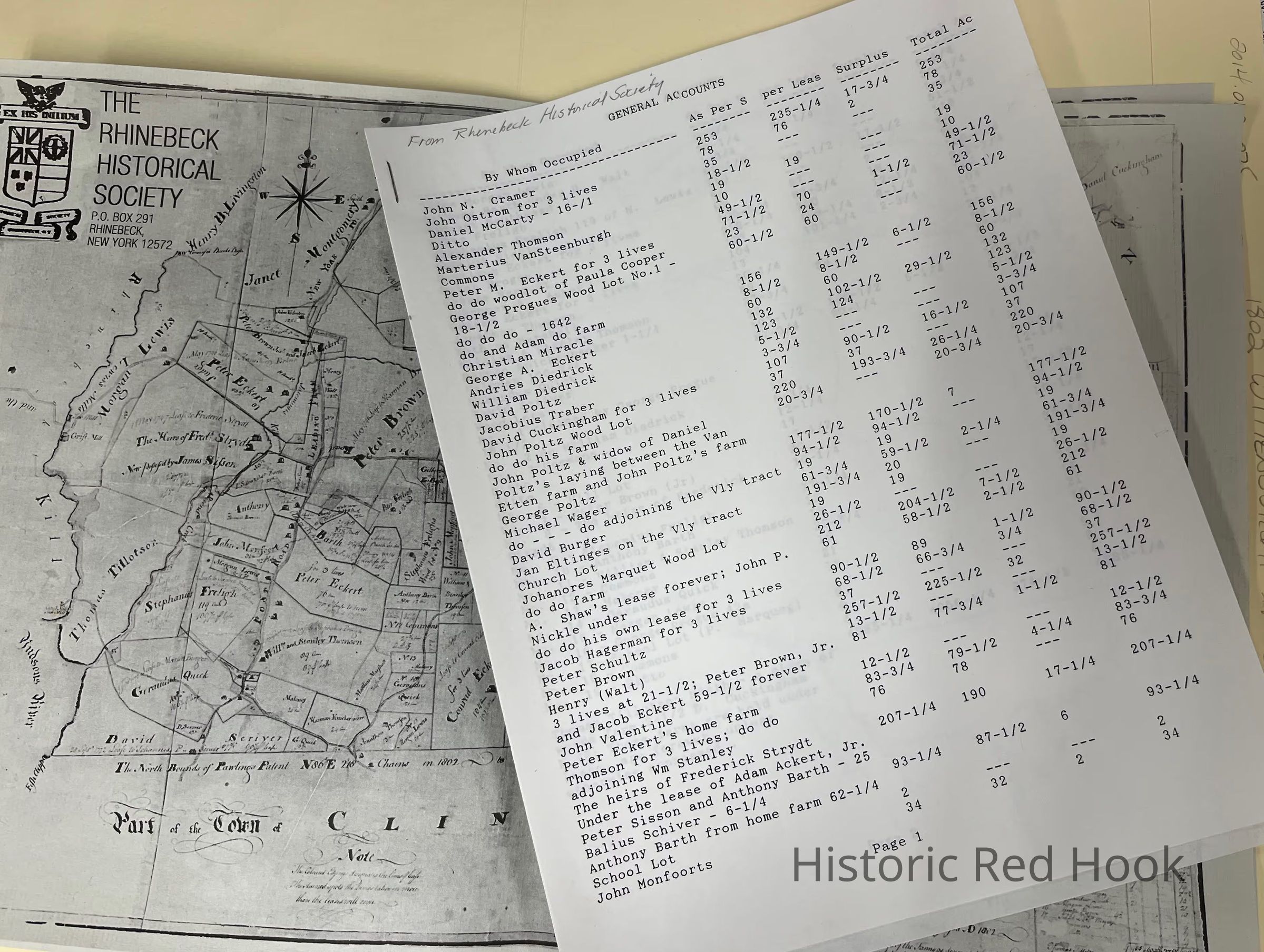
Name/Title
Map of Van Benthuysen land parcels, Wittenburgh Tract, Town of Rhienbeck, 1802 based on 1774 deedEntry/Object ID
2014.002.075Description
Rhinebeck Historical Society's reproduction of map of Wittenburgh Tract, 1802 (?)
Map was attached to Van Benthuysen 1747 land parcel deed ( L. 10, p 137). Document with names included.Collection
Red Hook Maps