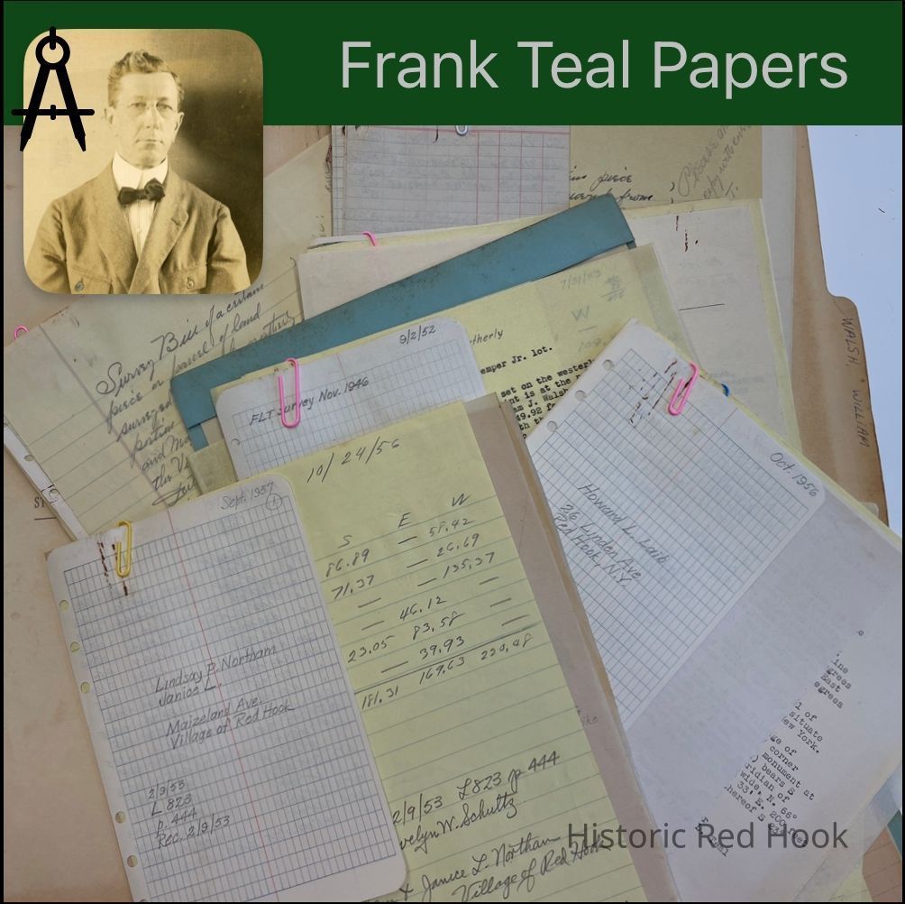
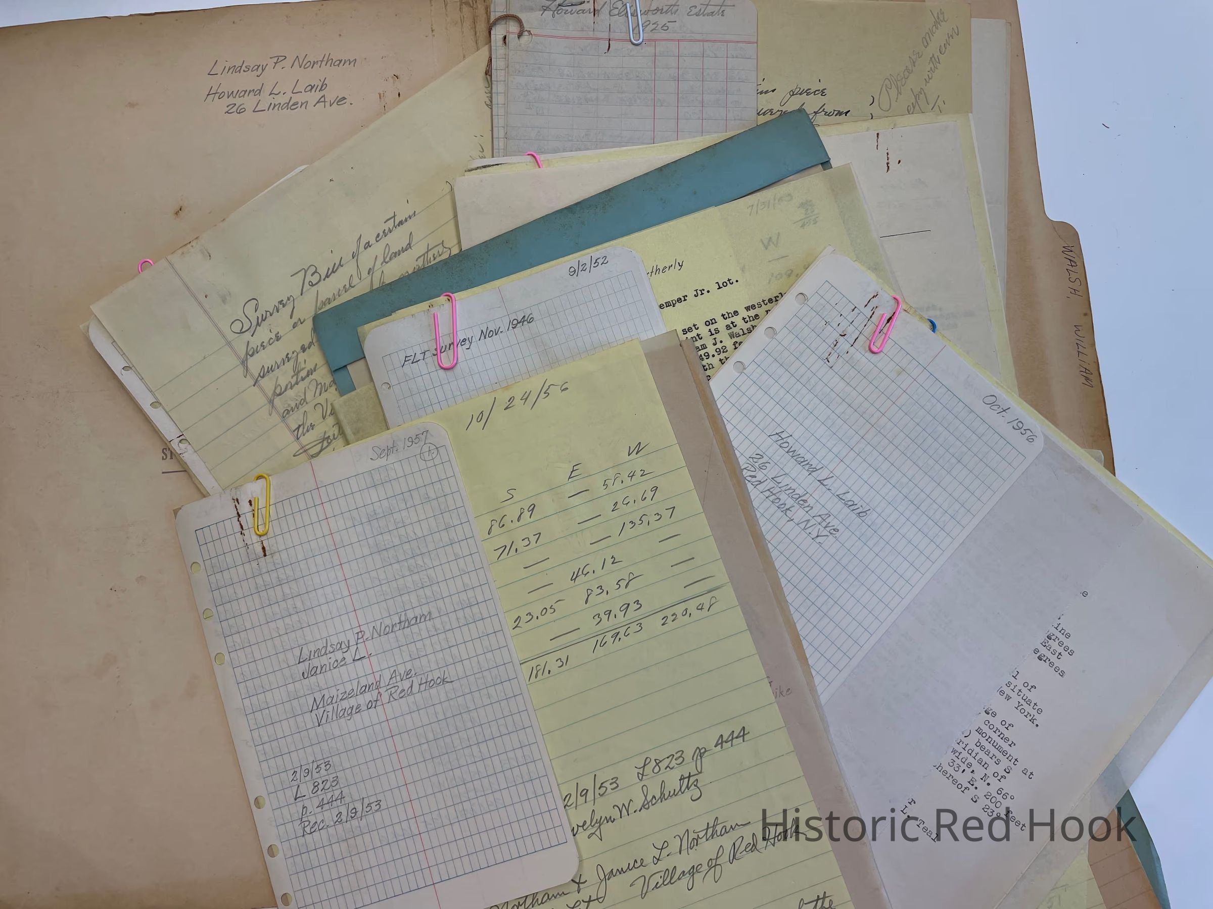
Name/Title
WALSH, WILLIAM RED HOOK VILLAGEEntry/Object ID
2016.011.390Scope and Content
(Miscellaneous papers and lots)
Field Notes: Lindsay P. Northam & Janice L. Sep 1957
Deed: 823:444 Robert H. Schultz & Evelyn Schultz to Lindsay P. Northam & Janice L. South Lot 9 Feb 1953
Map: (2) Of above property 0.66 acre
Field Notes: Haoward L. Laib 26 Linden Ave. Oct 1956
Survey:For Henry Abrahams oct 1946 584:329 Edith I. Komaromy to Philip Eisenberg 20 Aug 1940.
Field Notes: Joseph Shapiro @ Sep 1952; Lot from Wil’m Walsh on Linden Avenue
Revised Desc. Of Stanton Tremper, Jr. Lot 0.73 acre
Deed: 845:598 Stanton Tremper & Kathryn Tremper to Stanton Tremper Jr. & Priscilla Tremper 0.73 acre. Same as William Walsh to Stanton R. Tremper 711:578
Survey: For William Walsh 20 Aug 1951 0.577 acre
Survey: For William Walsh 29 Nov 1954. Parcel taken from property of William Walsh 1.016 acre
Survey: For William Walsh Nov 1954. Property of Joseph Shapiro 0.97 acre
Deed Desc.:709:349 William Walsh to Village of Red Hook
1st parecl- Maizeland Tract 1.5 acres
2nd parcel-Avenue B 1.07 acres
Deed: 709:345 William Walsh to John h. Rider and Helen P. Rider 2.48 acres
Survey: For Elizabeth M. Cole Nov 1953 Parcel on Fisk street 0.171 acre. Taken from easterly part of property from Frederick Zipser to Elizabeth Massonneau Cole 701:210
Field Notes: 8 Oct 1952 from FLT Survey 1924 Parcel C of Est. Of Howard Ellsworth
Survey: For Elizabeth Cole Aug 1954 Property of Elizabeth Cole, n. Side of Fraleigh St. 0.428 acre
Survey: For Estate of Howard Ellsworth 9 Jun 1924. Parcel C surveyed from the southerly portion of land from Peter G. Fraleigh to Walter Shafer and now in poss. Of Est of Howard Ellsworth 0.42 acre
Survey: For Estate of Howard Ellsworth 9 Jun 1924- Parcel D, North portion of “Walter Shafer Lot” on Prince Street .42 acre Note from FLT”No buildings on this lot”
Survey: For Foster W. Burger 26 Jun 1953 North side of property of Verna Lasher 283.6 Sq. Feet- Phillips St.
Field Notes: Howard Ellsworth Estate 1925
Survey: For James Melley Jun 1949 0.139 acre
Map: Inked drawing of lots on West Market and St. Johns
Deed: 116:365 P. Fraleigh to Walter Shafer- Parcel D ½ acre
Deed: 297:356 1898 Eli Ham to Howard Ellsworth ½ acre. Same as by two deeds; Stephen R. Burnett, Geo., John & David Ham to Eli Ham 244:327 1889 & 2nd Geo Ham as Guardian of H, Lizzie, Libbie & Minnie Shafer to Eli Ham 1889
Deed: 1850 P. G. Fraleigh to David A. Kipp ½ acre
Survey: For Estate of Howard Ellsworth- Parcel B as from Peter Fraleigh to William C. Kipp 0.25 acre
Survey: state of Howard Ellsworth 5 Feb 1825- Parcel G”Gertrude Kipp Lot”
Survey: For Lawren Ayres 28 Apr 1932. Parcel from northerly portion of land of Lawrens Ayres and Marion A. Ayres 0.295 acre
Letter: 27 Oct 1953 From Elizabeth M. Cole to Robert Decker
Field Notes: For Mrs. Joseph Vigeant 3 Oct 1951 “Mary Quirk Lot”
Survey: For Mrs. Joseph Vigeant 3 Oct 1951. Parcel from easterly portion of lot from Mary E. Cotting to Mary Quirk, now property of Martha Nillon 0.203 acre
Deed: 225:63 (Referee) Philip H. Coon et al to Mary E. Cotting17 Apr 1886-Lot on Prince Street. Being same as from William Phillips to Albert Marquart 15 Nov 1866
Survey: For Mrs. Walter Covingston 14 Oct 1949. Surveyed from northerly portion of Lot No. 3 of the Estate of Oliver D. Rider. 0.262 acre
Map: 26 Apr 1917 Of Property of Oliver Rider Bounded by Fraleigh & Garden Street.
Survey: 26 Apr 1917 Several lots of Oliver D. Rider:
1. 0.52 acre 2.0.50 acre 3.0.50 acreCollection
Teal-Decker CollectionRelationships
Related Person or Organization
Person or Organization
Teal, Frank L.