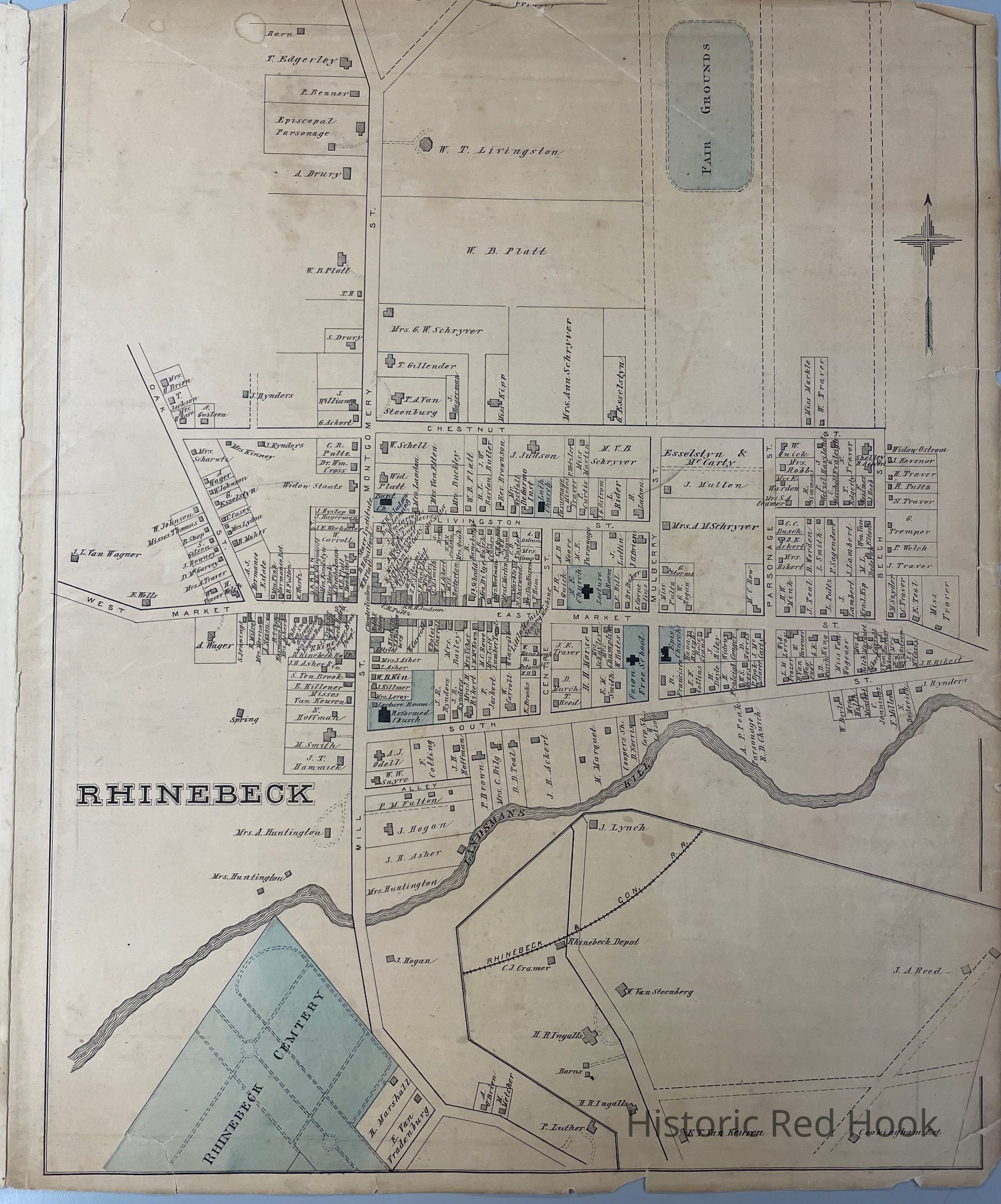
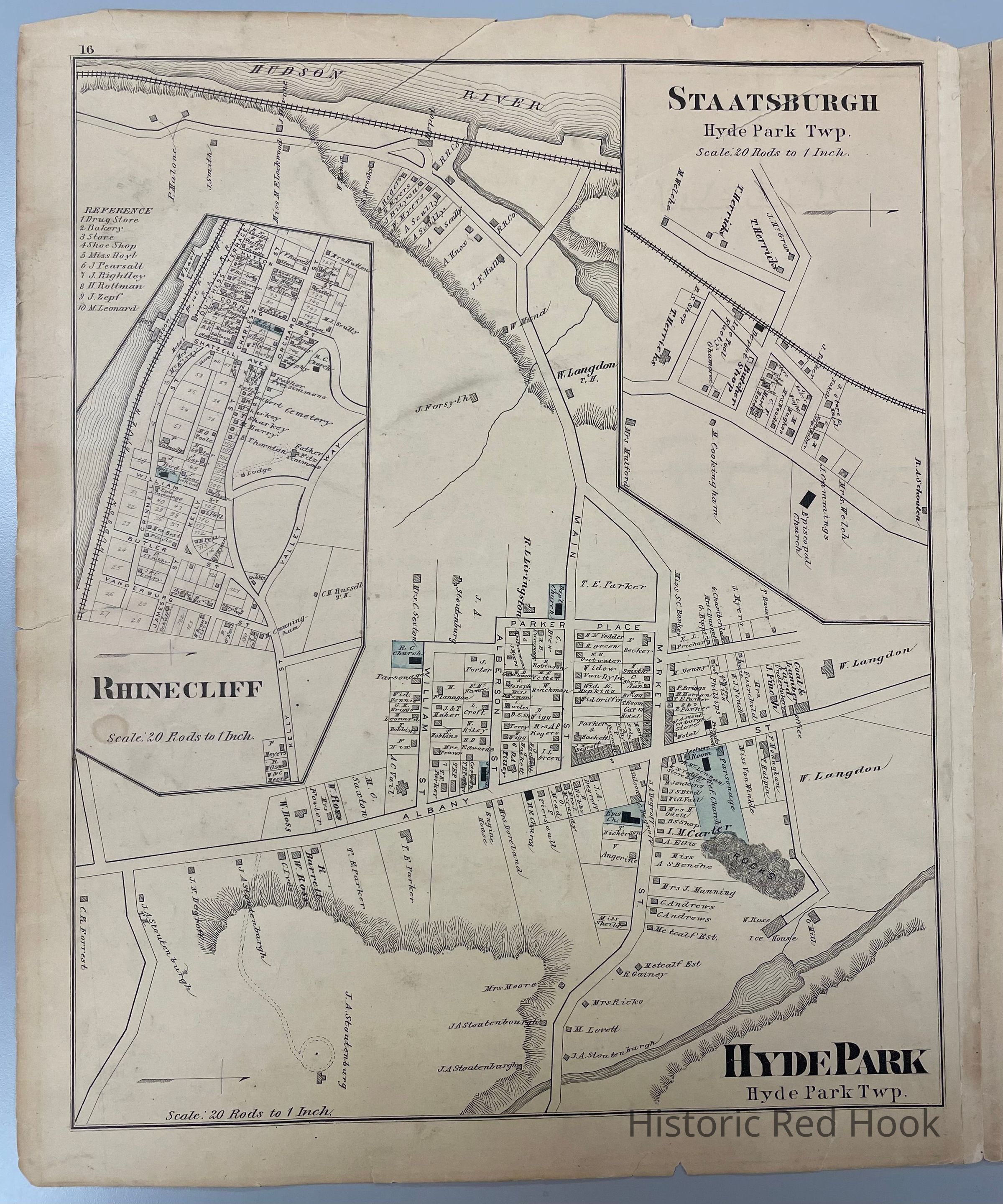
Name/Title
1876 O.W. Gray Maps of Rhinebeck, Hyde Park, Staatsburg, Rhinecliff, Bengal, StanfordvilleEntry/Object ID
2014.002.80Description
Plate from 1876 O.W. Gray New Illustrated Atlas of Dutchess County - Map of Rhinebeck Village, Village of Hyde Park, Staatsburg and Rhinecliff and on reverse, Town of Hyde Park with Bengal and StanfordvilleCollection
Red Hook Maps