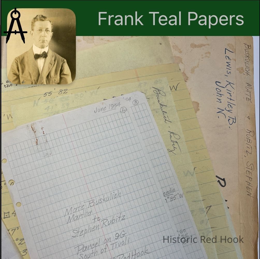
Name/Title
LEWIS, KIRTLEY B. & JOHN N. Buskulich, Nate & Rubitz, StephenEntry/Object ID
2016.011.249Scope and Content
Survey: For Walter Brothers 10 May 1949 Two lots. “North Lot” 1.382 acre. “South Lot” 1.382 acre
Survey: For Walter Brothers 10 May 1949 Parcel from the southerly portion of a certain 2 acre parcel from Samuel Robbins to Fred Walter in 1949 0.453 acre
Survey: For Kirtley B. Lewis 3 Apr 1933 4.57 acres
Survey: For Kirtley B. Lewis 1 Feb 1933 Parcel surveyed from the Homestead farm of Kirtley Lewis 6.72 acres
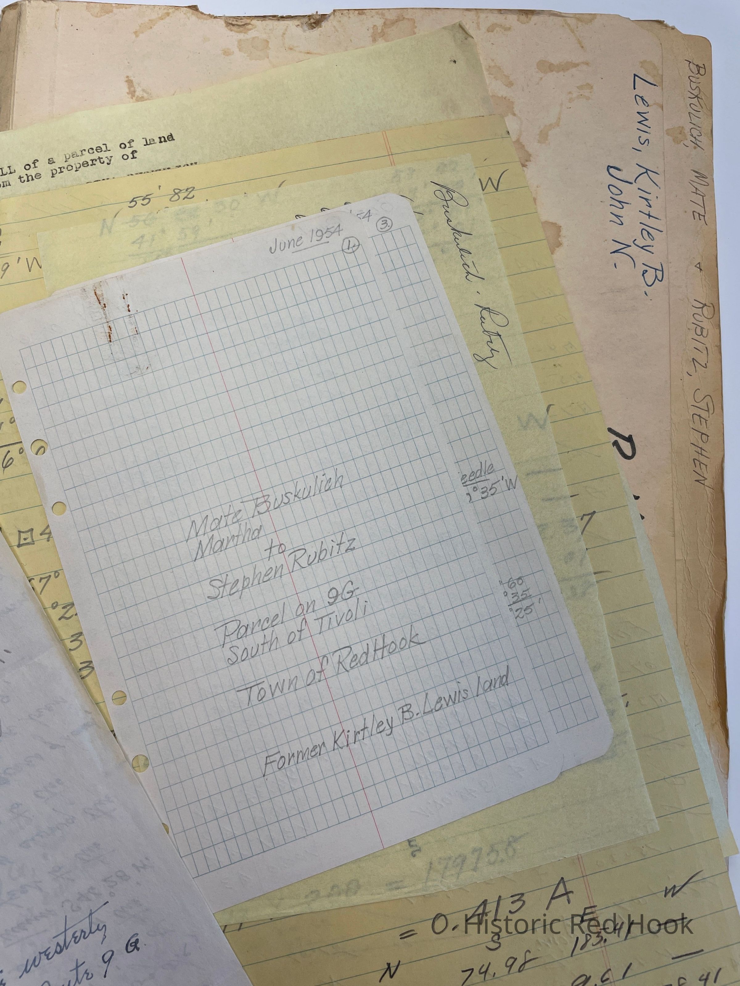
Field Notes & Survey: Nate Buskulich & Martha to Stephen Rubitz, Parcel on 9G south of Tivoli, formerly Kirtley B. Lewis Land. Survey for Nate Buskulich & Stephen Rubitz .413 acre
Map: 1927 Plan of N. Lot and part of Adams Lot 10.4 acre & 1.6 acre- “Harris”.
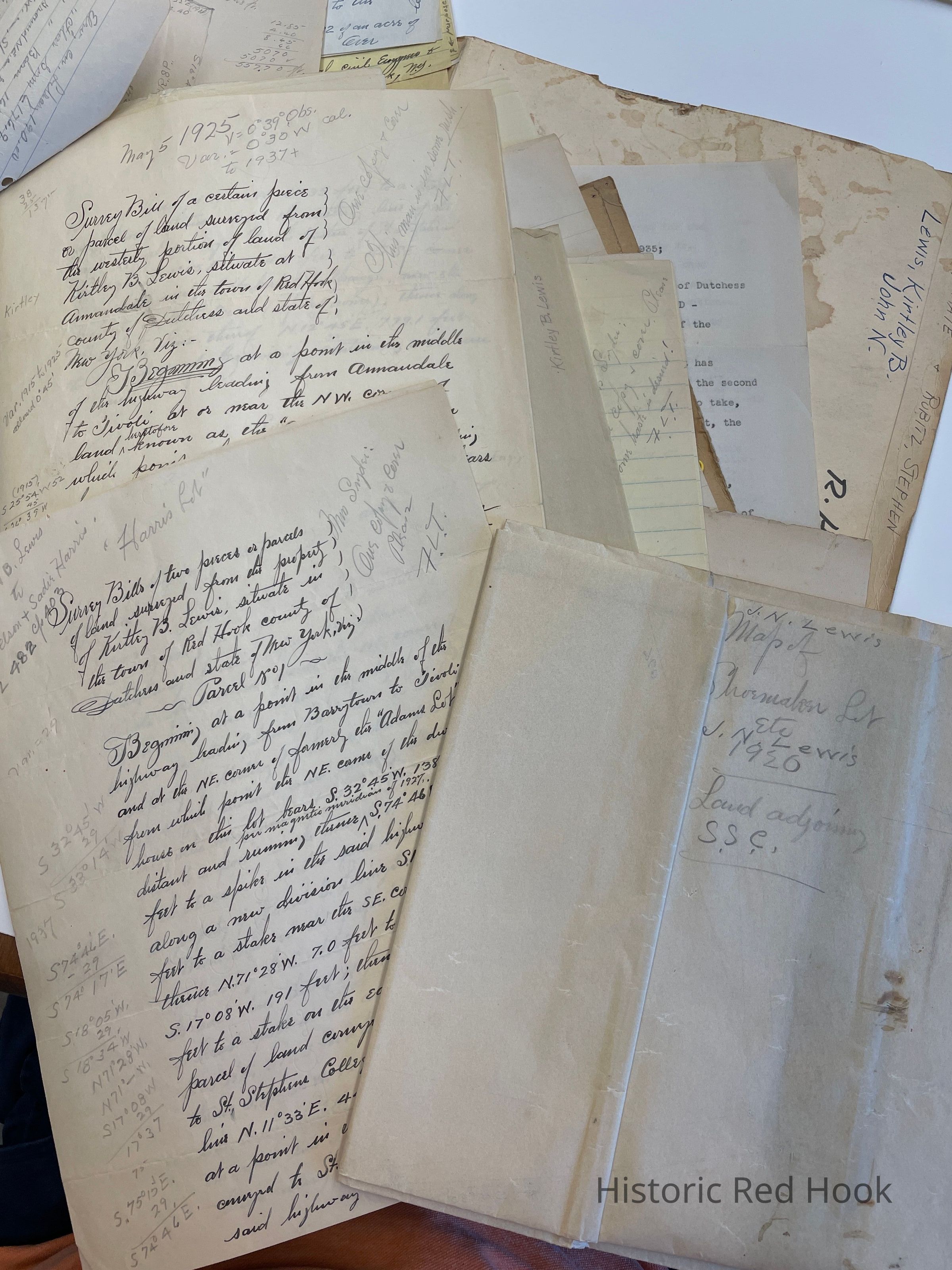
Survey: For Kirtley Lewis 22 Sep 1927 2 parcels 1st- 1.6 acre 2nd- 10.4 acres. Mentions “Adams Lot”, Ward Manor, “Shoemaker Lot”
Survey: For Kirtley B. Lewis 5 May 1925 From westerly portion of Lewis’s land. 3.26 acres with map.
Map: 3 Apr 1933 Plan 4.56 acres
Survey & Map: For Kirtley B. Lewis 20 Feb 1932. Parcel taken from farm of formerly John N. Lewis, dec’d, now Kirtley B. Lewis 26.9 acres. Mentions Seward Lasher, dec’d, Robert S. Livingston, Amelia S. Tanner
Survey: For Kirtley Lewis Sep 1923 Tract of land formerly of John N. Lewis 177.15 acres. Mentions: NE corner of “Showmaker Lot’, NE corner of “Adams Lot”, SE corner of land formerly of Robert S. Livingston, now Gordon Hammersley, S line of Seward Lasher, along line of Amelia Tanner, now Dr. Samuel H. Brown, S line of late Robert D. Sherman, W line of Thomas Beckwith, W line of George Fraleigh, long line of Joseph Griffing now George Skinner, along line of Mrs. Andrew Zabriskie, NW corner of certain lot of 15 1/4 acre from John Van Benthuysen to Anthony Straat in 1788 now property of Andrew Zabriskie
Survey: For Henry D. Lewis 15 Mar 1915: “Shoemaker Lot” portion of estate of John N. Lewis dec’d. 26.75 acres. Mentions: Along westerly bounds of Peter Lewis in 1820, northerly bounds of formerly the Staats Farm, new division line of “Adams Lot”
Survey: For Henry D. Lewis 15 Mar 1915, portion of estate of John N. Lewis, “Adams Lot” 17.03 acres. Mentions: along bounds of “Shoemaker Lot”, n bounds of Staats farm to NW corner of Staats farm, along N bounds of Andrew C. Zabriskie, formerly property of Charles E. Sands, along property of St. Stephens College, to SW corner of lot from William Allendorph to Thomas Harris in 1820
Map: Shoemaker Lot 1920 and adjoining property.
Map & Note: The “Harris Lot”. 4.18 ½ acres. Deed of 1875, John N. Lewis & wife to Peter A. Harris 181:351
Survey: Parcel from westerly portion of land of Kirtley Lewis .937 acre
Survey: For Keble Dean Parcel from westerly portion of land of Kirtley Lewis .33 acre 2 May 1905. Bounded by John N. Lewis, James Dennis, Arthur DuBois
Survey: Kirtley Lewis & wife Margaret to Dutchess County ROW 1930
Survey: For Bard College & Kirtley Lewis Sept 1937 0.31 acre
Survey: For Bard College and Kirtley Lewis Sep 1937 6.50 acres
Lease Agreement: Bet Bard College and Kirtley Lewis Oct 1935
Deed: 7 Apr 1915 388:598 Nelson P. Lewis & wife to Kirtley B. Lewis 17.3 acres “Adams Lot” & Shoemaker Lot 26.75 acres
Deed: Elizabeth B. Lewis to Kirtley B. Lewis 28 Nov 1931 520:83 177.15 acres
Map: John N. Lewis Farm 1923
Map: By P.N. Lewis
Map: Two properties. One is of the .937 acres of K. Lewis and the other is of a parcel in Rhinebeck. Surveyed from Farm of Alfred Welch, now Michael Proper “Eighmyville” 1920 6.98 acres.Collection
Teal-Decker CollectionRelationships
Related Person or Organization
Person or Organization
Teal, Frank L.