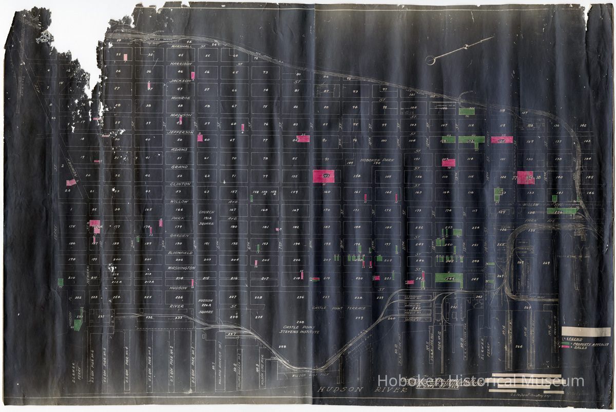
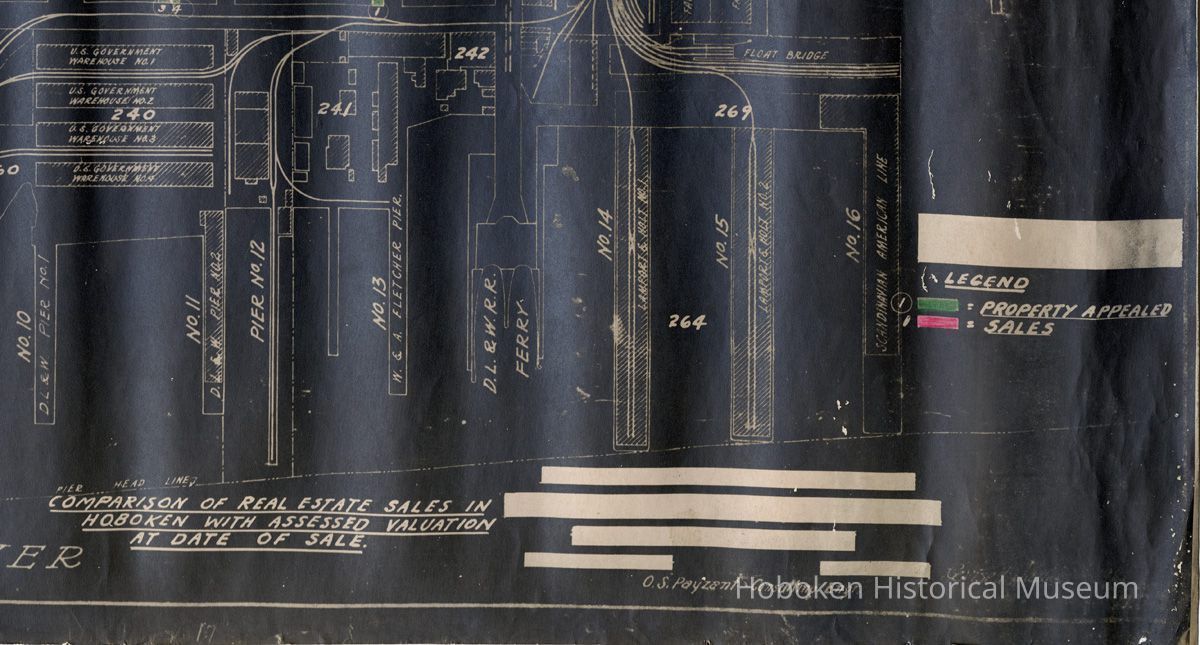
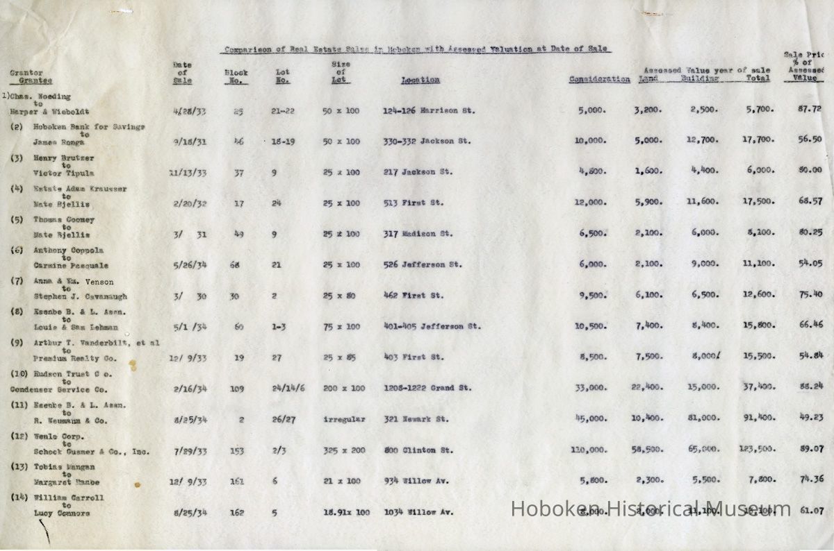
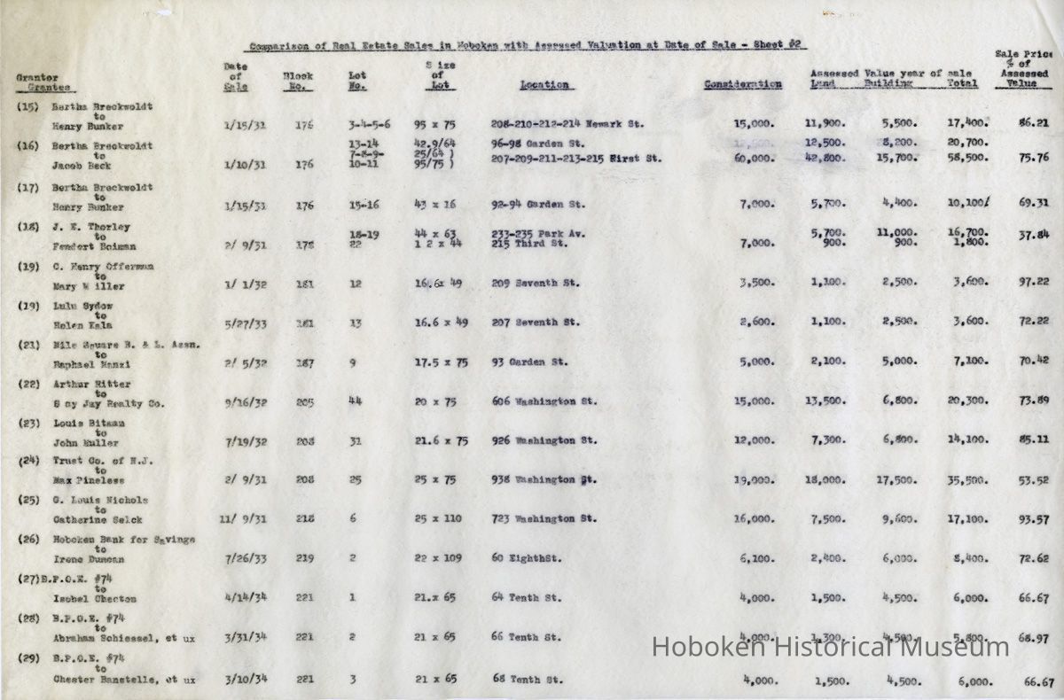
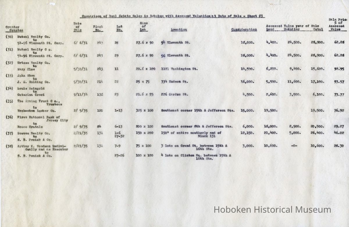
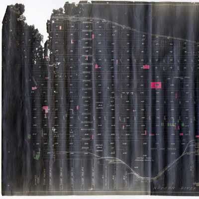
Map: Comparison of Real Estate Sales in Hoboken with Assessed Valuation At Date of Sale. N.d., ca. 1936-1937.
Entry/Object ID
2012.040.0004
Scope and Content
Map: Comparison of Real Estate Sales in Hoboken with Assessed Valuation At Date of Sale. No date, circa 1935-1936 (date on map not legible).
Drawing - white line print, black background 35" wide x 23" high. A full map of Hoboken.
With: three typewritten carbon leaves, 12" x18" wide
Titled same as drawing, 38 properties keyed to map, numbered 1 to 38, 11 columns of information. Dates of sales are from 1930 up to early 1935.
Title:
Comparison of Real Estate Sales in
Hoboken with Assessed Valuation
At Date of Sale.
O.S. Payzant, Consulting Engr. Revised: [date not legible]
(Several blocks of text in the title area have been redacted and appear as white blocks on the black ground; it appears that the title above replaced text in this area.)
Legend
[green] = Property Appealed
[red] = Sales
----
Tax map / assessments / valuations