Name/Title
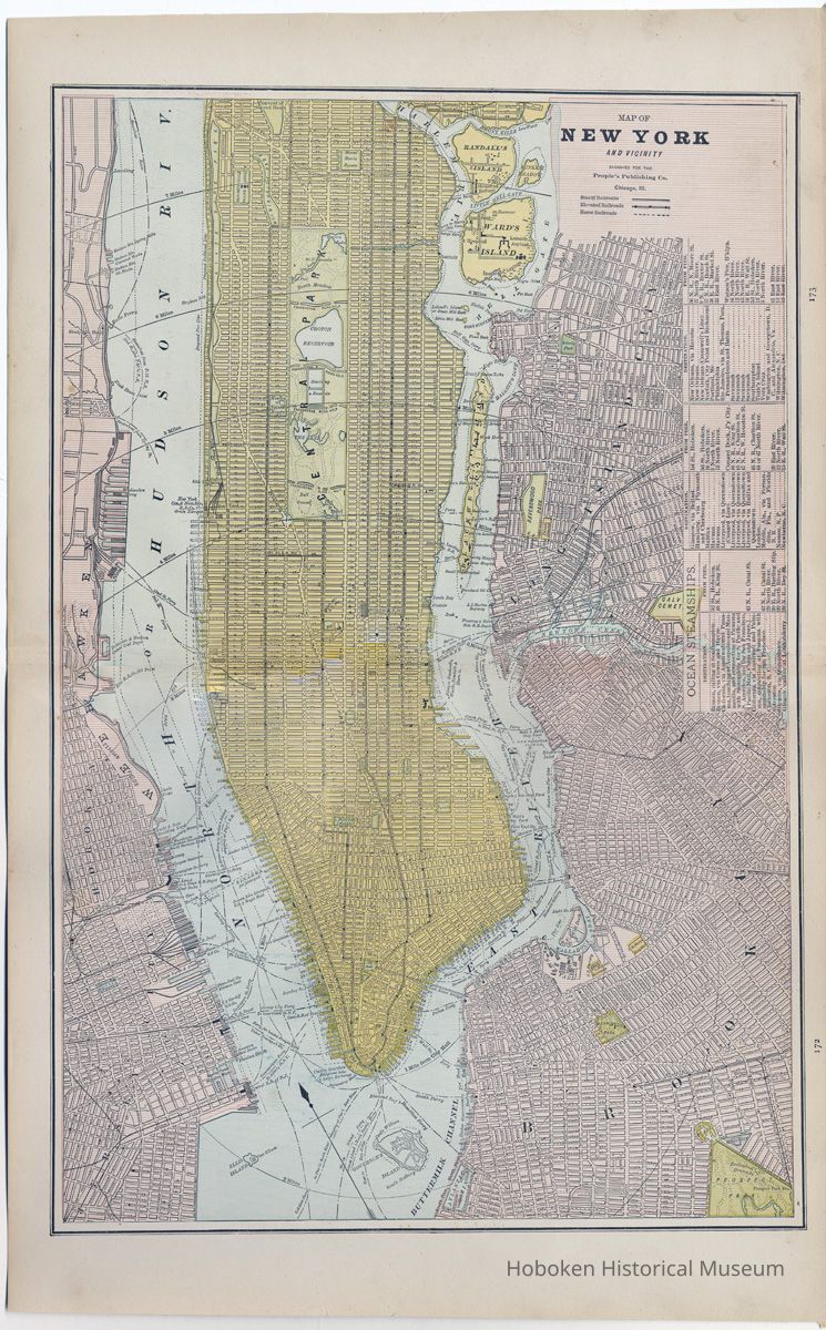
Map of New York and Vicinity. People's Publishing Co., Chicago, Ill., [1886.]Entry/Object ID
2009.006.0081Scope and Content
Map of New York and Vicinity. Engraved for the People's Publishing Co., Chicago, Illinois, [1886.] Pages 172-173 from People's Illustrative and Descriptive Family Atlas of the World, Chicago, 1886.
Double plate map 13-1/2" wide x 21-1/4" high. Printed in color; no scale. Note: color printing registration is just fair. PDF on file.
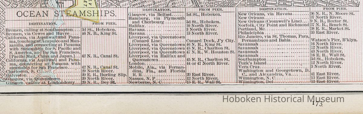
Map shows New York (then only Manhattan) from below 132nd St. plus parts of Brooklyn, Long Island City (Queens) and the west bank of the Hudson including Hoboken. A table at the upper left is titled "Ocean Steamships" and lists destinations and the pier that the ships sailed from. Hoboken is the departure port for cities of Bremen, Glasgow, Hamburg and Southampton.
Main legend: Steam Railroads, Elevated Railroads; Horse Railroads.
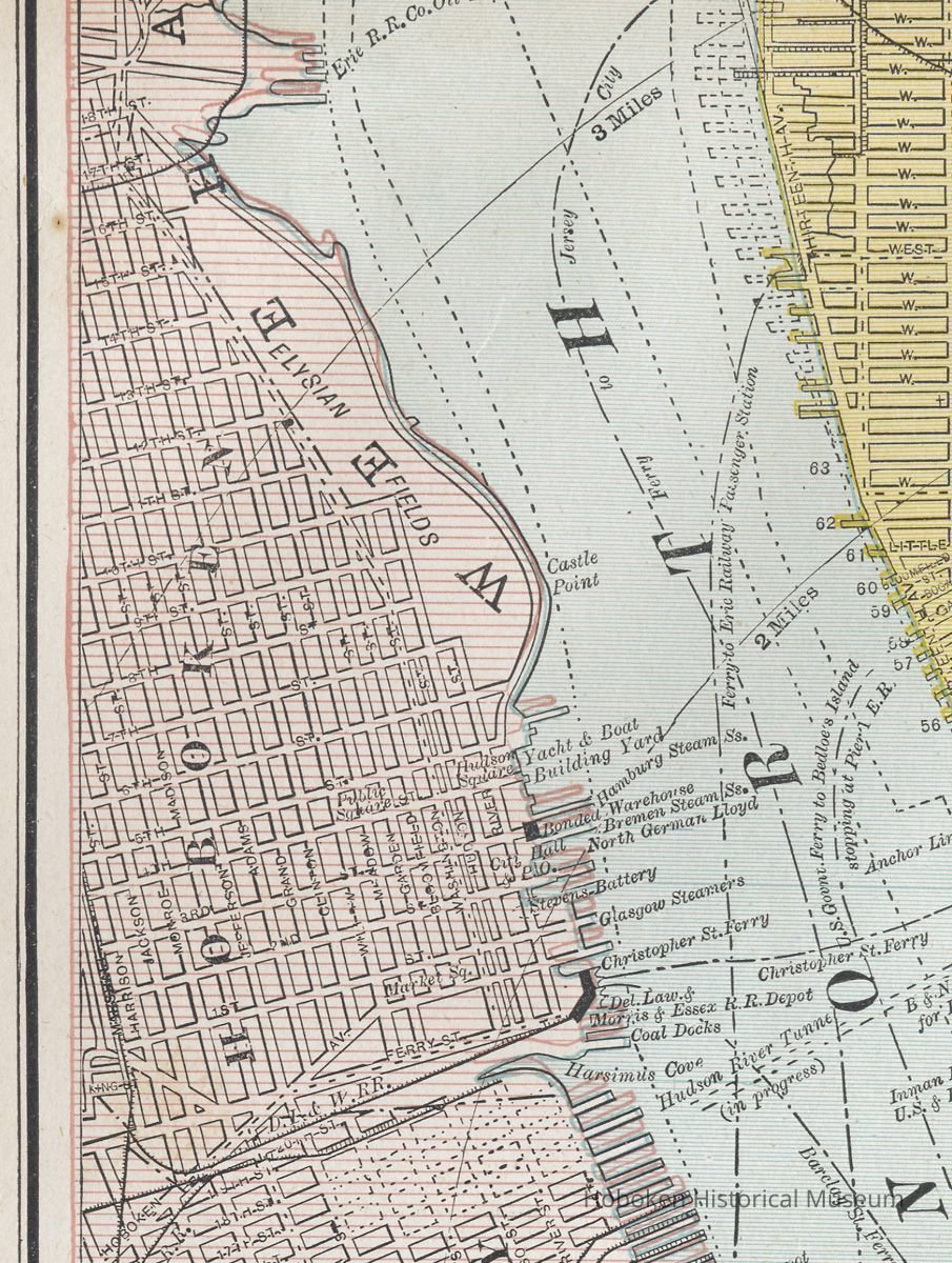
Hoboken features printed on map include all streets.
Note: Sybil's Cave and River Walk are not on the map.
Points in Hoboken:
Elysian Fields
Castle Point
Public Square [later Church Square Park]
Hudson Square [Park]
Yacht & Boat Building Yard
Hamburg Steam Ships
Bonded Warehouse
Bremen Steam Ships
North German Lloyd
Glasgow Steamers
City Hall & Post Office (Hudson and Third Streets)
Market Square
Christopher St. Ferry
Barclay St. Ferry
Delaware, Lackawanna & Western Railroad
Delaware Lackawanna & Morris & Essex Railroad Depot
Coal Docks
A horse railroad (horsecar trolley) route is shown in Hoboken, but it is not named.
Also notable is a "Hoboken Street" on the west side of Manhattan running from Canal Street to the Hudson River. It was just over a block long.Acquisition
Accession
2009.006Source or Donor
Lukacs, ClaireAcquisition Method
GiftCredit Line
Museum Collections. Gift of a friend of the Museum.Archive Details
Date(s) of Creation
1886 - 1886Archive Notes
Date(s) Created: 1886
Date(s): 1886-1886General Notes
Note
Notes: Although other editions of this map by this publisher were issued in this period, the donor received information that identified it as being from the 1886 edition.
The folio has on page 171 a section title, "Plans for the Principal Cities of the United States", followed by eleven city names including Brooklyn which is on page 174.
Status: OK
Status By: dw
Status Date: 2009-06-11