Name/Title
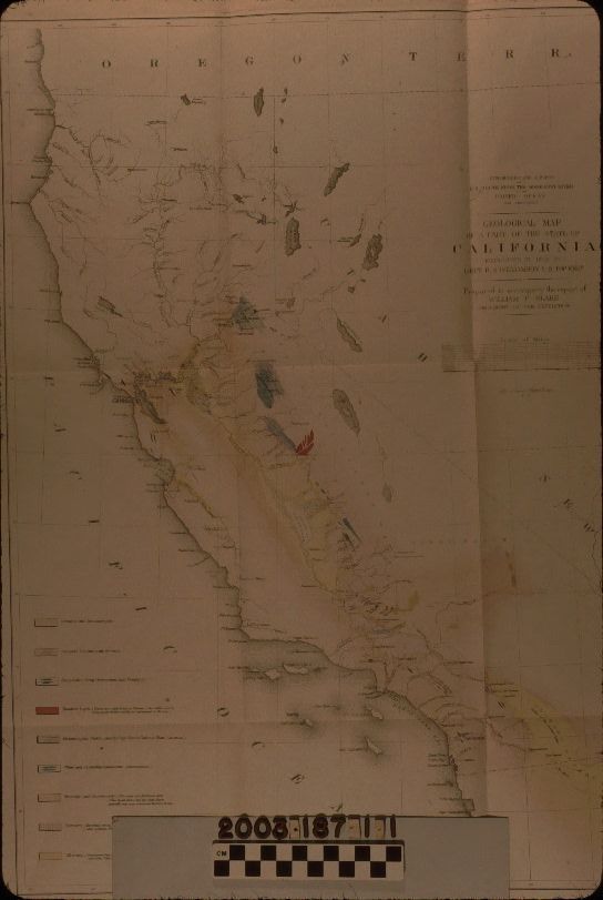
A GEOLOGICAL MAP OF CALIFORNIA, 1853Entry/Object ID
2003.187.1.1Description
Color: Black; Blue; Green; Pink; Red; Yellow; White
A map titled "Geological Map of a Part of the State of California," conducted under the auspices of the Explorations and Surveys for a Railroad Route from the Mississippi River to the Pacific Ocean, War Department, 1853. The map was a reult of a topographic expedition led by Lt. R. S. Williamson and parepared to accompany the report of expedition geologist William P. Blake. The title and scale of miles is at the upper right, as is the name of the lithographer, Sarony, Major & Knapp of New York. The modern boundaries of the state are shown, with the territories of Oregon, Utah, and New Mexico bordering, and a small portion of Mexico at the bottom right. Because of the limits of the exploration, this area is shown in a pink tint from Nevada City south to the Mexican border, although place names, rivers, lakes, and other features are shown outside of the explored area. Colored sections on the map, referenced by a legend at the lower left, denote the types of stone and mineral composition encountered. One such small area, colored green, appears to be in the Puente Hills on the Rancho La Puente and is denoted as "Serpentine, Trap, Greenstone, and Porphyry." Roads, rivers, and creeks, and trails, such as the Old Spanish, are included throughout, but are of particular interest in the Los Angeles area. At the margins are degrees latitude and longitude. On the upper right of the back is the pencil signature of pervious owner, historian Marion Parks. With adhesive residue on the back, light creases, soiling, and yellowing, folds, losses at the left edge, pin holes, small stains, and some small tears, the overall condition is fair.Lexicon
Search Terms
Two-dimensional, Maps, Sarony, Major & Knapp [firm], Geology--California, Voyages and travels, West (U. S.)--History--1848-1950