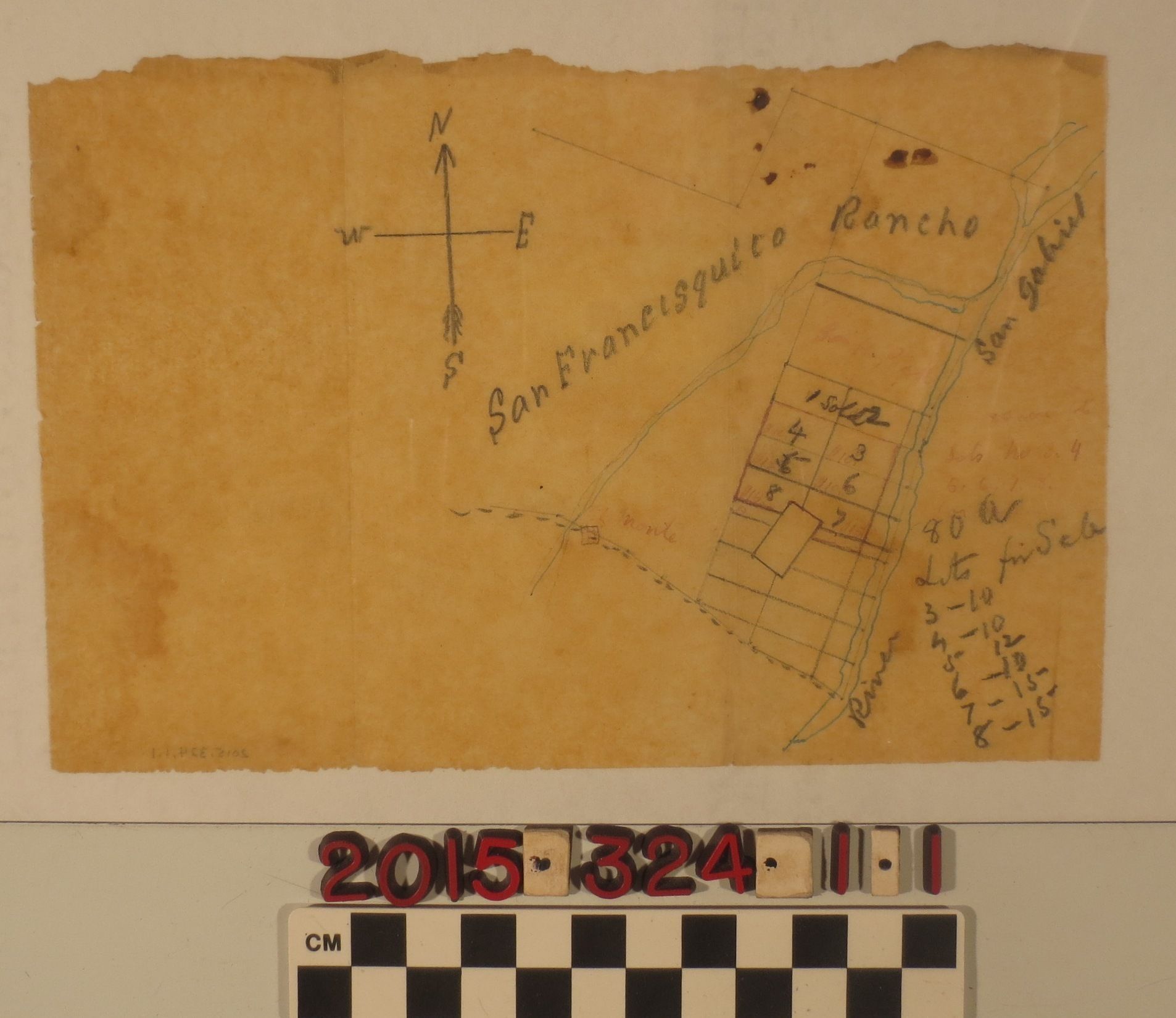
A hand drawn map of a portion of the San Francisquito Rancho, San Gabriel Valley
Entry/Object ID
2015.324.1.1
Description
A hand drawn map of a portion of the San Francisquito Rancho, San Gabriel Valley, ca. 1870. The map, drawn freehand in ink and pencil on tracing paper, depicts the San Gabriel River at the eastern border of six 80 acre lots for sale. To the west is the San Francisquito Rancho and to the south is El Monte. The lots are joined and together make up a rectangle. To the north of these six lots, two lots have already been sold and the land directly north belonged to Peck. At the upper left is a drawn directional compass, lot numbers and prices are at bottom right. The page has a rough torn edge at the top and a few ink stains at top right, red ink is fading. In general the page is thin but in good condition.