Color: Black; White
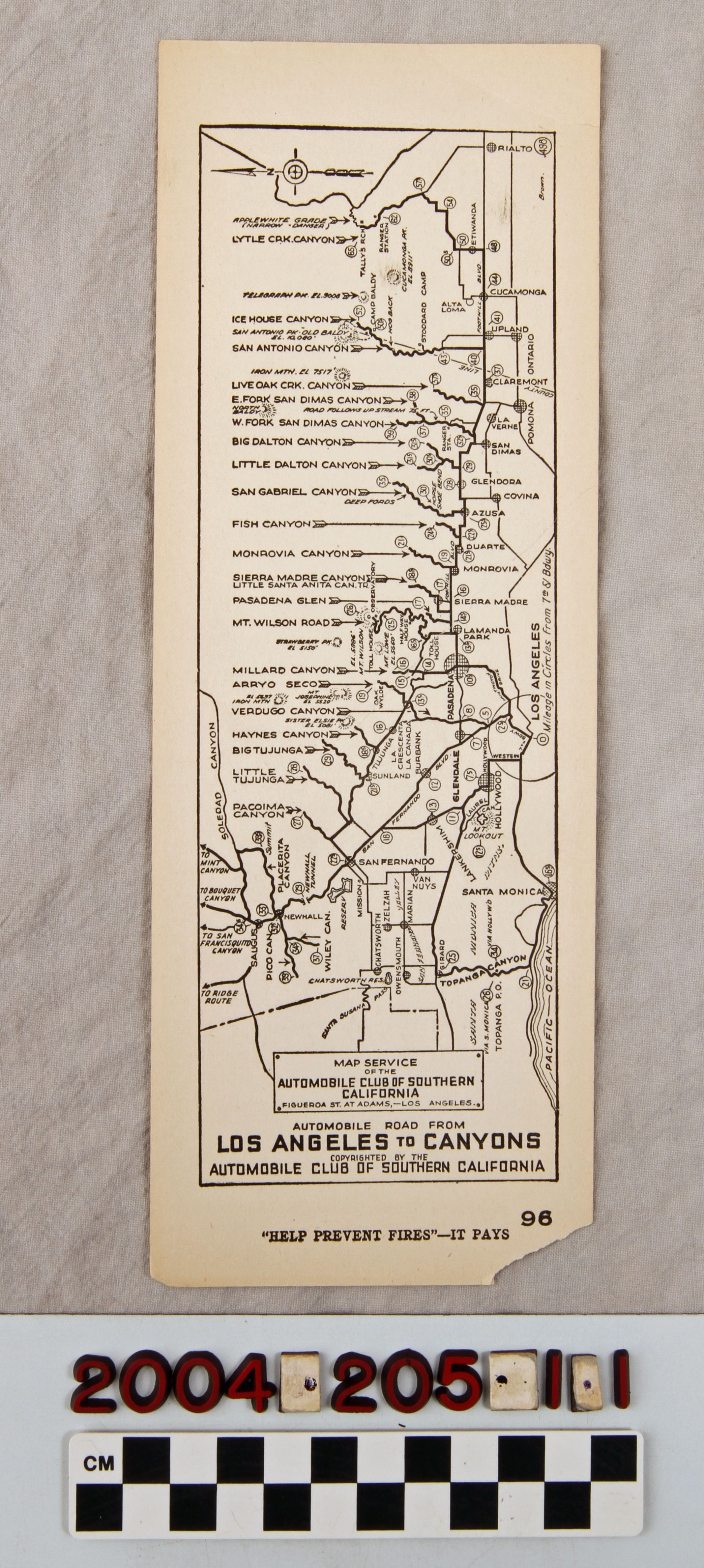
A strip map showing the route from Los Angeles to canyons, issued by the Automobile Association of Southern California, ca. 1920s. The artifact shows many different routes to canyons from Saugus to Cajon Pass, with most canyon names at the left side of the map with arrows pointing to the roads that lead to them. Mileage markers are in circled borders along these routes and major thoroughfares on the routes are identified. There are community and city names, locations of attractions and places of interest on the canyon roads. At the far right is the place of origin at 7th and Broadway in downtown Los Angeles for determining the mileage to canyons. The title of the map is at the bottom and a compass at the top left. At the bottom is the admonition "'HELP PREVENT FIRES' - IT PAYS" with the number "96" next to it. The surname Brown is at the upper right probably indicating who drew the map. With only some creases at the bottom corner and at the center, light soiling, minor browning, a fold at the bottom left corner, light smudges at the top of the front and tears at the top left, the condition is good.
Lexicon
LOC Thesaurus for Graphic Materials
Tourist trade, Automobiles
Search Terms
Two-dimensional, Maps, Automobile Club of Southern California, Canyons--California, Southern