Color: Black; White
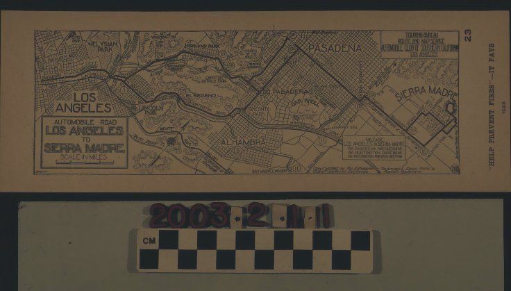
A strip map showing the route from Los Angeles to Sierra Madre, issued by the Automobile Association of Southern California, ca. 1920s. The artifact shows three one-way routes from Seventh and Broadway in downtown Los Angeles to the San Gabriel Valley suburb via Pasadena Avenue (now Figueroa St.) to Mission Street to Orange Grove Ave., to Colorado St. to Foothill Bl., to Sierra Madre Ave. or Baldwin Ave.; or via Huntington Drive to Fair Oaks Ave. to Colorado St. and then as in the first route or via Huntington Drive to, probably, Baldwin Ave. though this is not clearly demarcated on the map. Mileage markers are in circled borders along these routes and a box showing the distances for the three routes is toward the lower right. There are community and city names, locations of parks and tourist attractions (such as Cawston's Ostrich Farm) and other thoroughfares marked on the artifact, as well. The title of the map and a scale of miles are at the bottom left and there is a box at the upper right that indicates the map was issued by the AAA's "Touring Bureau Route and Map Service." At the right margin is the admonition "'HELP PREVENT FIRES' - IT PAYS" with the number "1023" beneath it. The number "23" is at the upper right and the name Brown is at the lower left, probably indicating who drew the map. On the back is a notice of contracted garages and hotels. With only some minor browning of the paper, the artifact is in good overall condition.
Lexicon
LOC Thesaurus for Graphic Materials
Tourist trade, Automobiles
Search Terms
Two-dimensional, Maps, Automobile Club of Southern California