Name/Title
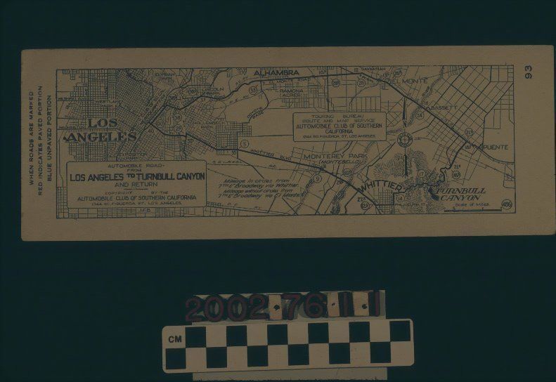
AAA STRIP MAP, LOS ANGELES TO TURNBULL CANYONEntry/Object ID
2002.76.1.1Description
Color: Black; White
A strip map showing the route from Los Angeles to Turnbull Canyon, issued by the Automobile Association of Southern California, ca. 1920. The artifact shows a round-trip from the company's headquarters at Pico and Figueroa streets, through downtown and leading into the San Gabriel Valley along Mission and El Monte roads (this latter now being Valley Blvd.) Mile markers are given occasionally, and at the 21.5 mark is where Turnbull Canyon and Valley meet, near the Homestead. The route then turns south and ascends the Puente Hills, leading down to downtown Whittier and across to Whittier Blvd. Becoming Stephenson Ave. in East Los Angeles (this is now Whittier Blvd.), a slight jog at Boyle Avenue in Boyle Heights leads to Seventh Street and back into downtown Los Angeles and AAA headquarters. Mileage indicators are for both legs of the trip, so that circled markers are for the route via Whittier and uncircled markers are for the route via El Monte. There are some indications of surveyed areas, some community and city names, a scale of miles at the bottom right, and the title of the map at the bottom left, within a border. A bordered box at the right of center indicates the map was issued by the AAA's "Touring Bureau Route and Map Service." At the left margin is the notation that red and blue streets indicate paved and unpaved roads, respectively, but there are no such marks. The number "93" is at the right margin, indicating, probably, an identification number. On the back is a notice of contracted garages, which are five in number in Alhambra, El Monte, and Whitter. With minor creases and dents at the corner, slight discoloration and minor foxing, the object is in good condition.Lexicon
LOC Thesaurus for Graphic Materials
Tourist trade, AutomobilesSearch Terms
Two-dimensional, Maps, Automobile Club of Southern California