Name/Title
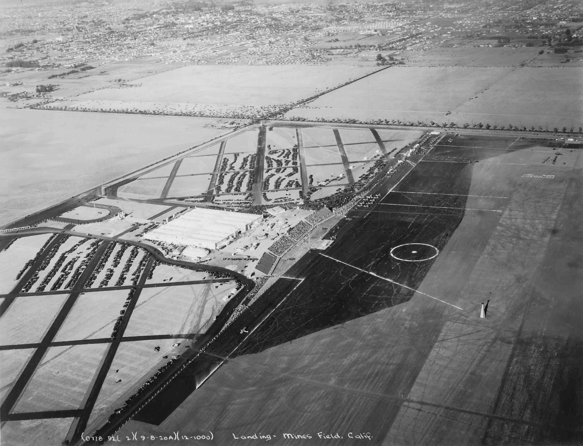
AERIAL VIEW OF MINES FIELD, LOS ANGELES, 1928Entry/Object ID
2003.108.1.1Description
Color: Black; White
An aerial photograph of Mines Field, now Los Angles International Airport, 8 September 1928. The view is looking toward the northeast from the western end of the airport and slightly south of the runway. At the center are four sets of bleachers filled with people. On the runway are several dozen aircraft and persons milling about. To the right are lines drawn, including one to a tower and a circular area with a dot in the middle of it. To the left is a large building, the hangar, with a few smaller adjacent structures. North and south of these buildings are crosshathced roads at angles, between which are many parked cars. To the immediate north of the hangar is the main airport entrance featuring a u-shaped road approach. A main thoroughfare, probably today's Century Blvd., at the far left leads from the airport east, where, a few miles away, past empty plots of land, the spreading city is located. To the east of the airport is a north-south road and there might be animals grazing in the plots along this road, probably Sepulveda Blvd. At the bottom in white lettering is a caption, including sets of numbers in parentheses, one being the date, and the wording: "Landing - Mines Field, Calif." With bowing, a missing corner on the bottom left and a piece gone at the top right, some soiling on the back, page yellowing, small folds, and some finger stains on the back, the overall condition is good.
Number-Units: 1Lexicon
Search Terms
Two-dimensional, Photographs, Los Angeles (Calif.)--Aerial views, Airports--Los Angeles (Calif.), Aeronautics--Los Angeles (Calif.)