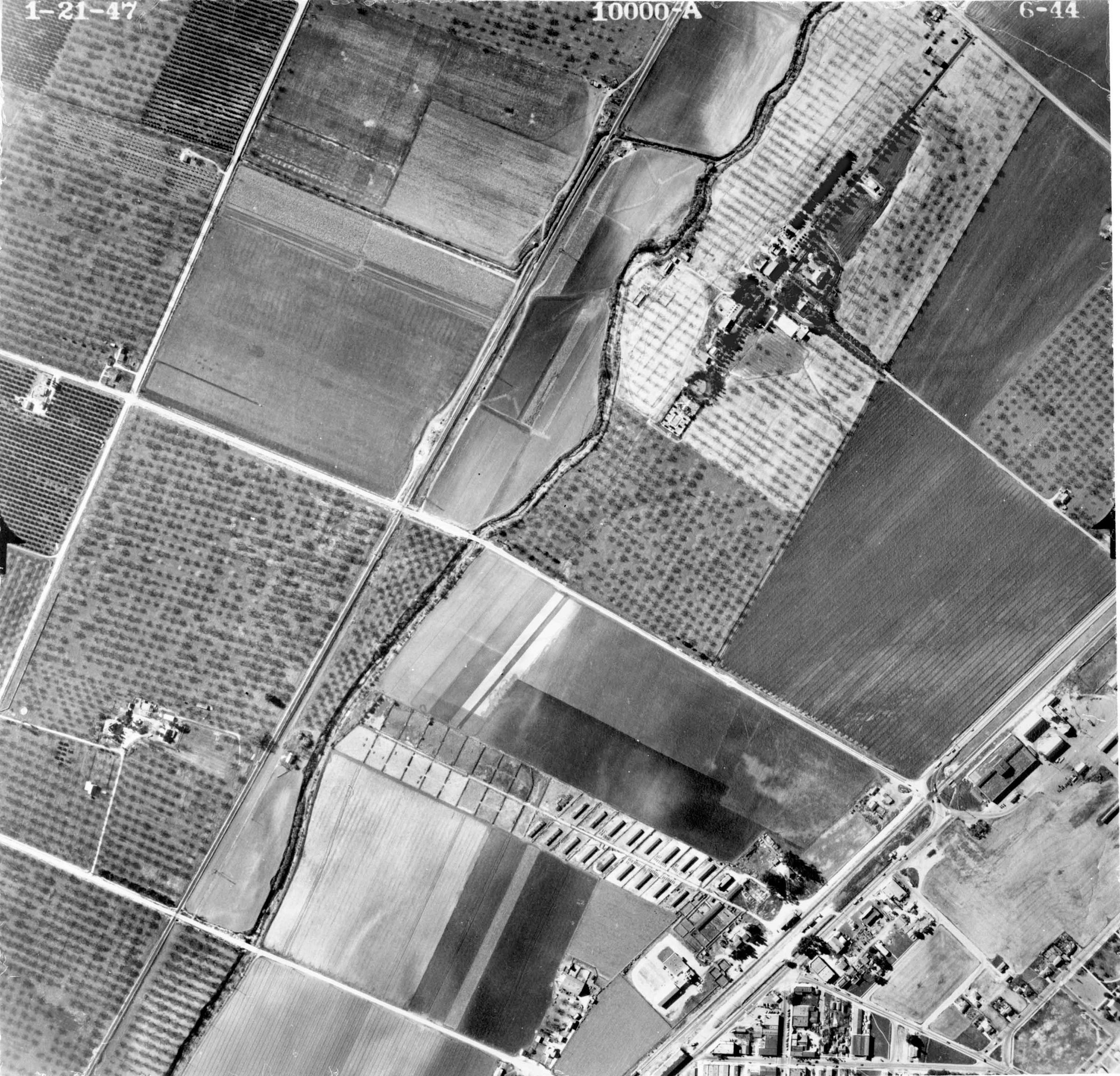
AERIAL VIEW OF THE HOMESTEAD FROM DIRECTLY ABOVE, 21 JANUARY 1947
Entry/Object ID
99.6.6.161
Description
AERIAL VIEW OF THE HOMESTEAD FROM DIRECTLY ABOVE, 21 JANUARY 1947
Color: Black and white
A black and white aerial negative of the Homestead site, 21 January 1947. Taken from directly above the site, almost all of the 92-acre ranch previously owned by Walter P. Temple and then owned by Harry and Lois Brown is visible. The ranch is visible at the center and lower right with the historic houses and cemetery in a darker section of a portion of the ranch that appears white. the dark portion above that is also part of the 92 acres. At the upper left corner is part of La Puente with Valley Blvd. running along the right side of the town. Hudson Road, now Hacienda Blvd., runs horizontally across the image just above the Homestead, while Rowland St., now Gale Ave., is a vertical line along the right side. The Rowland House is at the top right with driveways leading to Rowland St. to the right and Stimson Ave. at the top. Some of the agricultural ranches and farms can be seen with walnut and citrus groves, including that of the Homestead. Being a new copy negative corresponding to print 98.47.2.2, the image is in mint condition.
Number-Units: 1
Lexicon
Search Terms
Two-dimensional, Negatives, El Encanto Sanatorium, City of Industry (Calif.)--Aerial views, City of Industry (Calif.)--Homestead Museum, Hospitals, Convalescent--Los Angeles County (Calif.), Historic sites--Los Angeles County (Calif.), Ranches--Los Angeles County (Calif.), Sanatoriums--Los Angeles County (Calif.)