Name/Title
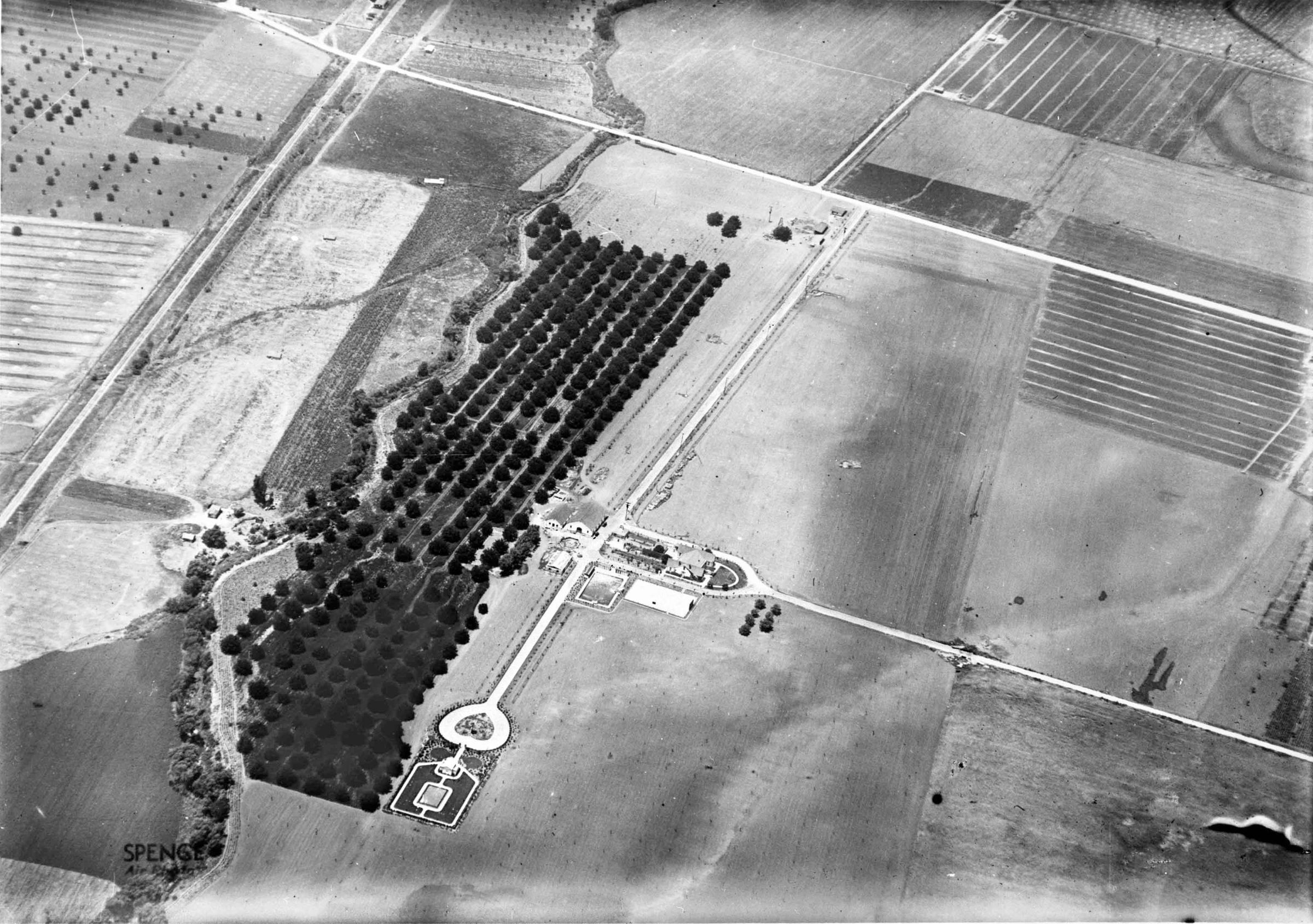
AERIAL VIEW OF THE HOMESTEAD SITE, CA. 1921Entry/Object ID
99.6.10.223Description
Color: Black; White
A negative of a black and white aerial photograph of the Homestead site from the northeast, ca. 1921. The main portion of the site is at center with a road coming in from the north to the Workman House and Water Tower which are enclosed in a semicircular area. Only the roof and a portion of the east wall of the home, which is in an "h" shape, can be seen. To the left is a courtyard with trees and bushes and further left is the roof and east side of the Water Tower. Below this is a reservoir/swimming pool and a tennis court. Several other structures are left of the Water Tower including former winery buildings used by the Temple family as a cafeteria and auditorium. Evergreen Lane crosses between the Water Tower and these structures extending from Turnbull Canyon Road towards the top to the El Campo Santo, with its adjoining heart-shaped planter, at the bottom. Clearly distinguished within the cemetery are the mausoleum at its top and the center plot in the back. Surrounding the site are agricultural fields and walnut trees seen to the left, alongside of which is San Jose Creek, and train tracks. At the top of the image near the corner of Evergreen Lane, Turnbull Canyon, and Don Julian Road, just to the left of Evergreen Lane, are two homes. Largely unused fields are to the right, in which a faint line running from the top to bottom demarcates the boundaries of the 75-acre Workman Homestead. There are three photographs with the number 99.5.10.223, and the artifact is in good condition.
Number-Units: 1Lexicon
LOC Thesaurus for Graphic Materials
Aerial photographsSearch Terms
Two-dimensional, Negatives, Spence Air Photos, Ranches--Los Angeles County (Calif.), Walnut industry