Name/Title
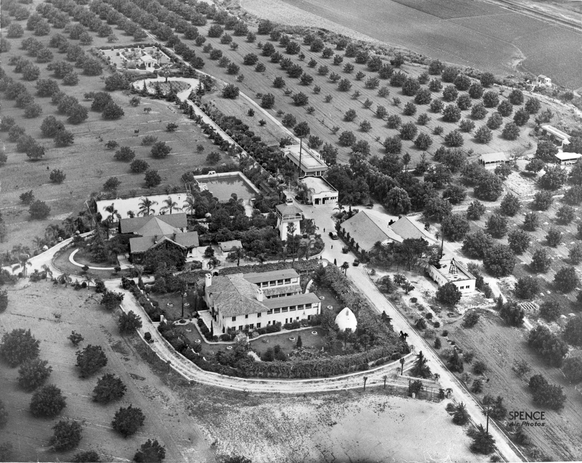
AERIAL VIEW OF THE HOMESTEAD SITE FROM THE NORTHWEST, CA. 1940Entry/Object ID
99.6.10.224Description
AERIAL VIEW OF THE HOMESTEAD SITE FROM THE NORTHWEST, CA. 1940
Color: Black; White
A black and white aerial photograph of the Homestead site from the northwest, ca. 1940. At center are the various buildings of the site including the tennis court and reservoir, below which is the Workman House on the center left. To the right is the Water Tower and adjacent Pump House, around which are palm trees, bushes, and hedges. Below the Workman House is La Casa Nueva and the Tepee, surrounded by landscaping and the Mission Walkway. On the perimeter of the homes are driveways, connecting to entrance roads from the left toward Valley Blvd. and the bottom toward Turnbull Canyon Rd. ; in the southwest corner of the west lawn which has grass; trees; bushes; round planters. To the right are seven structures including the auditorium, dining hall, laundry room, garage, and stables or barns. At the top, at the end of Evergreen Lane, is the heart-shaped planter and El Campo Santo cemetery, within which is the mausoleum and burial ground. Walnut trees compose most of the surrounding landscape which includes a portion of San Jose Creek on the far right. On the bottom right corner is, "SPENCE/ AIR PHOTOS." The photograph was taken while the site was being used as El Encanto Sanitarium. The negative, which has red tape to indicate cropping for photo reprinting, has a corresponding photograph as 99.5.10.224, is in good condition.
Number-Units: 1Lexicon
LOC Thesaurus for Graphic Materials
Aerial photographsSearch Terms
Two-dimensional, Negatives, Ranches--Los Angeles County (Calif.), Walnut industry