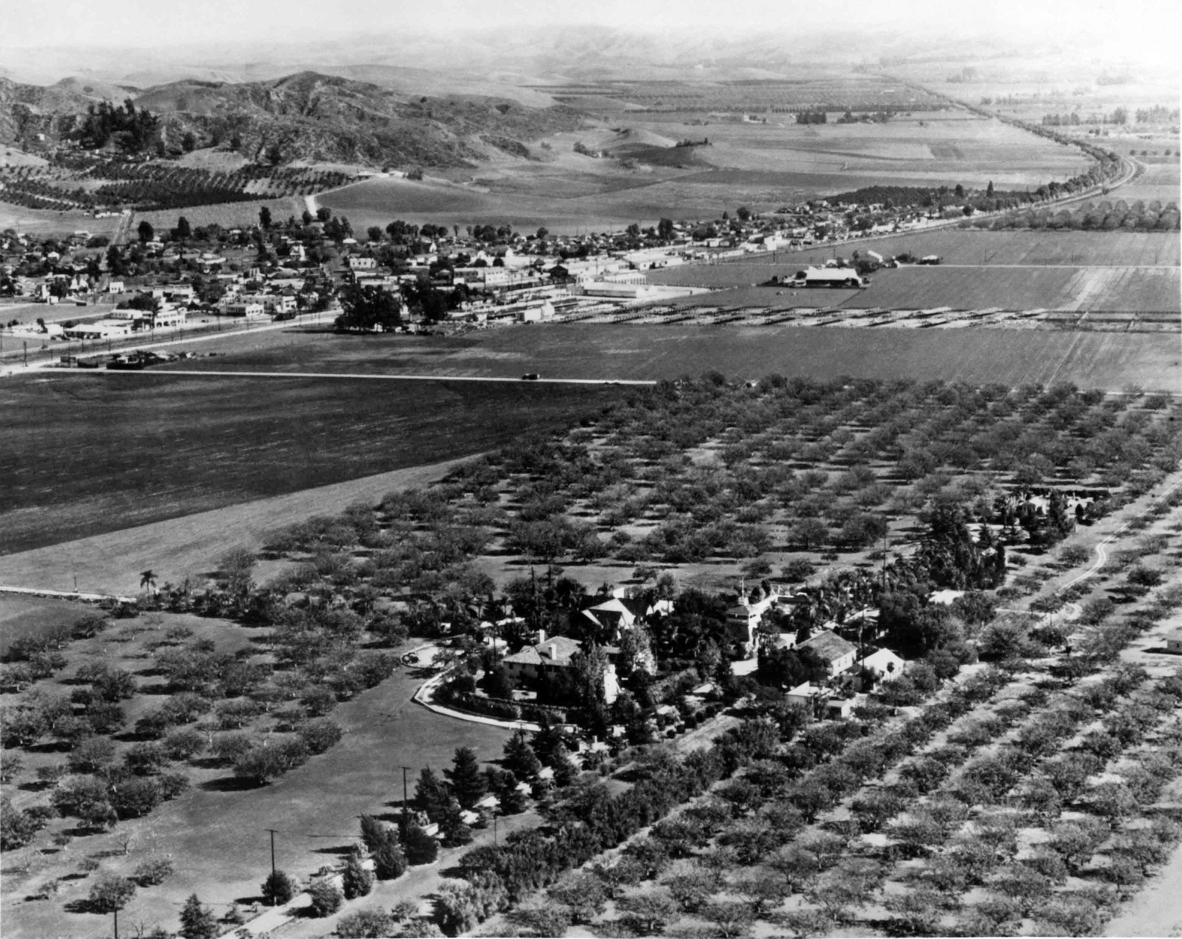
AERIAL VIEW OF THE HOMESTEAD SITE FROM THE SOUTHWEST, CA. 1940
Entry/Object ID
99.5.10.225
Description
AERIAL VIEW OF THE HOMESTEAD SITE FROM THE SOUTHWEST, CA. 1940
Color: Black; White
A black and white aerial photograph and enlargement of the Homestead site from the southwest, ca. 1940. On the bottom center are the various buildings of the site surrounded by trees and bushes. Only the h-shaped roof of the Workman House, with its four gables; center-hipped roof; and wood shigles can be seen. Seen below is La Casa Nueva with the two wings of the u-shaped adobe home extending to the south; five of the home's windows are seen on the second floor of the west wall as well as the west lawn, and the top portion of the Tepee in the southwest corner. To the south is the pavilion roof of the water tower followed by the tree-lined Evergreen Lane, which runs west to east. On the other side of the lane are several other buildings, including the pitch-roofed auditorium. To the far east, at the end of the lane, is the Walter P. Temple memorial and cemetery surrounded by trees and bushes. Surrounding the site are walnut trees and agricultural fields; a street with a single automobile going south to north; and the city of La Puente on the northeast. In the city can be seen homes; commercial buildings; streets; "P" Hill; and agricultural crops. Valley Boulevard runs through the center of the city from the west, and curves east. The photograph was taken at the time of the Homestead's use as El Encanto Convalescent Hospital. There are three copies of the image, with a corresponding negative in 99.6.10.225, and the artifact is in good condition.
Number-Units: 2
Lexicon
LOC Thesaurus for Graphic Materials
Aerial photographs
Search Terms
Photographs, Spence Air Photos, City of Industry (Calif.)--Homestead Museum--Aerial views, Ranches--Los Angeles County (Calif.), Walnut industry