Name/Title
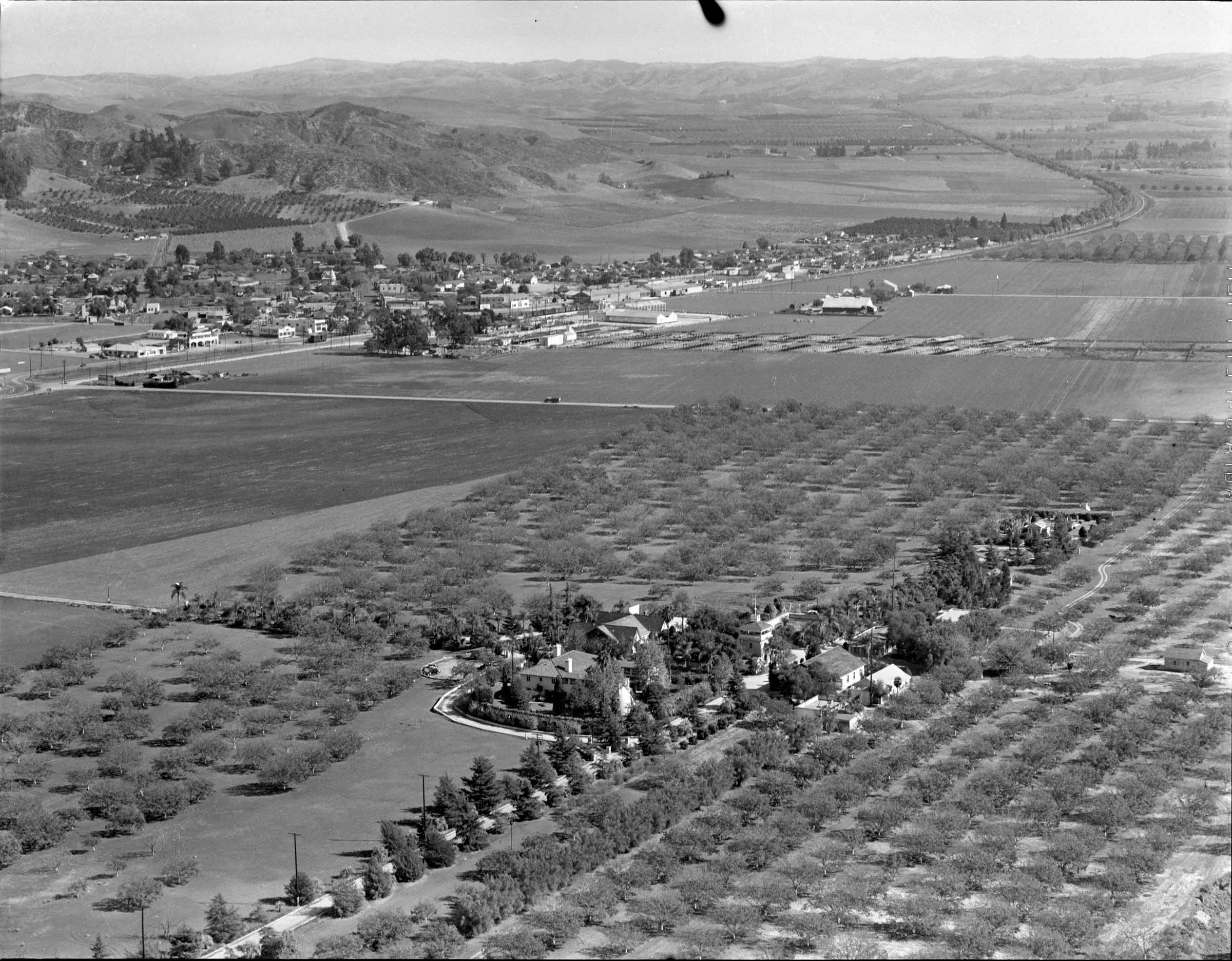
AERIAL VIEW OF THE HOMESTEAD SITE FROM THE SOUTHWEST, CA. 1940Entry/Object ID
99.6.10.225Description
AERIAL VIEW OF THE HOMESTEAD SITE FROM THE SOUTHWEST, CA. 1940
Color: Black; White
Two copies of a black and white negative of an aerial photograph of the Homestead site from the southwest, ca. 1940. At the bottom center are the various buildings of the site, surrounded by trees and bushes, including the Workman House and, to the right, the Water Tower and Pump House, and below it, La Casa Nueva and the Tepee. At left is an entrance road leading toward Valley Blvd., which is at the upper left. Just to the right of the aforementioned structures is the tree-lined Evergreen Lane and on the other side are several other buildings, including the former wineries, later an auditorium, dining hall, and garage and, at right, stables or barns. At the end of Evergreen Lane, is the cemetery and mausoleum, around which are trees and bushes. Surrounding the site are walnut trees and agricultural fields. At the top of the photo is Hudson Road, now Hacienda Blvd., while part of the town of Puente is at the upper left, with "P" Hill, now Industry Hills behind the town. Various farms and fields are alongside Valley Blvd. as it heads towards Pomona at the top with the Chino Hills in the background. curves east. The photograph was taken at the time of the Homestead's use as El Encanto Convalescent Hospital. There are three photos of the image, and the artifact is in good condition.
Number-Units: 2Lexicon
LOC Thesaurus for Graphic Materials
Aerial photographsSearch Terms
Two-dimensional, Negatives, Spence Air Photos, Ranches--Los Angeles County (Calif.), Walnut industry