Name/Title
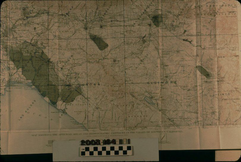
ARTESIAN AND HYDROGRAPHIC CONTOUR MAP OF SOUTHERN CALIFORNIAEntry/Object ID
2003.164.1.1Description
ARTESIAN AND HYDROGRAPHIC CONTOUR MAP OF SOUTHERN CALIFORNIA
Color: Black; Brown; Gray; White
"Map Showing the Artesian Areas and Hydrographic Contours in the Valley of Southern California," data compiled by W. C. Mendenhall and published by the U. S. Geological Survey, 1905. The map is divided into quadrants that conform to U. S. G. S. topographic maps, the names of which are in each quadrant. Township refernces and latitude and longitude markings are at the borders. At the bottom is a scale of miles and kilometers and a legend, notably for light gray area showing approximate original artesian areas and dark gray showing those areas current to 1904. These areas include the long section from modern Irvine to the areas just south and west of Los Angeles; the Chino area; San Bernardino; and the San Jacinto Valley section north of Hemet. Blue lines indicate elevations. Usual topographic map details, such as cities and towns; railroad lines; streets and highways; historic rancho boundaries; rivers, creeks, and lakes; hills and mountains; and county boundaries. The area covered runs from Santa Monica on the west, Cabazon on the east, San Juan Capistrano and Temecula on the south, and the San Gabriel Mountains on the north. On the upper right corner of the back is a crayon inscription reading "1905 / Valley of / S. Calif." Other than the original folds, there are some creases, light soiling, and very small, light stains, so the condition is good.Lexicon
Search Terms
Two-dimensional, Maps, U. S. Geological Survey, Hydrogeology--California, Southern, Artesian basins--California, Southern