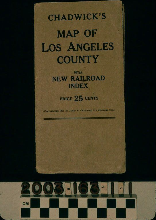
Name/Title
"CHADWICK'S MAP OF LOS ANGELES COUNTY"Entry/Object ID
2003.163.1.1Description
Color: Black; Yellow; White
"Chadwick's Map of Los Angeles County," published by James P. Chadwick, Los Angeles, 1912. The front cover has the title with the subtitle "With / NEW RAILROAD / INDEX" at the top, the price of twenty-five cents below this, and the copyright date and publisher's name under the price. Inside is a yellow foldout map that measures 27 1/2'H x 20 1/2W. The title "MAP OF / LOS ANGELES COUNTY" is at the lower left with a compass and the copyright date and publisher's name. Township markings are at the left and there are letter and numerical markings with the letters at the horizontal hashes and the numbers at the vertical ones. Features shown include cities and towns, with Los Angeles in a shaded form; major roads; the lines and stations of the electric streetcar system; local freight and passenger railroads; rivers and creeks; hills and mountains, including the San Gabriel Forest Reserve, predating the Angeles and San Bernardino National Forests; and others. At the lower right is a portion of Orange County as far south and east as Newport Beach and Santa Ana. Small sections, without detail other than railroad lines, are for Ventura, Kern, and San Bernardino counties. At the bottom is a listing with guides for cities and towns and initials for the type of railroad service offered to these locales. With cover abrasions and rubbing, creases, corner dents, soiling, discoloration, and stains, spine tears, and some creases to the map, the overall condition is good.Lexicon
Search Terms
Two-dimensional, Maps, Streets--Los Angeles County (Calif.), Railroads--Los Angeles County (Calif.)