Color: White; Black; Red; Purple
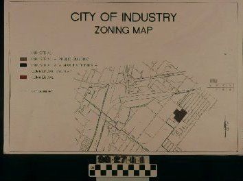
An eight-page booklet with zoning maps for the City of Industry, ca. 1980s. The front reads on the top center in black, "CITY OF INDUSTRY/ ZONING MAP." On the middle left is a legend which establishes colors for different zones including white for industrial; brown for industrial public buildings; purple for manufacturing and commercial overlay; and red for commercial. Broken lines are also included and mark the city boundary. Three staples bound the booklet on the left and a page number is indicated on the bottom right corner. On the first page, and seen at center, the map begins with the northwest boundary of the city located near the San Gabriel and San Bernardino Freeways. Public streets; railways; schools; large businesses; zoning districts; and rivers and creeks are indicated. The entire city is detailed throughout the booklet and ends with the southwest boundary near the Pomona and Orange Freeways. With light creases on all four corners, the object is in good condition.
Lexicon
Search Terms
Maps, City of Industry (Calif.), Zoning maps, Industrialization--City of Industry (Calif.), Industrial sites--City of Industry (Calif.), City of Industry (Calif.)--Commerce