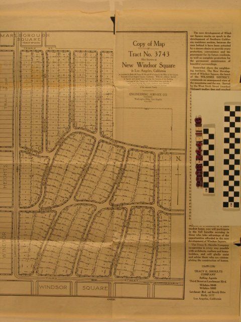
"Copy of Map of Tract No. 3743, Also Known as New Windsor Square in Los Angeles, California"
Entry/Object ID
2006.344.1.16
Description
"Copy of Map of Tract No. 3743, Also Known as New Windsor Square in Los Angeles, California," prepared by the Engineering Service Company and published by Tracy E. Shoults Company, 1920. The item consists of a map shows fourteen blocks with individually-numbered lots within each and also providing lot sizs in feet for fronts and depth. The area shown is from Temple Street (now Beverly Boulevard) on the north to Third Street on the south and from Larchmont Boulevard on the west to east of Irving Boulevard on the east. This map is the fully realized map derived from drafts that constitute .8 to .14 of the accession. Adjacent to the map is text on the development and its amenities, as well as developer contact information. On the reverse is a synopsis of the restrictions and covenants (including racial clauses) and a list of cost restrictions on residences built in the tract. With original folds, creases and some edge wear, including dog-eared corners and some tears, the general condition is fair.
Lexicon
Search Terms
Engineering Service Company, Tracy E. Shoults Company, Real estate subdivisions--California--Los Angeles, Residential neighborhoods--California--Los Angeles