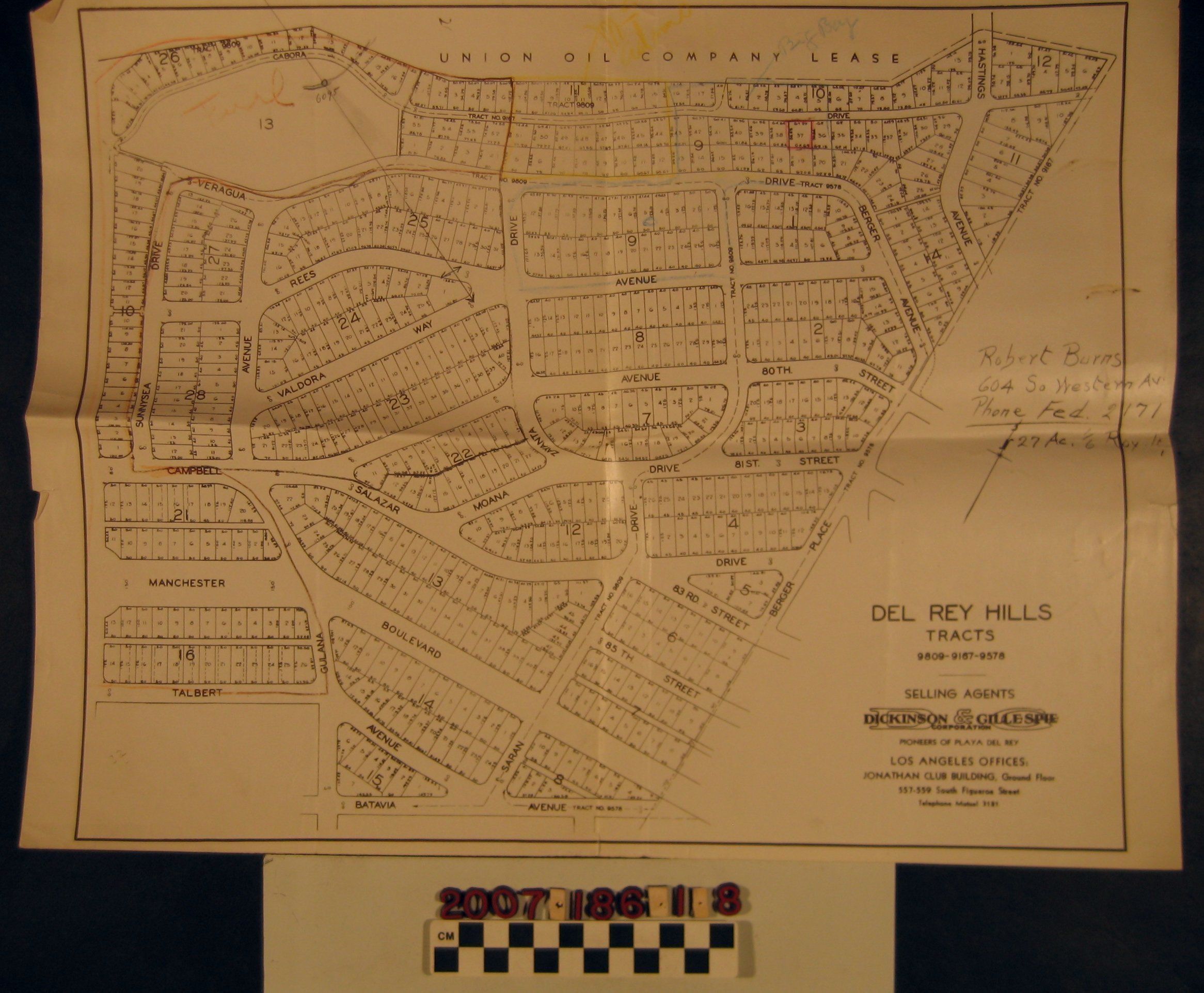
Name/Title
"Del Rey Hills tracts 9809-9167-9578"Entry/Object ID
2007.186.1.8Description
A tract map, "Del Rey Hills tracts 9809-9167-9578," by Dickinson & Gillespie Corporation, ca. 1928. The map shows the subdivision, located in Playa del Rey north of Los Angeles International Airport and west of Loyola Marymount University. Street names, many of which have changed, tract numbers, blocks, and lots are identified, as is the area to the north, shown as a Union Oil Company of California lease. A name and address is inscribed at the right and there are other inscriptions, as well. On the back is a map-like inscription in pencil. With folds, creases, small edge tears, and soiling and stains, the overall condition is good.Lexicon
Search Terms
Dickinson and Gillespie Corporation, Real estate subdivision--California--Los Angeles, Real estate subdivision--California--Playa del Rey (Los Angeles)