Name/Title
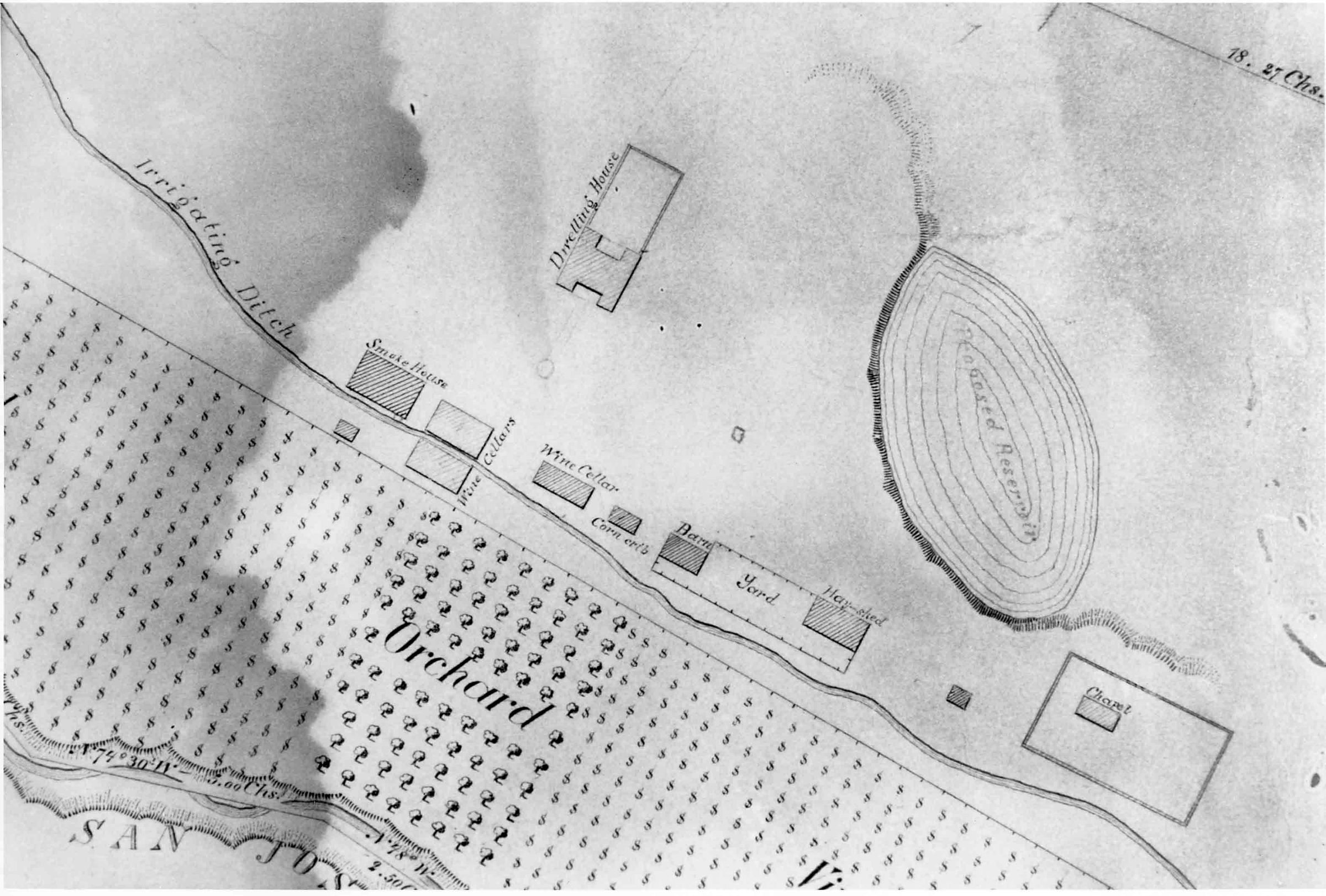
DETAIL OF MAP OF THE LA PUENTE HOMESTEAD PROPERTY, 1880-81Entry/Object ID
2001.208.1.5Description
DETAIL OF MAP OF THE LA PUENTE HOMESTEAD PROPERTY, 1880-81
Color: Black; White
A photograph of a detail from a map titled "Map of the La Puente Homestead Property," 1880-81. The map, commissioned by Francis W. Temple and drawn by Los Angeles County Surveyor E. T. Wright, shows the Workman House and surrounding buildings and areas. These include the Workman House, identified as "Dwelling House" with an enclosure on the north side and a faint line and circle extending, south, the adobe smoke house below and to the left, three wine cellars to the right of the smokehouse, a corn crib to the right of a wine cellar, and a fenced yard, with a barn and hay shed within it to the right of the corn crib. Further right is the cemetery, with the chapel denoted within it. Above this is an indicated "Proposed Reservoir." Two other small unidentified structures, once below the smoke house, and one between the hay shed and cemetery, are also shown. Running through two of the wine cellars and below the smoke house, corn crib, barn, barnyard, and hayshed, is an irrigating ditch. Below the ditch is a fenced area, including two vineyards and an orchard (presumably fruit, because a walnut orchard was separately identified in another section of the property not visible here.) At the lower left corner is a portion of San Jose Creek, which was the southern boundary of the Homestead. Dark shading at the far left may indicate damage to the original map. As a reproduced item, the artifact is in mint condition.
Number-Units: 1Lexicon
LOC Thesaurus for Graphic Materials
Maps, OutbuildingsSearch Terms
Two-dimensional, Photographs, Dwellings--City of Industry (Calif.), Adobe houses--City of Industry (Calif.), Cemeteries--City of Industry (Calif.), Chapels--Los Angeles County (Calif.), Barns--Los Angeles County (Calif.), Wine cellars--Los Angeles County (Calif.), Wine and wine making--Equipment and supplies--Los Angeles County (Calif.)