Name/Title
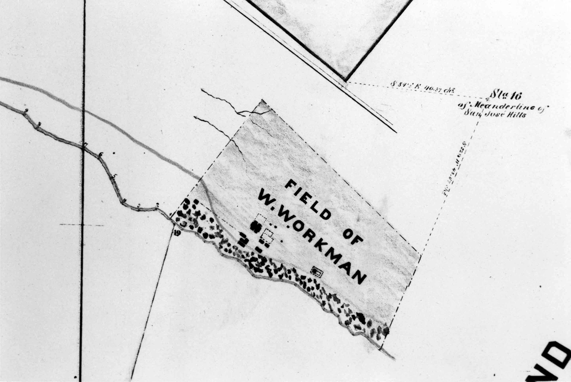
DETAIL OF WORKMAN HOUSE AREA, SOUTHWEST PART OF RANCHO LA PUENTE, 1870Entry/Object ID
2001.208.1.2Description
DETAIL OF WORKMAN HOUSE AREA, SOUTHWEST PART OF RANCHO LA PUENTE, 1870
Color: Black; White
A photograph of a detail from a map of "Southwest Part of Rancho La Puente, A Portion of the Land of W. Workman," surveyed in June 1870 by Los Angeles County Assistant Surveyor Lothar Seebold. The detail shows, at the center, an area denoted the "Field of W. Workman." This area seems roughly conformable to the 75-acre Homestead that was created after Workman's death and is slightly shaded. Elements of the "Field" include the Workman House, with an enclosure at its north side; three buildings below the house, which were the winery structures; a building just to the left of one of the wineries, which was an adobe, the cemetery and chapel at right, and other enclosures and buildings to the right of the house. Dotted areas indicate vineyards and orchards between San Jose Creek and an irrigation ditch paralleling the creek. Meander lines are indicated at the right and upper right, along with station 16 of the survey. At the top is a triangular area, which is a portion of 500 acres set aside for Workman's grandson, Thomas W. Temple. As a reproduced photo, this artifact is in mint condition.
Number-Units: 1Lexicon
LOC Thesaurus for Graphic Materials
Maps, OutbuildingsSearch Terms
Two-dimensional, Photographs, Dwellings--City of Industry (Calif.), Adobe houses--City of Industry (Calif.), Cemeteries--City of Industry (Calif.), Chapels--Los Angeles County (Calif.), Rivers--Los Angeles County (Calif.), Ranches--Los Angeles County (Calif.)