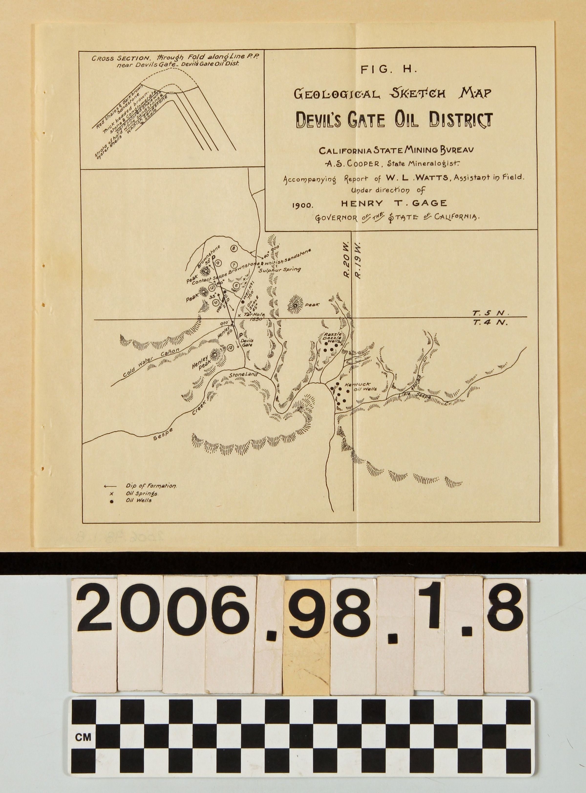
Name/Title
"Geological Sketch Map, Devil's Gate Oil District."Entry/Object ID
2006.98.1.8Description
"Geological Sketch Map, Devil's Gate Oil District," California State Mining Bureau, 1900. The area covered along Sespe Creek in Ventura County has oil field locations, as well as railroad lines, major streets, hills, water courses, and other notable features. With original folds, edge yellowing, staple holes, ceases and soem eoiling, the general condition is good.Lexicon
Search Terms
California. State Mining Bureau, Mines and mineral resources--Ventura County (Calif.), Oil fields--Ventura County (Calif.), Petroleum prospecting--Ventura County (Calif.)