Name/Title
GEOLOGIC AND TOPOGRAPHIC MAP OF THE SANTA FE ROUTEEntry/Object ID
2003.27.1.1Description
GEOLOGIC AND TOPOGRAPHIC MAP OF THE SANTA FE ROUTE
Color: Black; Brown; Red
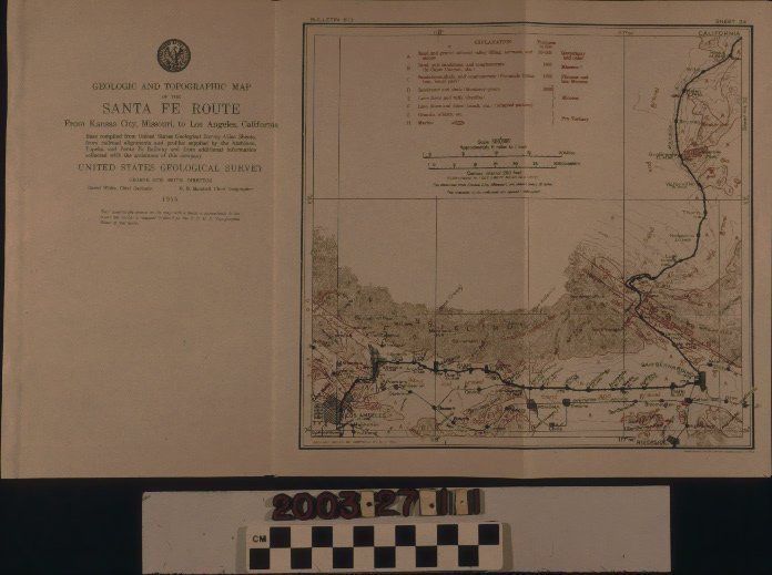
"Geologic and Topographic Map of the Santa Fe Route from Kansas City, Missouri, to Los Angeles, California," surveyed by the United States Geological Survey, 1915. The artifact, which has three panels, has the seal and name of the USGS and the title on the left panel. Also at the left are a brief explanation of where the information was gathered, the names of the USGS Director and chief Geologist and Geographer, and the date. The map, on the center and right panels, shows a major railway marked by a bold black line from Hicks, the northernmost point, south to San Bernardino, and west to Los Angeles. Denoted on the rail line are cities such as Fontana, Claremont, and Monrovia. South of the Santa Fe line are other smaller railways, including the Southern Pacific, which travels through Pomona, Puente, and San Gabriel. Aside from the railways, the map also shows surrounding cities and towns. Some of these have grids of differing sizes denoting the population. Faults and other geological features are marked in red. The San Gabriel Mountains are across the center in brown. At the center of the top is a legend with an explanation of geological findings and a scale. With only light creases at two corners, two folds, and slight discoloration of the paper, the artifact is in good condition.Lexicon
Search Terms
Two-dimensional, Maps, United States Geological Survey, Maps--California, Transportation--California, Railroads--California, Formations (Geology), Geological surveys, Geology--California