Name/Title
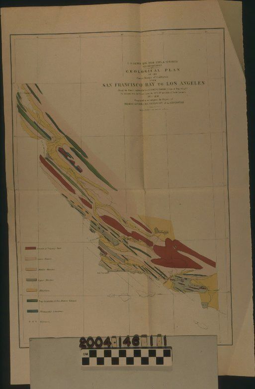
"GEOLOGICAL PLAN OF THE COAST RANGE OF CALIFORNIA FROM SAN FRANCISCO BAY TO LOS ANGELES," 1855-56Entry/Object ID
2004.146.1.1Description
"GEOLOGICAL PLAN OF THE COAST RANGE OF CALIFORNIA FROM SAN FRANCISCO BAY TO LOS ANGELES," 1855-56
Color: Black; Blue; Gray; Green; Pink; Red; Yellow; White
"Geological Plan of the Coast Range of California from San Francisco Bay to Los Angeles," issued as part of a report of the U. S. Pacific Railroad Exploration and Surveys from the United States War Department, 1856. Based on the report of geologist Thomas Antisell in the party led by Lieut. John G. Parke, the map shows via colored sections the mineral types found along the Coast Range in the 1855-56 expedition. The title, scale, and list of parties involved is at the top right. At the bottom left is the color-coded legend indicating material types, with stars used to denote bitumen regions, including areas west, northwest, and southwest of Los Angeles, which is at the bottom right of the map. In addition to the mineral types and bitumen locations, towns, some rivers, the Kern Lakes area, Monterey Bay, and some of the Channel Islands are also noted. With creases at the corners, the most significant of which is at the bottom left; some soiling, especially on the reverse; yellowing; original quarter folds; signs of foxing on the back; handling stains, mainly on the reverse; and a one-inch tear at the center of the left edge, the overall condition is good.Lexicon
Search Terms
Two-dimensional, Maps, United States. War Department, Geological surveys--California, Railroads--Surveying--California