Name/Title
GEOLOGICAL SKETCH MAP AND TERRITORY BETWEEN LOS ANGELES AND SANTA ANA RIVEREntry/Object ID
2003.219.1.1Description
GEOLOGICAL SKETCH MAP AND TERRITORY BETWEEN LOS ANGELES AND SANTA ANA RIVER
Color: Black; White
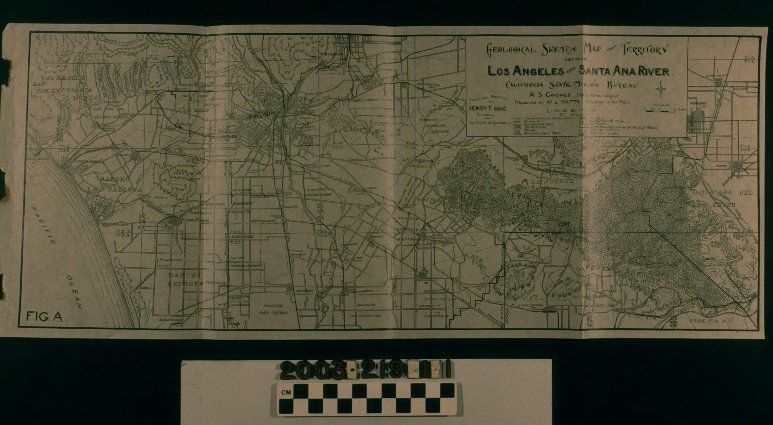
Map, "Geological Sketch Map of Territory Between Los Angeles and Santa Ana River," California State Mining Bureau, 1898. The map was conducted under the direction of Governor Henry T. Gage, supervised by state mineralogist A. S. Cooper, and prepared by W. L. Watts. It shows the area from Santa Monica and Redondo Beach on the west to Claremont, Chino, and Santa Ana Canyon on the east and from Pasadena to Long Beach from the north to south. The title panel with a scale, compass, legend, and names of those involved in the map, is at the upper right. Rancho names and boundaries; roads; railroad lines; rivers and creeks; cities, towns, and communities; hill ranges; township boundaries; and other features are of note, but the main area of interest are oil fields in Los Angeles and the Puente Hills and test wells in these areas and in west Los Angeles. These are marked as indicated in the legend. With minor yellowing; original folds; tears at the left where the map was detached from some publication; and stains and tarnish from these latter, the overall condition is good.Lexicon
Search Terms
Two-dimensional, Maps, California State Mining Bureau, Oil fields--Los Angeles County (Calif.), Oil prospecting--Los Angeles County (Calif.), Topographical surveys--Los Angeles County (Calif.), Topographical drawing--Los Angeles County (Calif.)