Name/Title
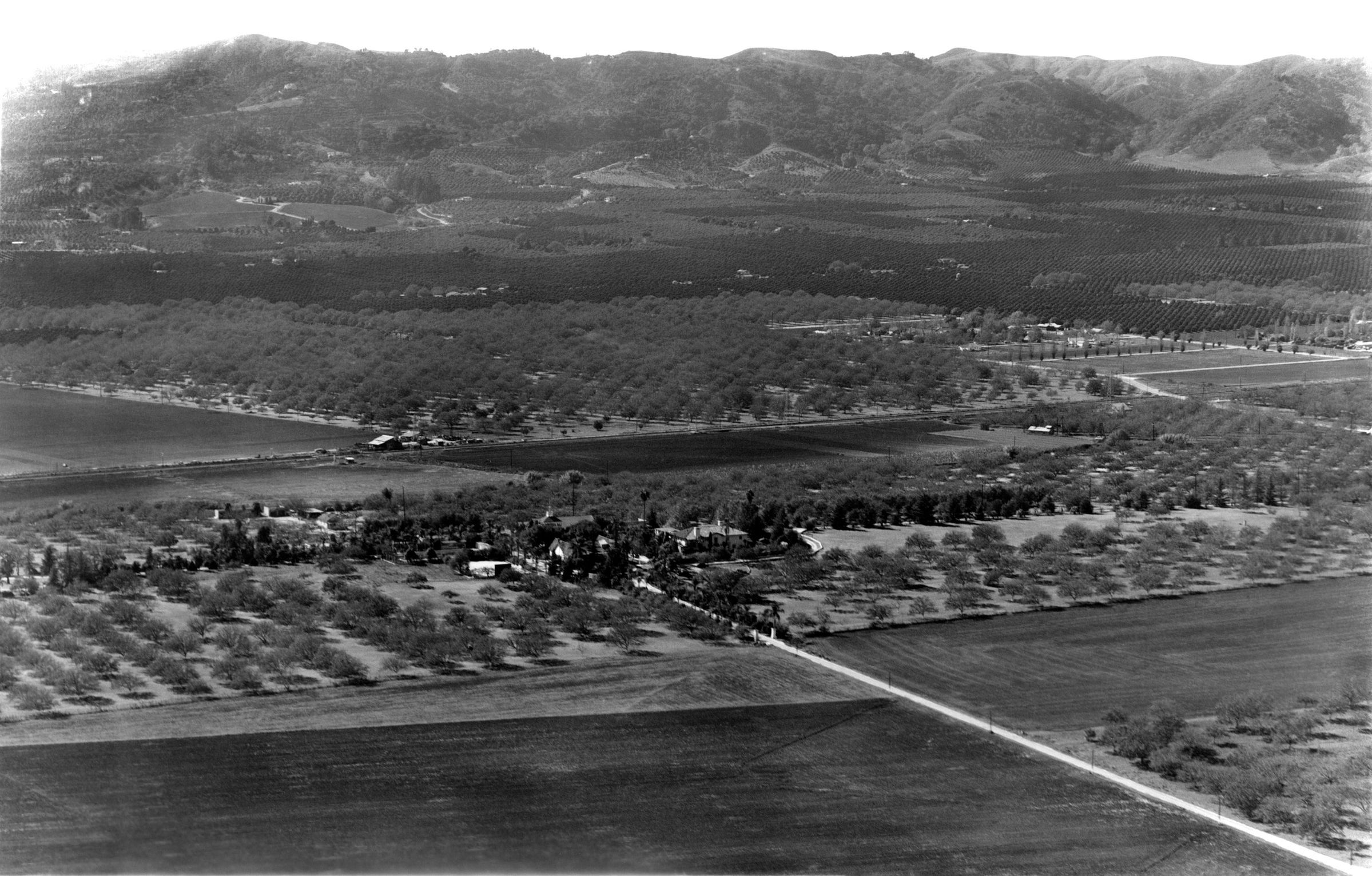
HOMESTEAD AERIAL VIEW FROM THE NORTH, ca. 1940Entry/Object ID
99.5.5.155Description
HOMESTEAD AERIAL VIEW FROM THE NORTH, ca. 1940
Color: Black; White
A black and white photograph of an aerial view of the Homestead, ca. 1940. Taken from the north at a distance, nearly the whole 92-acre ranch is visible. From the lower right corner to the center is the entrance road from Valley Road and two pillars and a line of walnut trees marks the northern boundary of the ranch. In the center where there is another line of trees, as well as some outbuildings at center left, is the southern boundary at San Jose Creek. Turnbull Canyon, the western boundary of the ranch, is at the center right, though the ranch boundary cannot be seen. Neither can the eastern line, which terminated at Hudson Road (now Hacienda Blvd.) Running from left to right at the center, and lined by trees (presumably evergreen) is Evergreen Lane, with the cemetery at the left terminus. Just left of center is the main complex of structures, including the Workman House; La Casa Nueva; the Water Tower; the auditorium, dining hall, and garage; the reservoir/swimming pool; the tennis court and various other outbuildings, though there is little detail at the distance seen here. In the foreground is undeveloped land, except for the lower right corner where a walnut grove is located. In the background are other groves, both walnuts and citrus, in North Whittier [now Hacienda] Heights. There are many inscriptions on the back concerning reproduction specifications. Aside from a small crease at the lower left corner, the image is in good condition.
Number-Units: 1Lexicon
Search Terms
Two-dimensional, Photographs, Aerial views--City of Industry (Calif.), Agriculture--Los Angeles County (Calif.), Ranches--Los Angeles County (Calif.)