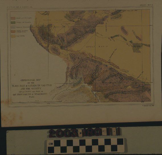
LITHOGRAPHED MAP, GEOLOGICAL MAP OF THE TEJON PASS, 1856
Entry/Object ID
2003.180.1.1
Description
LITHOGRAPHED MAP, GEOLOGICAL MAP OF THE TEJON PASS, 1856
Color: Brown; Red; White; Yellow
A lithographic map titled "Geological Map of the Tejon Pass & Canada de las Uvas and the Vicnity," 1856. Done as part of the United States Pacific Railroad Route Expedition & Surveys and appearing as Map III in the "Geology" section of a published report on the survey, the item shows a region north of present-day Santa Clarita and south of the Tehachapi area. The modern Grapevine is at the left with an identification of Tejon Pass apparently further east than today's pass. Tehachapi Pass would be a little north and west of what is given as Tejon Pass. A dry lake at the right may be near present Elizabeth Lake or further east towards present Palmdale. The Santa Clara River is at the bottom left, along with San Francisquito Creek and a couple of other watercourses. The mountains extending from the center to the lower right and labeled "BERNARDINO SIERRA" is probably the extension of the San Gabriel Mountains from the Angeles National Forest. At the upper left is a color-coded legend denoting mineral types. At the bottom left is the title and a scale of miles per inch. The name of the lithographer, T. Sinclair of Philadelphia, is at the bottom right. At the top left is the expedition name and the identiification of section and map number is at the top right. With some stains or foxing at the bottom left, creased corners, and minor discoloration, the item is in good overall condition.
Lexicon
Search Terms
Two-dimensional, Maps, Sinclair, T. [firm], Geology--California, Southern, Railroads--Surveying--California, Southern, Overland journeys to the Pacific