Name/Title
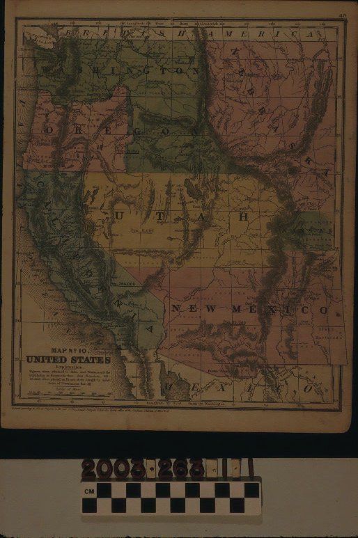
"MAP, NO. 10, UNITED STATES," 1853Entry/Object ID
2003.263.1.1Description
Color: Black; Green; Blue; Red; Yellow; White
"Map No. 10, United States," published by Daniel Burgess & Co., 1853. The map shows the area from the boundaries with British America, or Canada, on the north to Mexico on the south and from the Pacific Ocean to the territories of Nebraska, Kansas, and New Mexico on the east. There are several colors to denote the states of California and Oregon and neighboring territories, of which several other future states, such as Nevada, Idaho, Montana, Colorado, and Arizona were created. Degrees of latitude and longitude are on the borders and there are usual features of note, including towns; settlements; forts; rivers and lakes; mountains and mountain ranges; Indian tribal areas; boundary lines; and so on. For California, New Mexico; Utah; and Washington and Oregon combined, there are population figures in each area. At the bottom left is the title and an explanatory note that numbers near some towns are for population in thousands. A scale of miles and a note of entrance for the map into the Library of Congress are also at the bottom left. With a substance along the right edge; creases; browning; foxing; some stains; and a few tears at the right and left edges, the overall condition is good.Lexicon
Search Terms
Two-dimensional, Maps, Daniel Burgess & Co., West (U. S.), California