Name/Title
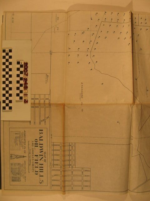
"Map of Baldwin Hills Oil Field, Los Angeles County"Entry/Object ID
2007.248.1.3Description
"Map of Baldwin Hills Oil Field, Los Angeles County," Associated Oil Company Geological Department, 1 March 1925, revised to 1 December 1926. The map covers areas now part of Culver City, unincorporated Baldwin Hills area, and parts of Los Angeles. Various tracts leased by oil companies are shown with oil company names, surnames of landowners, and numbered well sites. There are also city boundaries, rail lines, streets, and other landmarks. With many folds, browning along folds and creases, the condition is overall good.Lexicon
Search Terms
Associated Oil Company. Geological Department, Baldwin Hills oil field